


Use Case - Collection and Granule Search (FedEO)#
Overview#
This chapter provides a comprehensive and detailed process about how to implement a CEOS STAC client, which includes how to find collections and granules of interest.
In the examples, we use the pystac [RD17] and pystac_client [RD18] libraries to access the interface. Examples using curl on the command-line are provided as well.
URL_LANDING_PAGE = 'https://fedeo.ceos.org/'
Access landing page#
The landing page provides access to collections (rel=”data”), child catalogs (rel=”child”) and the STAC item search endpoint (rel=”search”).
Get the catalogue landing page with links to other resources and available collections.
curl -X GET -G https://fedeo.ceos.org/
from pystac_client import Client

api = Client.open(URL_LANDING_PAGE)
# show as a dictionary
api.to_dict()
{'type': 'Catalog',
 'id': 'fedeo',
 'stac_version': '1.1.0',
 'description': 'FEDEO Catalogue provides interoperable access, following ISO/OGC interface guidelines, to Earth Observation metadata',
 'links': [{'rel': 'self',
   'href': 'https://fedeo.ceos.org/',
   'type': 'application/json'},
  {'rel': 'search',
   'href': 'https://fedeo.ceos.org/api?httpAccept=application/opensearchdescription%2Bxml',
   'type': 'application/opensearchdescription+xml',
   'title': 'OpenSearch Description Document'},
  {'rel': 'service-desc',
   'href': 'https://fedeo.ceos.org/api?httpAccept=application/vnd.oai.openapi%2Bjson;version=3.0',
   'type': 'application/vnd.oai.openapi+json;version=3.0',
   'title': 'OpenAPI definition in JSON format'},
  {'rel': 'data',
   'href': 'https://fedeo.ceos.org/collections',
   'type': 'application/json',
   'title': 'Metadata about the feature collections'},
  {'rel': 'data',
   'href': 'https://fedeo.ceos.org/collections',
   'type': 'application/ld+json',
   'title': 'Metadata about the feature collections'},
  {'rel': 'data',
   'href': 'https://fedeo.ceos.org/collections',
   'type': 'application/rdf+xml',
   'title': 'Metadata about the feature collections'},
  {'rel': 'data',
   'href': 'https://fedeo.ceos.org/collections',
   'type': 'text/turtle',
   'title': 'Metadata about the feature collections'},
  {'rel': 'conformance',
   'href': 'https://fedeo.ceos.org/conformance',
   'type': 'application/json',
   'title': 'OGC conformance classes implemented by this API'},
  {'rel': 'service-doc',
   'href': 'https://fedeo.ceos.org/doc/index.html',
   'type': 'text/html',
   'title': 'API Documentation (Jupyter)'},
  {'rel': 'service-doc',
   'href': 'http://petstore.swagger.io/?url=https://fedeo.ceos.org/api',
   'type': 'text/html',
   'title': 'API documentation in Swagger.io format'},
  {'rel': 'search',
   'href': 'https://fedeo.ceos.org/search',
   'type': 'application/geo+json',
   'title': 'STAC Search',
   'method': 'GET'},
  {'rel': 'search',
   'href': 'https://fedeo.ceos.org/search',
   'type': 'application/geo+json',
   'title': 'STAC Search',
   'method': 'POST'},
  {'rel': 'child',
   'href': 'https://fedeo.ceos.org/series',
   'type': 'application/json',
   'title': 'Collections'},
  {'rel': 'child',
   'href': 'https://fedeo.ceos.org/services',
   'type': 'application/json',
   'title': 'Services'},
  {'rel': 'root',
   'href': 'https://fedeo.ceos.org/',
   'type': 'application/json',
   'title': 'FEDEO Catalogue'}],
 'extent': {'spatial': {'bbox': [[-180, -90, 180, 90]]},
  'temporal': {'interval': [[None, None]]}},
 'license': 'other',
 'conformsTo': ['http://www.opengis.net/spec/ogcapi-features-1/1.0/conf/core',
  'http://www.opengis.net/spec/ogcapi-features-1/1.0/conf/oas30',
  'http://www.opengis.net/spec/ogcapi-features-1/1.0/conf/geojson',
  'http://www.opengis.net/spec/ogcapi_common-2/1.0/conf/collections',
  'http://www.opengis.net/spec/ogcapi-common-2/1.0/conf/simple-query',
  'http://www.opengis.net/spec/ogcapi-records-1/1.0/req/cql-filter',
  'http://www.opengis.net/spec/ogcapi-features-3/1.0/conf/features-filter',
  'http://www.opengis.net/spec/ogcapi-features-3/1.0/conf/filter',
  'https://api.stacspec.org/v1.0.0/core',
  'https://api.stacspec.org/v1.0.0/ogcapi-features',
  'https://api.stacspec.org/v1.0.0/collections',
  'https://api.stacspec.org/v1.0.0-rc.1/collection-search',
  'https://api.stacspec.org/v1.0.0-rc.1/collection-search#filter',
  'https://api.stacspec.org/v1.0.0-rc.1/collection-search#free-text',
  'https://api.stacspec.org/v1.0.0-rc.1/collection-search#sort',
  'https://api.stacspec.org/v1.0.0/item-search',
  'https://api.stacspec.org/v1.0.0-rc.3/item-search#filter',
  'http://www.opengis.net/spec/cql2/1.0/conf/cql2-text',
  'http://www.opengis.net/spec/cql2/1.0/conf/basic-cql2',
  'http://www.opengis.net/spec/cql2/1.0/conf/cql2-json',
  'http://www.opengis.net/spec/cql2/1.0/conf/advanced-comparison-operators',
  'https://api.stacspec.org/v1.0.0/item-search#sort',
  'https://api.stacspec.org/v1.0.0/ogcapi-features#sort',
  'https://api.stacspec.org/v1.0.0/ogcapi-features#sort',
  'https://api.stacspec.org/v1.0.0/item-search#fields',
  'https://api.stacspec.org/v1.0.0/ogcapi-features#fields',
  'https://api.stacspec.org/v1.0.0-rc.1/collection-search#fields',
  'https://api.stacspec.org/v1.0.0/ogcapi-features/extensions/transaction'],
 'title': 'FEDEO Catalogue'}
# Get catalog title and description
print("Title\t\t:", api.title)
print("Description\t:", api.description)
print("Search link\t:", api.get_search_link())

# List child catalogs
print("Child catalogs:")
# for child in api.get_children():
#    print("\t", child.id)

children = [c for c in api.get_children()]
children
Title		: FEDEO Catalogue
Description	: FEDEO Catalogue provides interoperable access, following ISO/OGC interface guidelines, to Earth Observation metadata
Search link	: <Link rel=search target=https://fedeo.ceos.org/search>
Child catalogs:
[<CollectionClient id=series>, <CollectionClient id=services>]
# Show title and id for each of the children.
for count, child in enumerate(children):
    print(f'\t{count} - {child.title}, id="{child.id}"')
	0 - Collections, id="series"
	1 - Services, id="services"
The collections are organised as a tree structure which can be traversed until arriving to a collection with items (granules). Get the details of one of the children of the root catalog as an example.
child = children[1]
child.to_dict()
{'type': 'Collection',
 'id': 'services',
 'stac_version': '1.1.0',
 'description': 'Services',
 'links': [{'rel': 'root',
   'href': 'https://fedeo.ceos.org/',
   'type': 'application/json',
   'title': 'FEDEO Catalogue'},
  {'rel': 'child',
   'href': 'https://fedeo.ceos.org/services/eo:platform',
   'type': 'application/json',
   'title': 'Services by platform'},
  {'rel': 'child',
   'href': 'https://fedeo.ceos.org/services/eo:organisationName',
   'type': 'application/json',
   'title': 'Services by organisation'},
  {'rel': 'child',
   'href': 'https://fedeo.ceos.org/services/concepts/earthtopics',
   'type': 'application/json',
   'title': 'Earth Topics'},
  {'rel': 'child',
   'href': 'https://fedeo.ceos.org/services/concepts/platforms',
   'type': 'application/json',
   'title': 'ESA Platforms'},
  {'rel': 'child',
   'href': 'https://fedeo.ceos.org/services/concepts/sciencekeyword',
   'type': 'application/json',
   'title': 'GCMD Science Keywords'},
  {'rel': 'self',
   'href': 'https://fedeo.ceos.org/services',
   'type': 'application/json'},
  {'rel': 'parent',
   'href': 'https://fedeo.ceos.org/',
   'type': 'application/json',
   'title': 'FEDEO Catalogue'}],
 'title': 'Services',
 'extent': {'spatial': {'bbox': [[-180, -90, 180, 90]]},
  'temporal': {'interval': [[None, None]]}},
 'license': 'other',
 'providers': [{'name': 'FEDEO Clearinghouse',
   'roles': ['host'],
   'url': 'https://fedeo.ceos.org/'}]}
# May have again children, get the list
children = [c for c in child.get_children()]
children
[<CollectionClient id=services_eo:platform>,
 <CollectionClient id=services_eo:organisationName>,
 <CollectionClient id=5c476560-e0a3-554a-9187-187a90da1309>,
 <CollectionClient id=738c519f-48db-5344-bebc-030c16781c22>,
 <CollectionClient id=1eb0ea0a-312c-4d74-8d42-6f1ad758f999>]
# Display shortened version of the catalog/collection tree structure.
# print_catalog_as_tree( api, max_level=3, max_children=3 )
Collection Search#
The API implements the STAC API Collection Search Extension [RD25].
Available collections can be retrieved from the landing page using a paging mechanism (with rel=”next” links). It requires the compliance class to be present. As pystac_client does not support collection search, the requests library is used in the examples.
The collection endpoint is available as rel=’data’ link at JSONPath $.links[?(@.rel==’data’)]. Alternatively, collections can be found by traversing the root catalog (i.e. landing page) and following the rel=’child’ links recursively. Searchable collections have type: ‘Collection’ and do not have year/month/day information in their id. E.g. LANDSAT.TM.GTC is a searchable collection, while LANDSAT.TM.GTC-2022 or LANDSAT.TM.GTC-2022-12 or LANDSAT.TM.GTC-2022-12-06 cannot be used for STAC Item Search. This limitation may be relaxed in future versions.
from jsonpath_ng.ext import parse

response = requests.get(URL_LANDING_PAGE)
data = json.loads(response.text)
expression = parse("$.links[?(@.rel == 'data')].href")
r = expression.find(data)
r[0].value
'https://fedeo.ceos.org/collections'
# retrieve /collections response
response = requests.get(r[0].value)
data = json.loads(response.text)
jstr = json.dumps(data, indent=3)
md("```json\n" + jstr + "\n```\n")
{
"collections": [
{
"extent": {
"spatial": {
"bbox": [
[
-180,
-90,
180,
90
]
]
},
"temporal": {
"interval": [
[
null,
null
]
]
}
},
"stac_version": "1.0.0",
"license": "various",
"itemType": "feature",
"description": "Metadata records representing EO datasets (a.k.a. EO products)",
"links": [
{
"rel": "self",
"href": "https://fedeo.ceos.org/collections/datasets",
"type": "application/json"
},
{
"rel": "root",
"href": "https://fedeo.ceos.org/",
"type": "application/json",
"title": "FEDEO Catalogue"
},
{
"rel": "parent",
"href": "https://fedeo.ceos.org/",
"type": "application/json",
"title": "FEDEO Catalogue"
},
{
"rel": "items",
"href": "https://fedeo.ceos.org/collections/datasets/items",
"type": "application/geo+json",
"title": "Datasets"
},
{
"rel": "alternate",
"href": "https://fedeo.ceos.org/collections/datasets?httpAccept=text/html",
"type": "text/html",
"title": "Self as HTML"
},
{
"rel": "alternate",
"href": "https://fedeo.ceos.org/collections/datasets?httpAccept=application/ld%2Bjson",
"type": "application/ld+json",
"title": "Self as JSON-LD"
},
{
"rel": "describedBy",
"href": "http://schemas.opengis.net/eo-geojson/1.0/eo-geojson-schema.json",
"type": "application/schema+json",
"title": "JSON schema for items belonging to this collection"
}
],
"id": "datasets",
"title": "EO Products",
"type": "Collection"
},
{
"extent": {
"spatial": {
"bbox": [
[
-180,
-90,
180,
90
]
]
},
"temporal": {
"interval": [
[
null,
null
]
]
}
},
"stac_version": "1.0.0",
"license": "various",
"itemType": "feature",
"description": "Metadata records representing EO services and applications",
"links": [
{
"rel": "self",
"href": "https://fedeo.ceos.org/collections/services",
"type": "application/json"
},
{
"rel": "root",
"href": "https://fedeo.ceos.org/",
"type": "application/json",
"title": "FEDEO Catalogue"
},
{
"rel": "parent",
"href": "https://fedeo.ceos.org/",
"type": "application/json",
"title": "FEDEO Catalogue"
},
{
"rel": "items",
"href": "https://fedeo.ceos.org/collections/services/items",
"type": "application/geo+json",
"title": "Services and applications"
},
{
"rel": "alternate",
"href": "https://fedeo.ceos.org/collections/services?httpAccept=text/html",
"type": "text/html",
"title": "Self as HTML"
},
{
"rel": "alternate",
"href": "https://fedeo.ceos.org/collections/services?httpAccept=application/ld%2Bjson",
"type": "application/ld+json",
"title": "Self as JSON-LD"
},
{
"rel": "http://www.opengis.net/def/rel/ogc/1.0/queryables",
"href": "https://fedeo.ceos.org/collections/services/queryables",
"type": "application/schema+json",
"title": "Queryables for services"
},
{
"rel": "describedBy",
"href": "http://schemas.opengis.net/eopad-geojson/1.0/eopad-geojson-schema.json",
"type": "application/schema+json",
"title": "JSON schema for items belonging to this collection"
}
],
"id": "services",
"title": "EO services and applications",
"type": "Collection"
},
{
"extent": {
"spatial": {
"bbox": [
[
-180,
-90,
180,
90
]
]
},
"temporal": {
"interval": [
[
"2011-02-28T00:00:00.000Z",
"2015-04-28T23:59:59.999Z"
]
]
}
},
"stac_version": "1.0.0",
"keywords": [
"DIF10",
"Land",
"Ocean",
"Ocean Surface Wind",
"Radar Backscatter NRCS",
"Soil Moisture",
"EARTH SCIENCE>LAND SURFACE",
"EARTH SCIENCE>AGRICULTURE>SOILS>SOIL MOISTURE/WATER CONTENT",
"METOP-A",
"METOP-B",
"ASCAT",
"Metop-A",
"Metop-B"
],
"description": "This ASCAT Multi-parameter product contains surface wind vectors over ocean and soil moisture index over land. Additionally, the backscatter values involved in the retrieval of the geophysical parameters above are also included, as well as several quality flags to facilitate the use of the data. For NWP users this product is provided in BUFR format. The netCDF version of this product contains Winds ONLY. For users interested in either ASCAT backscatter, wind or soil moisture index data in other formats, please refer to the relevant product entries available for the specific parameters. Finally, note that although the OSI SAF is identified as the originating centre for this product, it is not responsible for the processing of soil moisture index values, which is currently carried out at EUMETSAT. The product archive (EUMETSAT Data Centre and the SAF archive) stopped on 28 April 2015, when the product was discontinued. Please note that the product has been replaced by the ASCAT Coastal Winds (EO:EUM:DAT:METOP:OSI-104). Better than using this archived NRT product, please use the reprocessed ASCAT winds data records (EO:EUM:DAT:METOP:OSI-150-A, EO:EUM:DAT:METOP:OSI-150-B).",
"collection": "EOP:EUMETSAT",
"type": "Collection",
"title": "ASCAT Winds and Soil Moisture at 12.5 km Swath Grid - Metop",
"themes": [
{
"concepts": [
{
"id": "d00a0208-7c2f-5bb9-b141-511b8a9b3b77",
"title": "ASCAT",
"url": "https://earth.esa.int/concept/d00a0208-7c2f-5bb9-b141-511b8a9b3b77"
}
],
"scheme": "https://earth.esa.int/concepts/concept_scheme/instruments"
},
{
"concepts": [
{
"id": "f55d156c-adbc-47db-a69c-981afbaa0cf6",
"title": "ASCAT",
"url": "https://gcmd.earthdata.nasa.gov/kms/concept/f55d156c-adbc-47db-a69c-981afbaa0cf6"
}
],
"scheme": "https://gcmd.earthdata.nasa.gov/kms/concepts/concept_scheme/instruments"
},
{
"concepts": [
{
"id": "ad83e431-f28c-5801-abf1-6b7b0deb9cb0",
"title": "Metop-B",
"url": "https://earth.esa.int/concept/ad83e431-f28c-5801-abf1-6b7b0deb9cb0"
},
{
"id": "e0d6e80e-22a7-5c5b-87d3-3d65d893ddc9",
"title": "Metop-A",
"url": "https://earth.esa.int/concept/e0d6e80e-22a7-5c5b-87d3-3d65d893ddc9"
}
],
"scheme": "https://earth.esa.int/concepts/concept_scheme/platforms"
},
{
"concepts": [
{
"id": "88e1a654-5cfd-423f-9350-0ef48d85e085",
"title": "EARTH SCIENCE>AGRICULTURE>SOILS>SOIL MOISTURE/WATER CONTENT",
"url": "https://gcmd.earthdata.nasa.gov/kms/concept/88e1a654-5cfd-423f-9350-0ef48d85e085"
},
{
"id": "6a426480-c58f-4b6b-8e35-0975b7f6edb5",
"title": "EARTH SCIENCE>LAND SURFACE",
"url": "https://gcmd.earthdata.nasa.gov/kms/concept/6a426480-c58f-4b6b-8e35-0975b7f6edb5"
}
],
"scheme": "https://gcmd.earthdata.nasa.gov/kms/concepts/concept_scheme/sciencekeywords"
},
{
"concepts": [
{
"id": "c9f84df0-e807-46e3-8fce-c33e9201fbc2",
"title": "METOP-B",
"url": "https://gcmd.earthdata.nasa.gov/kms/concept/c9f84df0-e807-46e3-8fce-c33e9201fbc2"
},
{
"id": "8143808e-1005-4fed-a469-c2bd5f1521bf",
"title": "METOP-A",
"url": "https://gcmd.earthdata.nasa.gov/kms/concept/8143808e-1005-4fed-a469-c2bd5f1521bf"
}
],
"scheme": "https://gcmd.earthdata.nasa.gov/kms/concepts/concept_scheme/platforms"
}
],
"license": "various",
"assets": {
"metadata_iso_19139": {
"roles": [
"metadata"
],
"href": "https://fedeo.ceos.org/collections/EO%3AEUM%3ADAT%3AMETOP%3AOAS012?httpAccept=application/vnd.iso.19139%2Bxml",
"title": "ISO 19139 metadata",
"type": "application/vnd.iso.19139+xml"
},
"metadata_iso_19139_2": {
"roles": [
"metadata"
],
"href": "https://fedeo.ceos.org/collections/EO%3AEUM%3ADAT%3AMETOP%3AOAS012?httpAccept=application/vnd.iso.19139-2%2Bxml",
"title": "ISO 19139-2 metadata",
"type": "application/vnd.iso.19139-2+xml"
},
"metadata_dif_10": {
"roles": [
"metadata"
],
"href": "https://fedeo.ceos.org/collections/EO%3AEUM%3ADAT%3AMETOP%3AOAS012?httpAccept=application/dif10%2Bxml",
"title": "DIF-10 metadata",
"type": "application/dif10+xml"
},
"metadata_ogc_17_084r1": {
"roles": [
"metadata"
],
"href": "https://fedeo.ceos.org/collections/EO%3AEUM%3ADAT%3AMETOP%3AOAS012?mode=owc",
"title": "OGC 17-084r1 metadata",
"type": "application/geo+json;profile=\"http://www.opengis.net/spec/eoc-geojson/1.0\""
},
"metadata_iso_191115_3": {
"roles": [
"metadata"
],
"href": "https://fedeo.ceos.org/collections/EO%3AEUM%3ADAT%3AMETOP%3AOAS012?httpAccept=application/vnd.iso.19115-3%2Bxml",
"title": "ISO 19115-3 metadata",
"type": "application/vnd.iso.19115-3+xml"
},
"quicklook": {
"roles": [
"overview"
],
"href": "https://navigator.eumetsat.int/preview/OSISAF_Logo.png",
"type": "image/png",
"title": "graphic overview"
}
},
"links": [
{
"rel": "self",
"href": "https://fedeo.ceos.org/collections/EO:EUM:DAT:METOP:OAS012",
"type": "application/json"
},
{
"rel": "root",
"href": "https://fedeo.ceos.org/",
"type": "application/json",
"title": "FEDEO Catalogue"
},
{
"rel": "parent",
"href": "https://fedeo.ceos.org/",
"title": "collections",
"type": "application/json"
},
{
"rel": "alternate",
"href": "https://fedeo.ceos.org/collections/EO%3AEUM%3ADAT%3AMETOP%3AOAS012?httpAccept=application/xml",
"type": "application/xml",
"title": "Dublin Core metadata"
},
{
"rel": "alternate",
"href": "https://fedeo.ceos.org/collections/EO%3AEUM%3ADAT%3AMETOP%3AOAS012?httpAccept=application/ld%2Bjson;profile=https://schema.org",
"type": "application/ld+json;profile=\"https://schema.org\"",
"title": "JSON-LD (schema.org) metadata"
},
{
"rel": "alternate",
"href": "https://fedeo.ceos.org/collections/EO%3AEUM%3ADAT%3AMETOP%3AOAS012?httpAccept=application/ld%2Bjson",
"type": "application/ld+json;profile=\"http://data.europa.eu/930/\"",
"title": "JSON-LD (GeoDCAT-AP) metadata"
},
{
"rel": "alternate",
"href": "https://fedeo.ceos.org/collections/EO%3AEUM%3ADAT%3AMETOP%3AOAS012?httpAccept=application/rdf%2Bxml;profile=https://schema.org",
"type": "application/rdf+xml;profile=\"https://schema.org\"",
"title": "RDF/XML (schema.org) metadata"
},
{
"rel": "alternate",
"href": "https://fedeo.ceos.org/collections/EO%3AEUM%3ADAT%3AMETOP%3AOAS012?httpAccept=application/rdf%2Bxml",
"type": "application/rdf+xml;profile=\"http://data.europa.eu/930/\"",
"title": "RDF/XML (GeoDCAT-AP) metadata"
},
{
"rel": "alternate",
"href": "https://fedeo.ceos.org/collections/EO%3AEUM%3ADAT%3AMETOP%3AOAS012?httpAccept=text/turtle;profile=https://schema.org",
"type": "text/turtle;profile=\"https://schema.org\"",
"title": "Turtle (schema.org) metadata"
},
{
"rel": "alternate",
"href": "https://fedeo.ceos.org/collections/EO%3AEUM%3ADAT%3AMETOP%3AOAS012?httpAccept=text/turtle",
"type": "text/turtle;profile=\"http://data.europa.eu/930/\"",
"title": "Turtle (GeoDCAT-AP) metadata"
},
{
"rel": "related",
"href": "https://fedeo.ceos.org/series/eo:platform/Metop-A",
"title": "More collections for Metop-A platform"
},
{
"rel": "related",
"href": "https://fedeo.ceos.org/series/eo:platform/Metop-B",
"title": "More collections for Metop-B platform"
},
{
"rel": "related",
"href": "https://fedeo.ceos.org/series/concepts/instruments/d00a0208-7c2f-5bb9-b141-511b8a9b3b77",
"title": "More collections for ASCAT instrument"
},
{
"rel": "related",
"href": "https://fedeo.ceos.org/series/eo:organisationName/EUMETSAT@OSISAF",
"title": "More collections for EUMETSAT/OSISAF"
}
],
"id": "EO:EUM:DAT:METOP:OAS012",
"updated": "2024-01-18T00:00:00.00Z",
"stac_extensions": [
"https://stac-extensions.github.io/themes/v1.0.0/schema.json"
],
"providers": [
{
"roles": [
"producer"
],
"name": "EUMETSAT/OSISAF",
"uri": "http://osi-saf.eumetsat.int"
},
{
"roles": [
"producer"
],
"name": "EOP:EUMETSAT"
},
{
"roles": [
"host"
],
"name": "FEDEO Clearinghouse",
"url": "https://fedeo.ceos.org/"
}
],
"summaries": {
"instruments": [
"ASCAT",
"ASCAT"
],
"platform": [
"Metop-A",
"Metop-B"
]
}
},
{
"extent": {
"spatial": {
"bbox": [
[
-180,
-90,
180,
90
]
]
},
"temporal": {
"interval": [
[
"2019-11-07T00:00:00.000Z",
null
]
]
}
},
"stac_version": "1.0.0",
"keywords": [
"DIF10",
"Land",
"Ocean",
"Ocean Surface Wind",
"Radar Backscatter NRCS",
"Soil Moisture",
"EARTH SCIENCE>LAND SURFACE",
"EARTH SCIENCE>AGRICULTURE>SOILS>SOIL MOISTURE/WATER CONTENT",
"METOP-A",
"METOP-B",
"ASCAT",
"Metop-A",
"Metop-B"
],
"description": "This ASCAT Multi-parameter product contains surface wind vectors over ocean and soil moisture index over land. Additionally, the backscatter values involved in the retrieval of the geophysical parameters above are also included, as well as several quality flags to facilitate the use of the data. For NWP users this product is provided in BUFR format. The netCDF version of this product contains Winds ONLY. For users interested in either ASCAT backscatter, wind or soil moisture index data in other formats, please refer to the relevant product entries available for the specific parameters. Finally, note that although the OSI SAF is identified as the originating centre for this product, it is not responsible for the processing of soil moisture index values, which is currently carried out at EUMETSAT.",
"collection": "EOP:EUMETSAT",
"type": "Collection",
"title": "ASCAT Winds and Soil Moisture at 25 km Swath Grid - Metop-C",
"version": "1",
"themes": [
{
"concepts": [
{
"id": "d00a0208-7c2f-5bb9-b141-511b8a9b3b77",
"title": "ASCAT",
"url": "https://earth.esa.int/concept/d00a0208-7c2f-5bb9-b141-511b8a9b3b77"
}
],
"scheme": "https://earth.esa.int/concepts/concept_scheme/instruments"
},
{
"concepts": [
{
"id": "f55d156c-adbc-47db-a69c-981afbaa0cf6",
"title": "ASCAT",
"url": "https://gcmd.earthdata.nasa.gov/kms/concept/f55d156c-adbc-47db-a69c-981afbaa0cf6"
}
],
"scheme": "https://gcmd.earthdata.nasa.gov/kms/concepts/concept_scheme/instruments"
},
{
"concepts": [
{
"id": "ad83e431-f28c-5801-abf1-6b7b0deb9cb0",
"title": "Metop-B",
"url": "https://earth.esa.int/concept/ad83e431-f28c-5801-abf1-6b7b0deb9cb0"
},
{
"id": "e0d6e80e-22a7-5c5b-87d3-3d65d893ddc9",
"title": "Metop-A",
"url": "https://earth.esa.int/concept/e0d6e80e-22a7-5c5b-87d3-3d65d893ddc9"
}
],
"scheme": "https://earth.esa.int/concepts/concept_scheme/platforms"
},
{
"concepts": [
{
"id": "88e1a654-5cfd-423f-9350-0ef48d85e085",
"title": "EARTH SCIENCE>AGRICULTURE>SOILS>SOIL MOISTURE/WATER CONTENT",
"url": "https://gcmd.earthdata.nasa.gov/kms/concept/88e1a654-5cfd-423f-9350-0ef48d85e085"
},
{
"id": "6a426480-c58f-4b6b-8e35-0975b7f6edb5",
"title": "EARTH SCIENCE>LAND SURFACE",
"url": "https://gcmd.earthdata.nasa.gov/kms/concept/6a426480-c58f-4b6b-8e35-0975b7f6edb5"
}
],
"scheme": "https://gcmd.earthdata.nasa.gov/kms/concepts/concept_scheme/sciencekeywords"
},
{
"concepts": [
{
"id": "c9f84df0-e807-46e3-8fce-c33e9201fbc2",
"title": "METOP-B",
"url": "https://gcmd.earthdata.nasa.gov/kms/concept/c9f84df0-e807-46e3-8fce-c33e9201fbc2"
},
{
"id": "8143808e-1005-4fed-a469-c2bd5f1521bf",
"title": "METOP-A",
"url": "https://gcmd.earthdata.nasa.gov/kms/concept/8143808e-1005-4fed-a469-c2bd5f1521bf"
}
],
"scheme": "https://gcmd.earthdata.nasa.gov/kms/concepts/concept_scheme/platforms"
}
],
"license": "various",
"assets": {
"metadata_iso_19139": {
"roles": [
"metadata"
],
"href": "https://fedeo.ceos.org/collections/EO%3AEUM%3ADAT%3A0760?httpAccept=application/vnd.iso.19139%2Bxml",
"title": "ISO 19139 metadata",
"type": "application/vnd.iso.19139+xml"
},
"metadata_iso_19139_2": {
"roles": [
"metadata"
],
"href": "https://fedeo.ceos.org/collections/EO%3AEUM%3ADAT%3A0760?httpAccept=application/vnd.iso.19139-2%2Bxml",
"title": "ISO 19139-2 metadata",
"type": "application/vnd.iso.19139-2+xml"
},
"metadata_dif_10": {
"roles": [
"metadata"
],
"href": "https://fedeo.ceos.org/collections/EO%3AEUM%3ADAT%3A0760?httpAccept=application/dif10%2Bxml",
"title": "DIF-10 metadata",
"type": "application/dif10+xml"
},
"metadata_ogc_17_084r1": {
"roles": [
"metadata"
],
"href": "https://fedeo.ceos.org/collections/EO%3AEUM%3ADAT%3A0760?mode=owc",
"title": "OGC 17-084r1 metadata",
"type": "application/geo+json;profile=\"http://www.opengis.net/spec/eoc-geojson/1.0\""
},
"metadata_iso_191115_3": {
"roles": [
"metadata"
],
"href": "https://fedeo.ceos.org/collections/EO%3AEUM%3ADAT%3A0760?httpAccept=application/vnd.iso.19115-3%2Bxml",
"title": "ISO 19115-3 metadata",
"type": "application/vnd.iso.19115-3+xml"
},
"quicklook": {
"roles": [
"overview"
],
"href": "https://user.eumetsat.int/s3/eup-strapi-media/OSISAF_Logo_e2350fa186.png",
"type": "image/png",
"title": "graphic overview"
}
},
"links": [
{
"rel": "self",
"href": "https://fedeo.ceos.org/collections/EO:EUM:DAT:0760",
"type": "application/json"
},
{
"rel": "root",
"href": "https://fedeo.ceos.org/",
"type": "application/json",
"title": "FEDEO Catalogue"
},
{
"rel": "parent",
"href": "https://fedeo.ceos.org/",
"title": "collections",
"type": "application/json"
},
{
"rel": "alternate",
"href": "https://fedeo.ceos.org/collections/EO%3AEUM%3ADAT%3A0760?httpAccept=application/xml",
"type": "application/xml",
"title": "Dublin Core metadata"
},
{
"rel": "alternate",
"href": "https://fedeo.ceos.org/collections/EO%3AEUM%3ADAT%3A0760?httpAccept=application/ld%2Bjson;profile=https://schema.org",
"type": "application/ld+json;profile=\"https://schema.org\"",
"title": "JSON-LD (schema.org) metadata"
},
{
"rel": "alternate",
"href": "https://fedeo.ceos.org/collections/EO%3AEUM%3ADAT%3A0760?httpAccept=application/ld%2Bjson",
"type": "application/ld+json;profile=\"http://data.europa.eu/930/\"",
"title": "JSON-LD (GeoDCAT-AP) metadata"
},
{
"rel": "alternate",
"href": "https://fedeo.ceos.org/collections/EO%3AEUM%3ADAT%3A0760?httpAccept=application/rdf%2Bxml;profile=https://schema.org",
"type": "application/rdf+xml;profile=\"https://schema.org\"",
"title": "RDF/XML (schema.org) metadata"
},
{
"rel": "alternate",
"href": "https://fedeo.ceos.org/collections/EO%3AEUM%3ADAT%3A0760?httpAccept=application/rdf%2Bxml",
"type": "application/rdf+xml;profile=\"http://data.europa.eu/930/\"",
"title": "RDF/XML (GeoDCAT-AP) metadata"
},
{
"rel": "alternate",
"href": "https://fedeo.ceos.org/collections/EO%3AEUM%3ADAT%3A0760?httpAccept=text/turtle;profile=https://schema.org",
"type": "text/turtle;profile=\"https://schema.org\"",
"title": "Turtle (schema.org) metadata"
},
{
"rel": "alternate",
"href": "https://fedeo.ceos.org/collections/EO%3AEUM%3ADAT%3A0760?httpAccept=text/turtle",
"type": "text/turtle;profile=\"http://data.europa.eu/930/\"",
"title": "Turtle (GeoDCAT-AP) metadata"
},
{
"rel": "related",
"href": "https://fedeo.ceos.org/series/eo:platform/Metop-A",
"title": "More collections for Metop-A platform"
},
{
"rel": "related",
"href": "https://fedeo.ceos.org/series/eo:platform/Metop-B",
"title": "More collections for Metop-B platform"
},
{
"rel": "related",
"href": "https://fedeo.ceos.org/series/concepts/instruments/d00a0208-7c2f-5bb9-b141-511b8a9b3b77",
"title": "More collections for ASCAT instrument"
},
{
"rel": "related",
"href": "https://fedeo.ceos.org/series/eo:organisationName/EUMETSAT@OSISAF",
"title": "More collections for EUMETSAT/OSISAF"
}
],
"id": "EO:EUM:DAT:0760",
"updated": "2024-06-24T00:00:00.00Z",
"stac_extensions": [
"https://stac-extensions.github.io/version/v1.2.0/schema.json",
"https://stac-extensions.github.io/themes/v1.0.0/schema.json"
],
"providers": [
{
"roles": [
"producer"
],
"name": "EUMETSAT/OSISAF",
"uri": "http://osi-saf.eumetsat.int"
},
{
"roles": [
"producer"
],
"name": "EOP:EUMETSAT"
},
{
"roles": [
"host"
],
"name": "FEDEO Clearinghouse",
"url": "https://fedeo.ceos.org/"
}
],
"summaries": {
"instruments": [
"ASCAT",
"ASCAT"
],
"platform": [
"Metop-A",
"Metop-B"
]
}
},
{
"extent": {
"spatial": {
"bbox": [
[
-67.5,
-67.5,
67.5,
67.5
]
]
},
"temporal": {
"interval": [
[
"2009-03-23T00:00:00.000Z",
null
]
]
}
},
"stac_version": "1.0.0",
"keywords": [
"DIF10",
"Atmosphere",
"Clouds",
"Humidity",
"Precipitation",
"Temperature",
"Level 2 Data",
"EARTH SCIENCE>ATMOSPHERE",
"EARTH SCIENCE>ATMOSPHERE>CLOUDS",
"EARTH SCIENCE>ATMOSPHERE>ATMOSPHERIC WATER VAPOR>WATER VAPOR INDICATORS>HUMIDITY",
"EARTH SCIENCE>ATMOSPHERE>PRECIPITATION",
"MSG",
"SEVIRI"
],
"description": "Atmospheric air mass instability in cloud free areas. The product contains several stability parameters as well as information about the precipitable water contents of the atmosphere. For more information on the parameters and algorithms refer to the product guide in the resources. The algorithm is a physical retrieval scheme developed at EUMETSAT. Applications and Users: Nowcasting and short term forecasting (up to 12 hours). Resolution is 3x3 pixels.",
"collection": "EOP:EUMETSAT",
"type": "Collection",
"title": "Global Instability Index - MSG - 0 degree",
"themes": [
{
"concepts": [
{
"id": "c1bba609-e816-52c5-b9ed-9b22c0da820f",
"title": "SEVIRI",
"url": "https://earth.esa.int/concept/c1bba609-e816-52c5-b9ed-9b22c0da820f"
}
],
"scheme": "https://earth.esa.int/concepts/concept_scheme/instruments"
},
{
"concepts": [
{
"id": "c087ba2c-2ea3-4907-9477-ad9233c9f921",
"title": "SEVIRI",
"url": "https://gcmd.earthdata.nasa.gov/kms/concept/c087ba2c-2ea3-4907-9477-ad9233c9f921"
}
],
"scheme": "https://gcmd.earthdata.nasa.gov/kms/concepts/concept_scheme/instruments"
},
{
"concepts": [
{
"id": "f051b04a-150f-56a3-b107-7383a667143d",
"title": "MSG",
"url": "https://earth.esa.int/concept/f051b04a-150f-56a3-b107-7383a667143d"
}
],
"scheme": "https://earth.esa.int/concepts/concept_scheme/platforms"
},
{
"concepts": [
{
"id": "c47f6052-634e-40ef-a5ac-13f69f6f4c2a",
"title": "EARTH SCIENCE>ATMOSPHERE",
"url": "https://gcmd.earthdata.nasa.gov/kms/concept/c47f6052-634e-40ef-a5ac-13f69f6f4c2a"
},
{
"id": "427e5121-a142-41cb-a8e9-a70b7f98eb6a",
"title": "EARTH SCIENCE>ATMOSPHERE>ATMOSPHERIC WATER VAPOR>WATER VAPOR INDICATORS>HUMIDITY",
"url": "https://gcmd.earthdata.nasa.gov/kms/concept/427e5121-a142-41cb-a8e9-a70b7f98eb6a"
},
{
"id": "162e2243-3266-4999-b352-d8a1a9dc82ac",
"title": "EARTH SCIENCE>ATMOSPHERE>CLOUDS",
"url": "https://gcmd.earthdata.nasa.gov/kms/concept/162e2243-3266-4999-b352-d8a1a9dc82ac"
},
{
"id": "1532e590-a62d-46e3-8d03-2351bc48166a",
"title": "EARTH SCIENCE>ATMOSPHERE>PRECIPITATION",
"url": "https://gcmd.earthdata.nasa.gov/kms/concept/1532e590-a62d-46e3-8d03-2351bc48166a"
}
],
"scheme": "https://gcmd.earthdata.nasa.gov/kms/concepts/concept_scheme/sciencekeywords"
},
{
"concepts": [
{
"id": "5aac06ef-6ade-49b6-a98c-45516a9a646a",
"title": "MSG",
"url": "https://gcmd.earthdata.nasa.gov/kms/concept/5aac06ef-6ade-49b6-a98c-45516a9a646a"
}
],
"scheme": "https://gcmd.earthdata.nasa.gov/kms/concepts/concept_scheme/platforms"
}
],
"license": "various",
"assets": {
"metadata_iso_19139": {
"roles": [
"metadata"
],
"href": "https://fedeo.ceos.org/collections/EO%3AEUM%3ADAT%3AMSG%3AGII?httpAccept=application/vnd.iso.19139%2Bxml",
"title": "ISO 19139 metadata",
"type": "application/vnd.iso.19139+xml"
},
"metadata_iso_19139_2": {
"roles": [
"metadata"
],
"href": "https://fedeo.ceos.org/collections/EO%3AEUM%3ADAT%3AMSG%3AGII?httpAccept=application/vnd.iso.19139-2%2Bxml",
"title": "ISO 19139-2 metadata",
"type": "application/vnd.iso.19139-2+xml"
},
"metadata_dif_10": {
"roles": [
"metadata"
],
"href": "https://fedeo.ceos.org/collections/EO%3AEUM%3ADAT%3AMSG%3AGII?httpAccept=application/dif10%2Bxml",
"title": "DIF-10 metadata",
"type": "application/dif10+xml"
},
"metadata_ogc_17_084r1": {
"roles": [
"metadata"
],
"href": "https://fedeo.ceos.org/collections/EO%3AEUM%3ADAT%3AMSG%3AGII?mode=owc",
"title": "OGC 17-084r1 metadata",
"type": "application/geo+json;profile=\"http://www.opengis.net/spec/eoc-geojson/1.0\""
},
"metadata_iso_191115_3": {
"roles": [
"metadata"
],
"href": "https://fedeo.ceos.org/collections/EO%3AEUM%3ADAT%3AMSG%3AGII?httpAccept=application/vnd.iso.19115-3%2Bxml",
"title": "ISO 19115-3 metadata",
"type": "application/vnd.iso.19115-3+xml"
},
"quicklook": {
"roles": [
"overview"
],
"href": "https://user.eumetsat.int/s3/eup-strapi-media/20140716070000_Z_KI_GII_11f9eb4f9a.png",
"type": "image/png",
"title": "graphic overview"
}
},
"links": [
{
"rel": "self",
"href": "https://fedeo.ceos.org/collections/EO:EUM:DAT:MSG:GII",
"type": "application/json"
},
{
"rel": "root",
"href": "https://fedeo.ceos.org/",
"type": "application/json",
"title": "FEDEO Catalogue"
},
{
"rel": "parent",
"href": "https://fedeo.ceos.org/",
"title": "collections",
"type": "application/json"
},
{
"rel": "alternate",
"href": "https://fedeo.ceos.org/collections/EO%3AEUM%3ADAT%3AMSG%3AGII?httpAccept=application/xml",
"type": "application/xml",
"title": "Dublin Core metadata"
},
{
"rel": "alternate",
"href": "https://fedeo.ceos.org/collections/EO%3AEUM%3ADAT%3AMSG%3AGII?httpAccept=application/ld%2Bjson;profile=https://schema.org",
"type": "application/ld+json;profile=\"https://schema.org\"",
"title": "JSON-LD (schema.org) metadata"
},
{
"rel": "alternate",
"href": "https://fedeo.ceos.org/collections/EO%3AEUM%3ADAT%3AMSG%3AGII?httpAccept=application/ld%2Bjson",
"type": "application/ld+json;profile=\"http://data.europa.eu/930/\"",
"title": "JSON-LD (GeoDCAT-AP) metadata"
},
{
"rel": "alternate",
"href": "https://fedeo.ceos.org/collections/EO%3AEUM%3ADAT%3AMSG%3AGII?httpAccept=application/rdf%2Bxml;profile=https://schema.org",
"type": "application/rdf+xml;profile=\"https://schema.org\"",
"title": "RDF/XML (schema.org) metadata"
},
{
"rel": "alternate",
"href": "https://fedeo.ceos.org/collections/EO%3AEUM%3ADAT%3AMSG%3AGII?httpAccept=application/rdf%2Bxml",
"type": "application/rdf+xml;profile=\"http://data.europa.eu/930/\"",
"title": "RDF/XML (GeoDCAT-AP) metadata"
},
{
"rel": "alternate",
"href": "https://fedeo.ceos.org/collections/EO%3AEUM%3ADAT%3AMSG%3AGII?httpAccept=text/turtle;profile=https://schema.org",
"type": "text/turtle;profile=\"https://schema.org\"",
"title": "Turtle (schema.org) metadata"
},
{
"rel": "alternate",
"href": "https://fedeo.ceos.org/collections/EO%3AEUM%3ADAT%3AMSG%3AGII?httpAccept=text/turtle",
"type": "text/turtle;profile=\"http://data.europa.eu/930/\"",
"title": "Turtle (GeoDCAT-AP) metadata"
},
{
"rel": "related",
"href": "https://fedeo.ceos.org/series/eo:platform/MSG",
"title": "More collections for MSG platform"
},
{
"rel": "related",
"href": "https://fedeo.ceos.org/series/concepts/instruments/c1bba609-e816-52c5-b9ed-9b22c0da820f",
"title": "More collections for SEVIRI instrument"
},
{
"rel": "related",
"href": "https://fedeo.ceos.org/series/eo:organisationName/EUMETSAT",
"title": "More collections for EUMETSAT"
}
],
"id": "EO:EUM:DAT:MSG:GII",
"updated": "2024-08-09T00:00:00.00Z",
"stac_extensions": [
"https://stac-extensions.github.io/themes/v1.0.0/schema.json"
],
"providers": [
{
"roles": [
"producer"
],
"name": "EUMETSAT",
"uri": "http://www.eumetsat.int"
},
{
"roles": [
"producer"
],
"name": "EOP:EUMETSAT"
},
{
"roles": [
"host"
],
"name": "FEDEO Clearinghouse",
"url": "https://fedeo.ceos.org/"
}
],
"summaries": {
"instruments": [
"SEVIRI"
],
"platform": [
"MSG"
]
}
},
{
"extent": {
"spatial": {
"bbox": [
[
-180,
-90,
180,
90
]
]
},
"temporal": {
"interval": [
[
"2011-01-25T00:00:00.000Z",
null
]
]
}
},
"stac_version": "1.0.0",
"keywords": [
"DIF10",
"Atmosphere",
"Wind",
"EARTH SCIENCE>ATMOSPHERE",
"EARTH SCIENCE>ATMOSPHERE>ATMOSPHERIC WINDS",
"METOP-A",
"METOP-B",
"AVHRR",
"Metop-A",
"Metop-B"
],
"description": "Winds at all heights below the tropopause in the polar regions (latitudes higher than 55\u00c2\u00ba), derived from the METOP AVHRR instrument IR 10.8 channel. Atmospheric motion vectors (AMVs) are a valuable observation type for providing dynamical information for forecast models.Metop-A data are available in the Data Centre up to 15/11/2021.",
"collection": "EOP:EUMETSAT",
"type": "Collection",
"title": "AVHRR Atmospheric Motion Vectors - Metop - Polar",
"themes": [
{
"concepts": [
{
"id": "168847ad-fc84-5532-8608-3c3eb632f7e2",
"title": "AVHRR",
"url": "https://earth.esa.int/concept/168847ad-fc84-5532-8608-3c3eb632f7e2"
}
],
"scheme": "https://earth.esa.int/concepts/concept_scheme/instruments"
},
{
"concepts": [
{
"id": "e64e83bd-02b3-4a47-830d-00e1aa4b04d3",
"title": "AVHRR",
"url": "https://gcmd.earthdata.nasa.gov/kms/concept/e64e83bd-02b3-4a47-830d-00e1aa4b04d3"
}
],
"scheme": "https://gcmd.earthdata.nasa.gov/kms/concepts/concept_scheme/instruments"
},
{
"concepts": [
{
"id": "ad83e431-f28c-5801-abf1-6b7b0deb9cb0",
"title": "Metop-B",
"url": "https://earth.esa.int/concept/ad83e431-f28c-5801-abf1-6b7b0deb9cb0"
},
{
"id": "e0d6e80e-22a7-5c5b-87d3-3d65d893ddc9",
"title": "Metop-A",
"url": "https://earth.esa.int/concept/e0d6e80e-22a7-5c5b-87d3-3d65d893ddc9"
}
],
"scheme": "https://earth.esa.int/concepts/concept_scheme/platforms"
},
{
"concepts": [
{
"id": "df160e31-ae45-41a4-9093-a80fe5303cea",
"title": "EARTH SCIENCE>ATMOSPHERE>ATMOSPHERIC WINDS",
"url": "https://gcmd.earthdata.nasa.gov/kms/concept/df160e31-ae45-41a4-9093-a80fe5303cea"
},
{
"id": "c47f6052-634e-40ef-a5ac-13f69f6f4c2a",
"title": "EARTH SCIENCE>ATMOSPHERE",
"url": "https://gcmd.earthdata.nasa.gov/kms/concept/c47f6052-634e-40ef-a5ac-13f69f6f4c2a"
}
],
"scheme": "https://gcmd.earthdata.nasa.gov/kms/concepts/concept_scheme/sciencekeywords"
},
{
"concepts": [
{
"id": "c9f84df0-e807-46e3-8fce-c33e9201fbc2",
"title": "METOP-B",
"url": "https://gcmd.earthdata.nasa.gov/kms/concept/c9f84df0-e807-46e3-8fce-c33e9201fbc2"
},
{
"id": "8143808e-1005-4fed-a469-c2bd5f1521bf",
"title": "METOP-A",
"url": "https://gcmd.earthdata.nasa.gov/kms/concept/8143808e-1005-4fed-a469-c2bd5f1521bf"
}
],
"scheme": "https://gcmd.earthdata.nasa.gov/kms/concepts/concept_scheme/platforms"
}
],
"license": "various",
"assets": {
"metadata_iso_19139": {
"roles": [
"metadata"
],
"href": "https://fedeo.ceos.org/collections/EO%3AEUM%3ADAT%3AMETOP%3AAVHRAMV?httpAccept=application/vnd.iso.19139%2Bxml",
"title": "ISO 19139 metadata",
"type": "application/vnd.iso.19139+xml"
},
"metadata_iso_19139_2": {
"roles": [
"metadata"
],
"href": "https://fedeo.ceos.org/collections/EO%3AEUM%3ADAT%3AMETOP%3AAVHRAMV?httpAccept=application/vnd.iso.19139-2%2Bxml",
"title": "ISO 19139-2 metadata",
"type": "application/vnd.iso.19139-2+xml"
},
"metadata_dif_10": {
"roles": [
"metadata"
],
"href": "https://fedeo.ceos.org/collections/EO%3AEUM%3ADAT%3AMETOP%3AAVHRAMV?httpAccept=application/dif10%2Bxml",
"title": "DIF-10 metadata",
"type": "application/dif10+xml"
},
"metadata_ogc_17_084r1": {
"roles": [
"metadata"
],
"href": "https://fedeo.ceos.org/collections/EO%3AEUM%3ADAT%3AMETOP%3AAVHRAMV?mode=owc",
"title": "OGC 17-084r1 metadata",
"type": "application/geo+json;profile=\"http://www.opengis.net/spec/eoc-geojson/1.0\""
},
"metadata_iso_191115_3": {
"roles": [
"metadata"
],
"href": "https://fedeo.ceos.org/collections/EO%3AEUM%3ADAT%3AMETOP%3AAVHRAMV?httpAccept=application/vnd.iso.19115-3%2Bxml",
"title": "ISO 19115-3 metadata",
"type": "application/vnd.iso.19115-3+xml"
},
"quicklook": {
"roles": [
"overview"
],
"href": "https://navigator.eumetsat.int/preview/ppf190120101200.jpg",
"type": "image/jpeg",
"title": "graphic overview"
}
},
"links": [
{
"rel": "self",
"href": "https://fedeo.ceos.org/collections/EO:EUM:DAT:METOP:AVHRAMV",
"type": "application/json"
},
{
"rel": "root",
"href": "https://fedeo.ceos.org/",
"type": "application/json",
"title": "FEDEO Catalogue"
},
{
"rel": "parent",
"href": "https://fedeo.ceos.org/",
"title": "collections",
"type": "application/json"
},
{
"rel": "alternate",
"href": "https://fedeo.ceos.org/collections/EO%3AEUM%3ADAT%3AMETOP%3AAVHRAMV?httpAccept=application/xml",
"type": "application/xml",
"title": "Dublin Core metadata"
},
{
"rel": "alternate",
"href": "https://fedeo.ceos.org/collections/EO%3AEUM%3ADAT%3AMETOP%3AAVHRAMV?httpAccept=application/ld%2Bjson;profile=https://schema.org",
"type": "application/ld+json;profile=\"https://schema.org\"",
"title": "JSON-LD (schema.org) metadata"
},
{
"rel": "alternate",
"href": "https://fedeo.ceos.org/collections/EO%3AEUM%3ADAT%3AMETOP%3AAVHRAMV?httpAccept=application/ld%2Bjson",
"type": "application/ld+json;profile=\"http://data.europa.eu/930/\"",
"title": "JSON-LD (GeoDCAT-AP) metadata"
},
{
"rel": "alternate",
"href": "https://fedeo.ceos.org/collections/EO%3AEUM%3ADAT%3AMETOP%3AAVHRAMV?httpAccept=application/rdf%2Bxml;profile=https://schema.org",
"type": "application/rdf+xml;profile=\"https://schema.org\"",
"title": "RDF/XML (schema.org) metadata"
},
{
"rel": "alternate",
"href": "https://fedeo.ceos.org/collections/EO%3AEUM%3ADAT%3AMETOP%3AAVHRAMV?httpAccept=application/rdf%2Bxml",
"type": "application/rdf+xml;profile=\"http://data.europa.eu/930/\"",
"title": "RDF/XML (GeoDCAT-AP) metadata"
},
{
"rel": "alternate",
"href": "https://fedeo.ceos.org/collections/EO%3AEUM%3ADAT%3AMETOP%3AAVHRAMV?httpAccept=text/turtle;profile=https://schema.org",
"type": "text/turtle;profile=\"https://schema.org\"",
"title": "Turtle (schema.org) metadata"
},
{
"rel": "alternate",
"href": "https://fedeo.ceos.org/collections/EO%3AEUM%3ADAT%3AMETOP%3AAVHRAMV?httpAccept=text/turtle",
"type": "text/turtle;profile=\"http://data.europa.eu/930/\"",
"title": "Turtle (GeoDCAT-AP) metadata"
},
{
"rel": "related",
"href": "https://fedeo.ceos.org/series/eo:platform/Metop-A",
"title": "More collections for Metop-A platform"
},
{
"rel": "related",
"href": "https://fedeo.ceos.org/series/eo:platform/Metop-B",
"title": "More collections for Metop-B platform"
},
{
"rel": "related",
"href": "https://fedeo.ceos.org/series/concepts/instruments/168847ad-fc84-5532-8608-3c3eb632f7e2",
"title": "More collections for AVHRR instrument"
},
{
"rel": "related",
"href": "https://fedeo.ceos.org/series/eo:organisationName/EUMETSAT",
"title": "More collections for EUMETSAT"
}
],
"id": "EO:EUM:DAT:METOP:AVHRAMV",
"updated": "2024-01-18T00:00:00.00Z",
"stac_extensions": [
"https://stac-extensions.github.io/themes/v1.0.0/schema.json"
],
"providers": [
{
"roles": [
"producer"
],
"name": "EUMETSAT",
"uri": "http://www.eumetsat.int"
},
{
"roles": [
"producer"
],
"name": "EOP:EUMETSAT"
},
{
"roles": [
"host"
],
"name": "FEDEO Clearinghouse",
"url": "https://fedeo.ceos.org/"
}
],
"summaries": {
"instruments": [
"AVHRR",
"AVHRR"
],
"platform": [
"Metop-A",
"Metop-B"
]
}
},
{
"extent": {
"spatial": {
"bbox": [
[
-67.5,
-67.5,
67.5,
67.5
]
]
},
"temporal": {
"interval": [
[
"2020-09-01T00:00:00.000Z",
null
]
]
}
},
"stac_version": "1.0.0",
"keywords": [
"DIF10",
"Atmosphere",
"Clouds",
"Weather",
"EARTH SCIENCE>ATMOSPHERE",
"EARTH SCIENCE>ATMOSPHERE>CLOUDS",
"MSG",
"SEVIRI"
],
"description": "The Cloud Mask product describes the scene type (either 'clear' or 'cloudy') on a pixel level. Each pixel is classified as one of the following four types: clear sky over water, clear sky over land, cloud, or not processed (off Earth disc). Applications & Uses: The main use is in support of Nowcasting applications, where it frequently serves as a basis for other cloud products, and the remote sensing of continental and ocean surfaces.",
"collection": "EOP:EUMETSAT",
"type": "Collection",
"title": "Cloud Mask - MSG - 0 degree",
"themes": [
{
"concepts": [
{
"id": "c1bba609-e816-52c5-b9ed-9b22c0da820f",
"title": "SEVIRI",
"url": "https://earth.esa.int/concept/c1bba609-e816-52c5-b9ed-9b22c0da820f"
}
],
"scheme": "https://earth.esa.int/concepts/concept_scheme/instruments"
},
{
"concepts": [
{
"id": "c087ba2c-2ea3-4907-9477-ad9233c9f921",
"title": "SEVIRI",
"url": "https://gcmd.earthdata.nasa.gov/kms/concept/c087ba2c-2ea3-4907-9477-ad9233c9f921"
}
],
"scheme": "https://gcmd.earthdata.nasa.gov/kms/concepts/concept_scheme/instruments"
},
{
"concepts": [
{
"id": "f051b04a-150f-56a3-b107-7383a667143d",
"title": "MSG",
"url": "https://earth.esa.int/concept/f051b04a-150f-56a3-b107-7383a667143d"
}
],
"scheme": "https://earth.esa.int/concepts/concept_scheme/platforms"
},
{
"concepts": [
{
"id": "c47f6052-634e-40ef-a5ac-13f69f6f4c2a",
"title": "EARTH SCIENCE>ATMOSPHERE",
"url": "https://gcmd.earthdata.nasa.gov/kms/concept/c47f6052-634e-40ef-a5ac-13f69f6f4c2a"
},
{
"id": "162e2243-3266-4999-b352-d8a1a9dc82ac",
"title": "EARTH SCIENCE>ATMOSPHERE>CLOUDS",
"url": "https://gcmd.earthdata.nasa.gov/kms/concept/162e2243-3266-4999-b352-d8a1a9dc82ac"
}
],
"scheme": "https://gcmd.earthdata.nasa.gov/kms/concepts/concept_scheme/sciencekeywords"
},
{
"concepts": [
{
"id": "5aac06ef-6ade-49b6-a98c-45516a9a646a",
"title": "MSG",
"url": "https://gcmd.earthdata.nasa.gov/kms/concept/5aac06ef-6ade-49b6-a98c-45516a9a646a"
}
],
"scheme": "https://gcmd.earthdata.nasa.gov/kms/concepts/concept_scheme/platforms"
}
],
"license": "various",
"assets": {
"metadata_iso_19139": {
"roles": [
"metadata"
],
"href": "https://fedeo.ceos.org/collections/EO%3AEUM%3ADAT%3AMSG%3ACLM?httpAccept=application/vnd.iso.19139%2Bxml",
"title": "ISO 19139 metadata",
"type": "application/vnd.iso.19139+xml"
},
"metadata_iso_19139_2": {
"roles": [
"metadata"
],
"href": "https://fedeo.ceos.org/collections/EO%3AEUM%3ADAT%3AMSG%3ACLM?httpAccept=application/vnd.iso.19139-2%2Bxml",
"title": "ISO 19139-2 metadata",
"type": "application/vnd.iso.19139-2+xml"
},
"metadata_dif_10": {
"roles": [
"metadata"
],
"href": "https://fedeo.ceos.org/collections/EO%3AEUM%3ADAT%3AMSG%3ACLM?httpAccept=application/dif10%2Bxml",
"title": "DIF-10 metadata",
"type": "application/dif10+xml"
},
"metadata_ogc_17_084r1": {
"roles": [
"metadata"
],
"href": "https://fedeo.ceos.org/collections/EO%3AEUM%3ADAT%3AMSG%3ACLM?mode=owc",
"title": "OGC 17-084r1 metadata",
"type": "application/geo+json;profile=\"http://www.opengis.net/spec/eoc-geojson/1.0\""
},
"metadata_iso_191115_3": {
"roles": [
"metadata"
],
"href": "https://fedeo.ceos.org/collections/EO%3AEUM%3ADAT%3AMSG%3ACLM?httpAccept=application/vnd.iso.19115-3%2Bxml",
"title": "ISO 19115-3 metadata",
"type": "application/vnd.iso.19115-3+xml"
},
"quicklook": {
"roles": [
"overview"
],
"href": "https://user.eumetsat.int/s3/eup-strapi-media/msgclm_41615ded85.jpg",
"type": "image/jpeg",
"title": "graphic overview"
}
},
"links": [
{
"rel": "self",
"href": "https://fedeo.ceos.org/collections/EO:EUM:DAT:MSG:CLM",
"type": "application/json"
},
{
"rel": "root",
"href": "https://fedeo.ceos.org/",
"type": "application/json",
"title": "FEDEO Catalogue"
},
{
"rel": "parent",
"href": "https://fedeo.ceos.org/",
"title": "collections",
"type": "application/json"
},
{
"rel": "alternate",
"href": "https://fedeo.ceos.org/collections/EO%3AEUM%3ADAT%3AMSG%3ACLM?httpAccept=application/xml",
"type": "application/xml",
"title": "Dublin Core metadata"
},
{
"rel": "alternate",
"href": "https://fedeo.ceos.org/collections/EO%3AEUM%3ADAT%3AMSG%3ACLM?httpAccept=application/ld%2Bjson;profile=https://schema.org",
"type": "application/ld+json;profile=\"https://schema.org\"",
"title": "JSON-LD (schema.org) metadata"
},
{
"rel": "alternate",
"href": "https://fedeo.ceos.org/collections/EO%3AEUM%3ADAT%3AMSG%3ACLM?httpAccept=application/ld%2Bjson",
"type": "application/ld+json;profile=\"http://data.europa.eu/930/\"",
"title": "JSON-LD (GeoDCAT-AP) metadata"
},
{
"rel": "alternate",
"href": "https://fedeo.ceos.org/collections/EO%3AEUM%3ADAT%3AMSG%3ACLM?httpAccept=application/rdf%2Bxml;profile=https://schema.org",
"type": "application/rdf+xml;profile=\"https://schema.org\"",
"title": "RDF/XML (schema.org) metadata"
},
{
"rel": "alternate",
"href": "https://fedeo.ceos.org/collections/EO%3AEUM%3ADAT%3AMSG%3ACLM?httpAccept=application/rdf%2Bxml",
"type": "application/rdf+xml;profile=\"http://data.europa.eu/930/\"",
"title": "RDF/XML (GeoDCAT-AP) metadata"
},
{
"rel": "alternate",
"href": "https://fedeo.ceos.org/collections/EO%3AEUM%3ADAT%3AMSG%3ACLM?httpAccept=text/turtle;profile=https://schema.org",
"type": "text/turtle;profile=\"https://schema.org\"",
"title": "Turtle (schema.org) metadata"
},
{
"rel": "alternate",
"href": "https://fedeo.ceos.org/collections/EO%3AEUM%3ADAT%3AMSG%3ACLM?httpAccept=text/turtle",
"type": "text/turtle;profile=\"http://data.europa.eu/930/\"",
"title": "Turtle (GeoDCAT-AP) metadata"
},
{
"rel": "related",
"href": "https://fedeo.ceos.org/series/eo:platform/MSG",
"title": "More collections for MSG platform"
},
{
"rel": "related",
"href": "https://fedeo.ceos.org/series/concepts/instruments/c1bba609-e816-52c5-b9ed-9b22c0da820f",
"title": "More collections for SEVIRI instrument"
},
{
"rel": "related",
"href": "https://fedeo.ceos.org/series/eo:organisationName/EUMETSAT",
"title": "More collections for EUMETSAT"
}
],
"id": "EO:EUM:DAT:MSG:CLM",
"updated": "2024-06-14T00:00:00.00Z",
"stac_extensions": [
"https://stac-extensions.github.io/themes/v1.0.0/schema.json"
],
"providers": [
{
"roles": [
"producer"
],
"name": "EUMETSAT",
"uri": "http://www.eumetsat.int"
},
{
"roles": [
"producer"
],
"name": "EOP:EUMETSAT"
},
{
"roles": [
"host"
],
"name": "FEDEO Clearinghouse",
"url": "https://fedeo.ceos.org/"
}
],
"summaries": {
"instruments": [
"SEVIRI"
],
"platform": [
"MSG"
]
}
},
{
"extent": {
"spatial": {
"bbox": [
[
-180,
-90,
180,
90
]
]
},
"temporal": {
"interval": [
[
"2011-01-25T00:00:00.000Z",
null
]
]
}
},
"stac_version": "1.0.0",
"keywords": [
"DIF10",
"Atmosphere",
"Wind",
"Level 2 Data",
"EARTH SCIENCE>ATMOSPHERE",
"EARTH SCIENCE>ATMOSPHERE>ATMOSPHERIC WINDS",
"METOP-A",
"METOP-B",
"AVHRR",
"Metop-A",
"Metop-B"
],
"description": "Winds at all heights below the tropopause in the polar regions (latitudes higher than 55\u00c2\u00ba), derived from the METOP AVHRR instrument IR 10.8 channel. Atmospheric motion vectors (AMVs) are a valuable observation type for providing dynamical information for forecast models.Metop-A data are available in the Data Centre up to 15/11/2021.",
"collection": "EOP:EUMETSAT",
"type": "Collection",
"title": "AVHRR Atmospheric Motion Vectors (BUFR) - Metop - Polar",
"themes": [
{
"concepts": [
{
"id": "168847ad-fc84-5532-8608-3c3eb632f7e2",
"title": "AVHRR",
"url": "https://earth.esa.int/concept/168847ad-fc84-5532-8608-3c3eb632f7e2"
}
],
"scheme": "https://earth.esa.int/concepts/concept_scheme/instruments"
},
{
"concepts": [
{
"id": "e64e83bd-02b3-4a47-830d-00e1aa4b04d3",
"title": "AVHRR",
"url": "https://gcmd.earthdata.nasa.gov/kms/concept/e64e83bd-02b3-4a47-830d-00e1aa4b04d3"
}
],
"scheme": "https://gcmd.earthdata.nasa.gov/kms/concepts/concept_scheme/instruments"
},
{
"concepts": [
{
"id": "ad83e431-f28c-5801-abf1-6b7b0deb9cb0",
"title": "Metop-B",
"url": "https://earth.esa.int/concept/ad83e431-f28c-5801-abf1-6b7b0deb9cb0"
},
{
"id": "e0d6e80e-22a7-5c5b-87d3-3d65d893ddc9",
"title": "Metop-A",
"url": "https://earth.esa.int/concept/e0d6e80e-22a7-5c5b-87d3-3d65d893ddc9"
}
],
"scheme": "https://earth.esa.int/concepts/concept_scheme/platforms"
},
{
"concepts": [
{
"id": "df160e31-ae45-41a4-9093-a80fe5303cea",
"title": "EARTH SCIENCE>ATMOSPHERE>ATMOSPHERIC WINDS",
"url": "https://gcmd.earthdata.nasa.gov/kms/concept/df160e31-ae45-41a4-9093-a80fe5303cea"
},
{
"id": "c47f6052-634e-40ef-a5ac-13f69f6f4c2a",
"title": "EARTH SCIENCE>ATMOSPHERE",
"url": "https://gcmd.earthdata.nasa.gov/kms/concept/c47f6052-634e-40ef-a5ac-13f69f6f4c2a"
}
],
"scheme": "https://gcmd.earthdata.nasa.gov/kms/concepts/concept_scheme/sciencekeywords"
},
{
"concepts": [
{
"id": "c9f84df0-e807-46e3-8fce-c33e9201fbc2",
"title": "METOP-B",
"url": "https://gcmd.earthdata.nasa.gov/kms/concept/c9f84df0-e807-46e3-8fce-c33e9201fbc2"
},
{
"id": "8143808e-1005-4fed-a469-c2bd5f1521bf",
"title": "METOP-A",
"url": "https://gcmd.earthdata.nasa.gov/kms/concept/8143808e-1005-4fed-a469-c2bd5f1521bf"
}
],
"scheme": "https://gcmd.earthdata.nasa.gov/kms/concepts/concept_scheme/platforms"
}
],
"license": "various",
"assets": {
"metadata_iso_19139": {
"roles": [
"metadata"
],
"href": "https://fedeo.ceos.org/collections/EO%3AEUM%3ADAT%3A0380?httpAccept=application/vnd.iso.19139%2Bxml",
"title": "ISO 19139 metadata",
"type": "application/vnd.iso.19139+xml"
},
"metadata_iso_19139_2": {
"roles": [
"metadata"
],
"href": "https://fedeo.ceos.org/collections/EO%3AEUM%3ADAT%3A0380?httpAccept=application/vnd.iso.19139-2%2Bxml",
"title": "ISO 19139-2 metadata",
"type": "application/vnd.iso.19139-2+xml"
},
"metadata_dif_10": {
"roles": [
"metadata"
],
"href": "https://fedeo.ceos.org/collections/EO%3AEUM%3ADAT%3A0380?httpAccept=application/dif10%2Bxml",
"title": "DIF-10 metadata",
"type": "application/dif10+xml"
},
"metadata_ogc_17_084r1": {
"roles": [
"metadata"
],
"href": "https://fedeo.ceos.org/collections/EO%3AEUM%3ADAT%3A0380?mode=owc",
"title": "OGC 17-084r1 metadata",
"type": "application/geo+json;profile=\"http://www.opengis.net/spec/eoc-geojson/1.0\""
},
"metadata_iso_191115_3": {
"roles": [
"metadata"
],
"href": "https://fedeo.ceos.org/collections/EO%3AEUM%3ADAT%3A0380?httpAccept=application/vnd.iso.19115-3%2Bxml",
"title": "ISO 19115-3 metadata",
"type": "application/vnd.iso.19115-3+xml"
},
"quicklook": {
"roles": [
"overview"
],
"href": "https://user.eumetsat.int/s3/eup-strapi-media/ppf190120101200_3633949ffa.jpg",
"type": "image/jpeg",
"title": "graphic overview"
}
},
"links": [
{
"rel": "self",
"href": "https://fedeo.ceos.org/collections/EO:EUM:DAT:0380",
"type": "application/json"
},
{
"rel": "root",
"href": "https://fedeo.ceos.org/",
"type": "application/json",
"title": "FEDEO Catalogue"
},
{
"rel": "parent",
"href": "https://fedeo.ceos.org/",
"title": "collections",
"type": "application/json"
},
{
"rel": "alternate",
"href": "https://fedeo.ceos.org/collections/EO%3AEUM%3ADAT%3A0380?httpAccept=application/xml",
"type": "application/xml",
"title": "Dublin Core metadata"
},
{
"rel": "alternate",
"href": "https://fedeo.ceos.org/collections/EO%3AEUM%3ADAT%3A0380?httpAccept=application/ld%2Bjson;profile=https://schema.org",
"type": "application/ld+json;profile=\"https://schema.org\"",
"title": "JSON-LD (schema.org) metadata"
},
{
"rel": "alternate",
"href": "https://fedeo.ceos.org/collections/EO%3AEUM%3ADAT%3A0380?httpAccept=application/ld%2Bjson",
"type": "application/ld+json;profile=\"http://data.europa.eu/930/\"",
"title": "JSON-LD (GeoDCAT-AP) metadata"
},
{
"rel": "alternate",
"href": "https://fedeo.ceos.org/collections/EO%3AEUM%3ADAT%3A0380?httpAccept=application/rdf%2Bxml;profile=https://schema.org",
"type": "application/rdf+xml;profile=\"https://schema.org\"",
"title": "RDF/XML (schema.org) metadata"
},
{
"rel": "alternate",
"href": "https://fedeo.ceos.org/collections/EO%3AEUM%3ADAT%3A0380?httpAccept=application/rdf%2Bxml",
"type": "application/rdf+xml;profile=\"http://data.europa.eu/930/\"",
"title": "RDF/XML (GeoDCAT-AP) metadata"
},
{
"rel": "alternate",
"href": "https://fedeo.ceos.org/collections/EO%3AEUM%3ADAT%3A0380?httpAccept=text/turtle;profile=https://schema.org",
"type": "text/turtle;profile=\"https://schema.org\"",
"title": "Turtle (schema.org) metadata"
},
{
"rel": "alternate",
"href": "https://fedeo.ceos.org/collections/EO%3AEUM%3ADAT%3A0380?httpAccept=text/turtle",
"type": "text/turtle;profile=\"http://data.europa.eu/930/\"",
"title": "Turtle (GeoDCAT-AP) metadata"
},
{
"rel": "related",
"href": "https://fedeo.ceos.org/series/eo:platform/Metop-A",
"title": "More collections for Metop-A platform"
},
{
"rel": "related",
"href": "https://fedeo.ceos.org/series/eo:platform/Metop-B",
"title": "More collections for Metop-B platform"
},
{
"rel": "related",
"href": "https://fedeo.ceos.org/series/concepts/instruments/168847ad-fc84-5532-8608-3c3eb632f7e2",
"title": "More collections for AVHRR instrument"
},
{
"rel": "related",
"href": "https://fedeo.ceos.org/series/eo:organisationName/EUMETSAT",
"title": "More collections for EUMETSAT"
}
],
"id": "EO:EUM:DAT:0380",
"updated": "2024-08-09T00:00:00.00Z",
"stac_extensions": [
"https://stac-extensions.github.io/themes/v1.0.0/schema.json"
],
"providers": [
{
"roles": [
"producer"
],
"name": "EUMETSAT",
"uri": "http://www.eumetsat.int"
},
{
"roles": [
"producer"
],
"name": "EOP:EUMETSAT"
},
{
"roles": [
"host"
],
"name": "FEDEO Clearinghouse",
"url": "https://fedeo.ceos.org/"
}
],
"summaries": {
"instruments": [
"AVHRR",
"AVHRR"
],
"platform": [
"Metop-A",
"Metop-B"
]
}
},
{
"extent": {
"spatial": null,
"temporal": {
"interval": [
[
"2020-01-01T00:00:00.000Z",
null
]
]
}
},
"stac_version": "1.0.0",
"keywords": [
"Oceanographic geographical features",
"satellite-observation",
"mass_concentration_of_suspended_matter_in_sea_water",
"volume_backwards_scattering_coefficient_of_radiative_flux_in_sea_water_due_to_particles",
"sea_water_turbidity",
"surface_ratio_of_upwelling_radiance_emerging_from_sea_water_to_downwelling_radiative_flux_in_air",
"mass_concentration_of_chlorophyll_a_in_sea_water",
"near-real-time",
"coastal-marine-environment",
"marine-resources",
"marine-safety",
"weather-climate-and-seasonal-forecasting",
"mediterranean-sea",
"Level 4",
"Not Applicable"
],
"description": "'''Short description:'''The High-Resolution Ocean Colour (HR-OC) Consortium (Brockmann Consult, Royal Belgian Institute of Natural Sciences, Flemish Institute for Technological Research) distributes Level 4 (L4) Turbidity (TUR, expressed in FNU), Solid Particulate Matter Concentration (SPM, expressed in mg/l), particulate backscattering at 443nm (BBP443, expressed in m-1) and chlorophyll-a concentration (CHL, expressed in \u00b5g/l) for the Sentinel 2/MSI sensor at 100m resolution for a 20km coastal zone. The products are delivered on a geographic lat-lon grid (EPSG:4326). To limit file size the products are provided in tiles of 600x800 km\u00b2. BBP443, constitute the category of the 'optics' products. The BBP443 product is generated from the L3 RRS products using a quasi-analytical algorithm (Lee et al. 2002). The 'transparency' products include TUR and SPM). They are retrieved through the application of automated switching algorithms to the RRS spectra adapted to varying water conditions (Novoa et al. 2017). The GEOPHYSICAL product consists of the Chlorophyll-a concentration (CHL) retrieved via a multi-algorithm approach with optimized quality flagging (O'Reilly et al. 2019, Gons et al. 2005, Lavigne et al. 2021). Monthly products (P1M) are temporal aggregates of the daily L3 products. Daily products contain gaps in cloudy areas and where there is no overpass at the respective day. Aggregation collects the non-cloudy (and non-frozen) contributions to each pixel. Contributions are averaged per variable. While this does not guarantee data availability in all pixels in case of persistent clouds, it provides a more complete product compared to the sparsely filled daily products. The Monthly L4 products (P1M) are generally provided withing 4 days after the last acquisition date of the month. Daily gap filled L4 products (P1D) are generated using the DINEOF (Data Interpolating Empirical Orthogonal Functions) approach which reconstructs missing data in geophysical datasets by using a truncated Empirical Orthogonal Functions (EOF) basis in an iterative approach. DINEOF reconstructs missing data in a geophysical dataset by extracting the main patterns of temporal and spatial variability from the data. While originally designed for low resolution data products, recent research has resulted in the optimization of DINEOF to handle high resolution data provided by Sentinel-2 MSI, including cloud shadow detection (Alvera-Azc\u00e1rate et al., 2021). These types of L4 products are generated and delivered one month after the respective period.'''Processing information:'''The HR-OC processing system is deployed on Creodias where Sentinel 2/MSI L1C data are available. The production control element is being hosted within the infrastructure of Brockmann Consult. The processing chain consists of:* Resampling to 60m and mosaic generation of the set of Sentinel-2 MSI L1C granules of a single overpass that cover a single UTM zone.* Application of a glint correction taking into account the detector viewing angles* Application of a coastal mask with 20km water + 20km land. The result is a L1C mosaic tile with data just in the coastal area optimized for compression.* Level 2 processing with pixel identification (IdePix), atmospheric correction (C2RCC and ACOLITE or iCOR), in-water processing and merging (HR-OC L2W processor). The result is a 60m product with the same extent as the L1C mosaic, with variables for optics, transparency, and geophysics, and with data filled in the water part of the coastal area.* invalid pixel identification takes into account corrupted (L1-) pixels, clouds, cloud shadow, glint, dry-fallen intertidal flats, coastal mixed-pixels, sea ice, melting ice, floating vegetation, non-water objects, and bottom reflection.* Daily L3 aggregation merges all Level 2 mosaics of a day intersecting with a target tile. All valid water pixels are included in the 20km coastal stripes; all other values are set to NaN. There may be more than a single overpass a day, in particular in the northern regions. The main contribution usually is the mosaic of the zone, but also adjacent mosaics may overlap. This step comprises resampling to the 100m target grid. * Monthly L4 aggregation combines all Level 3 products of a month and a single tile. The output is a set of 3 NetCDF datasets for optics, transparency, and geophysics respectively, for the tile and month.* Gap filling combines all daily products of a period and generates (partially) gap-filled daily products again. The output of gap filling are 3 datasets for optics (BBP443 only), transparency, and geophysics per day.'''Description of observation methods/instruments:'''Ocean colour technique exploits the emerging electromagnetic radiation from the sea surface in different wavelengths. The spectral variability of this signal defines the so-called ocean colour which is affected by the presence of phytoplankton.'''Quality / Accuracy / Calibration information:'''A detailed description of the calibration and validation activities performed over this product can be found on the CMEMS web portal and in CMEMS-BGP_HR-QUID-009-201_to_212.'''Suitability, Expected type of users / uses:'''This product is meant for use for educational purposes and for the managing of the marine safety, marine resources, marine and coastal environment and for climate and seasonal studies.'''Dataset names: '''*cmems_obs_oc_med_bgc_geophy_nrt_l4-hr_P1M-v01+D19*cmems_obs_oc_med_bgc_transp_nrt_l4-hr_P1M-v01*cmems_obs_oc_med_bgc_optics_nrt_l4-hr_P1M-v01*cmems_obs_oc_med_bgc_geophy_nrt_l4-hr_P1D-v01*cmems_obs_oc_med_bgc_transp_nrt_l4-hr_P1D-v01*cmems_obs_oc_med_bgc_optics_nrt_l4-hr_P1D-v01'''Files format:'''*netCDF-4, CF-1.7*INSPIRE compliant.'''DOI (product) :''' https://doi.org/10.48670/moi-00110",
"collection": "EOP:EU:CMEMS",
"type": "Collection",
"title": "Mediterranean Sea, Bio-Geo-Chemical, L4, monthly means and interpolated daily observation",
"version": "2.1",
"themes": [
{
"concepts": [
{
"id": "model-assimilation#not-applicable",
"title": "Not Applicable",
"url": "http://purl.org/myocean/ontology/vocabulary/model-assimilation#not-applicable"
}
],
"scheme": "http://purl.org/myocean/ontology/vocabulary/model-assimilation#"
},
{
"concepts": [
{
"id": "a9b1ea06-e21f-4c01-afb7-8eb027b2ccfa",
"title": "mediterranean-sea",
"url": "https://vocab.ifremer.fr/scheme/SXT/myocean.reference-geographical-area/a9b1ea06-e21f-4c01-afb7-8eb027b2ccfa"
}
],
"scheme": "https://vocab.ifremer.fr/scheme/SXT/myocean.reference-geographical-area"
},
{
"concepts": [
{
"id": "a9f2224a-0e1b-4815-9abc-7a7d6ba6fa76",
"title": "satellite-observation",
"url": "https://vocab.ifremer.fr/scheme/SXT/myocean.discipline/a9f2224a-0e1b-4815-9abc-7a7d6ba6fa76"
}
],
"scheme": "https://vocab.ifremer.fr/scheme/SXT/myocean.discipline"
},
{
"concepts": [
{
"id": "2e1374cd-3cce-4955-abc7-aa448a4e8c53",
"title": "marine-safety",
"url": "https://vocab.ifremer.fr/scheme/SXT/myocean.area-of-benefit/2e1374cd-3cce-4955-abc7-aa448a4e8c53"
},
{
"id": "440849d3-a62f-428e-b679-c815afd74084",
"title": "coastal-marine-environment",
"url": "https://vocab.ifremer.fr/scheme/SXT/myocean.area-of-benefit/440849d3-a62f-428e-b679-c815afd74084"
},
{
"id": "361657b6-6b9e-40f5-b75f-0d50e6ccd2fe",
"title": "marine-resources",
"url": "https://vocab.ifremer.fr/scheme/SXT/myocean.area-of-benefit/361657b6-6b9e-40f5-b75f-0d50e6ccd2fe"
},
{
"id": "8c77fb97-7415-45d6-8cf2-a90686ef7032",
"title": "weather-climate-and-seasonal-forecasting",
"url": "https://vocab.ifremer.fr/scheme/SXT/myocean.area-of-benefit/8c77fb97-7415-45d6-8cf2-a90686ef7032"
}
],
"scheme": "https://vocab.ifremer.fr/scheme/SXT/myocean.area-of-benefit"
},
{
"concepts": [
{
"id": "",
"title": "surface_ratio_of_upwelling_radiance_emerging_from_sea_water_to_downwelling_radiative_flux_in_air",
"url": "http://vocab.nerc.ac.uk/collection/P07/current/CFV13N26/"
},
{
"id": "",
"title": "sea_water_turbidity",
"url": "http://vocab.nerc.ac.uk/collection/P07/current/7B3X6L2J/"
},
{
"id": "",
"title": "mass_concentration_of_chlorophyll_a_in_sea_water",
"url": "http://vocab.nerc.ac.uk/collection/P07/current/CF14N7/"
},
{
"id": "",
"title": "mass_concentration_of_suspended_matter_in_sea_water",
"url": "http://vocab.nerc.ac.uk/collection/P07/current/CF12S23/"
},
{
"id": "volume_backwards_scattering_coefficient_of_radiative_flux_in_sea_water_due_to_particles",
"title": "volume_backwards_scattering_coefficient_of_radiative_flux_in_sea_water_due_to_particles",
"url": "http://mmisw.org/ont/cf/parameter/volume_backwards_scattering_coefficient_of_radiative_flux_in_sea_water_due_to_particles"
}
],
"scheme": "http://vocab.nerc.ac.uk/collection/P07/current/"
},
{
"concepts": [
{
"id": "78a4ba97-b2b9-4a16-8680-1eef0bdf8481",
"title": "Level 4",
"url": "https://vocab.ifremer.fr/scheme/SXT/myocean.processing-level/78a4ba97-b2b9-4a16-8680-1eef0bdf8481"
}
],
"scheme": "https://vocab.ifremer.fr/scheme/SXT/myocean.processing-level"
},
{
"concepts": [
{
"id": "3fee7ba0-0a1f-4558-a9d1-7a8078a26ee2",
"title": "near-real-time",
"url": "https://vocab.ifremer.fr/scheme/SXT/myocean.temporal-scale/3fee7ba0-0a1f-4558-a9d1-7a8078a26ee2"
}
],
"scheme": "https://vocab.ifremer.fr/scheme/SXT/myocean.temporal-scale"
}
],
"license": "various",
"assets": {
"metadata_iso_19139": {
"roles": [
"metadata"
],
"href": "https://fedeo.ceos.org/collections/OCEANCOLOUR_MED_BGC_HR_L4_NRT_009_211?httpAccept=application/vnd.iso.19139%2Bxml",
"title": "ISO 19139 metadata",
"type": "application/vnd.iso.19139+xml"
},
"metadata_iso_19139_2": {
"roles": [
"metadata"
],
"href": "https://fedeo.ceos.org/collections/OCEANCOLOUR_MED_BGC_HR_L4_NRT_009_211?httpAccept=application/vnd.iso.19139-2%2Bxml",
"title": "ISO 19139-2 metadata",
"type": "application/vnd.iso.19139-2+xml"
},
"metadata_dif_10": {
"roles": [
"metadata"
],
"href": "https://fedeo.ceos.org/collections/OCEANCOLOUR_MED_BGC_HR_L4_NRT_009_211?httpAccept=application/dif10%2Bxml",
"title": "DIF-10 metadata",
"type": "application/dif10+xml"
},
"metadata_ogc_17_084r1": {
"roles": [
"metadata"
],
"href": "https://fedeo.ceos.org/collections/OCEANCOLOUR_MED_BGC_HR_L4_NRT_009_211?mode=owc",
"title": "OGC 17-084r1 metadata",
"type": "application/geo+json;profile=\"http://www.opengis.net/spec/eoc-geojson/1.0\""
},
"metadata_iso_191115_3": {
"roles": [
"metadata"
],
"href": "https://fedeo.ceos.org/collections/OCEANCOLOUR_MED_BGC_HR_L4_NRT_009_211?httpAccept=application/vnd.iso.19115-3%2Bxml",
"title": "ISO 19115-3 metadata",
"type": "application/vnd.iso.19115-3+xml"
},
"quicklook": {
"roles": [
"overview"
],
"href": "https://catalogue.marine.copernicus.eu/documents/IMG/OCEANCOLOUR_MED_BGC_HR_L4_NRT_009_211.png",
"type": "image/png",
"title": "graphic overview"
}
},
"links": [
{
"rel": "self",
"href": "https://fedeo.ceos.org/collections/OCEANCOLOUR_MED_BGC_HR_L4_NRT_009_211",
"type": "application/json"
},
{
"rel": "root",
"href": "https://fedeo.ceos.org/",
"type": "application/json",
"title": "FEDEO Catalogue"
},
{
"rel": "parent",
"href": "https://fedeo.ceos.org/",
"title": "collections",
"type": "application/json"
},
{
"rel": "alternate",
"href": "https://fedeo.ceos.org/collections/OCEANCOLOUR_MED_BGC_HR_L4_NRT_009_211?httpAccept=application/xml",
"type": "application/xml",
"title": "Dublin Core metadata"
},
{
"rel": "alternate",
"href": "https://fedeo.ceos.org/collections/OCEANCOLOUR_MED_BGC_HR_L4_NRT_009_211?httpAccept=application/ld%2Bjson;profile=https://schema.org",
"type": "application/ld+json;profile=\"https://schema.org\"",
"title": "JSON-LD (schema.org) metadata"
},
{
"rel": "alternate",
"href": "https://fedeo.ceos.org/collections/OCEANCOLOUR_MED_BGC_HR_L4_NRT_009_211?httpAccept=application/ld%2Bjson",
"type": "application/ld+json;profile=\"http://data.europa.eu/930/\"",
"title": "JSON-LD (GeoDCAT-AP) metadata"
},
{
"rel": "alternate",
"href": "https://fedeo.ceos.org/collections/OCEANCOLOUR_MED_BGC_HR_L4_NRT_009_211?httpAccept=application/rdf%2Bxml;profile=https://schema.org",
"type": "application/rdf+xml;profile=\"https://schema.org\"",
"title": "RDF/XML (schema.org) metadata"
},
{
"rel": "alternate",
"href": "https://fedeo.ceos.org/collections/OCEANCOLOUR_MED_BGC_HR_L4_NRT_009_211?httpAccept=application/rdf%2Bxml",
"type": "application/rdf+xml;profile=\"http://data.europa.eu/930/\"",
"title": "RDF/XML (GeoDCAT-AP) metadata"
},
{
"rel": "alternate",
"href": "https://fedeo.ceos.org/collections/OCEANCOLOUR_MED_BGC_HR_L4_NRT_009_211?httpAccept=text/turtle;profile=https://schema.org",
"type": "text/turtle;profile=\"https://schema.org\"",
"title": "Turtle (schema.org) metadata"
},
{
"rel": "alternate",
"href": "https://fedeo.ceos.org/collections/OCEANCOLOUR_MED_BGC_HR_L4_NRT_009_211?httpAccept=text/turtle",
"type": "text/turtle;profile=\"http://data.europa.eu/930/\"",
"title": "Turtle (GeoDCAT-AP) metadata"
}
],
"id": "OCEANCOLOUR_MED_BGC_HR_L4_NRT_009_211",
"updated": "2024-03-26T10:39:17.336Z",
"stac_extensions": [
"https://stac-extensions.github.io/version/v1.2.0/schema.json",
"https://stac-extensions.github.io/themes/v1.0.0/schema.json"
],
"providers": [
{
"roles": [
"producer"
],
"name": "CMEMS",
"url": "http://marine.copernicus.eu/"
},
{
"roles": [
"producer"
],
"name": "OC-CNR-ROMA-IT"
},
{
"roles": [
"producer"
],
"name": "EOP:EU:CMEMS"
},
{
"roles": [
"host"
],
"name": "FEDEO Clearinghouse",
"url": "https://fedeo.ceos.org/"
}
]
},
{
"extent": {
"spatial": null,
"temporal": {
"interval": [
[
"2023-04-10T00:00:00.000Z",
null
]
]
}
},
"stac_version": "1.0.0",
"keywords": [
"mass_concentration_of_dinophytes_expressed_as_chlorophyll_in_sea_water",
"mass_concentration_of_cryptophytes_expressed_as_chlorophyll_in_sea_water",
"mass_concentration_of_greenalgae_and_prochlorophytes_expressed_as_chlorophyll_in_sea_water",
"mass_concentration_of_prokaryotes_expressed_as_chlorophyll_in_sea_water",
"mass_concentration_of_microphytoplankton_expressed_as_chlorophyll_in_sea_water",
"mass_concentration_of_nanophytoplankton_expressed_as_chlorophyll_in_sea_water",
"Oceanographic geographical features",
"satellite-observation",
"mass_concentration_of_chlorophyll_a_in_sea_water",
"surface_ratio_of_upwelling_radiance_emerging_from_sea_water_to_downwelling_radiative_flux_in_air",
"volume_attenuation_coefficient_of_downwelling_radiative_flux_in_sea_water",
"volume_absorption_coefficient_of_radiative_flux_in_sea_water_due_to_dissolved_organic_matter_and_non_algal_particles",
"volume_absorption_coefficient_of_radiative_flux_in_sea_water_due_to_phytoplankton",
"volume_backwards_scattering_coefficient_of_radiative_flux_in_sea_water_due_to_particles",
"mass_concentration_of_picophytoplankton_expressed_as_chlorophyll_in_sea_water",
"mass_concentration_of_diatoms_expressed_as_chlorophyll_in_sea_water",
"near-real-time",
"marine-safety",
"marine-resources",
"weather-climate-and-seasonal-forecasting",
"coastal-marine-environment",
"mediterranean-sea",
"Level 3",
"Not Applicable"
],
"description": "'''Short description:'''For the '''Mediterranean Sea''' Ocean '''Satellite Observations''', the Italian National Research Council (CNR \u2013 Rome, Italy), is providing '''Bio-Geo_Chemical (BGC)''' regional datasets:* '''''plankton''''' with the phytoplankton chlorophyll concentration (CHL) evaluated via region-specific algorithms (Case 1 waters: Volpe et al., 2019, with new coefficients; Case 2 waters, Berthon and Zibordi, 2004) and Phytoplankton Functional Types (PFT) evaluated via region-specific algorithm (Di Cicco et al. 2017)* '''''reflectance''''' with the spectral Remote Sensing Reflectance (RRS)* '''''transparency''''' with the diffuse attenuation coefficient of light at 490 nm (KD490) (for '''\"\"multi'''\"\" observations achieved via region-specific algorithm, Volpe et al., 2019)* '''''optics''''' including the IOPs (Inherent Optical Properties) such as absorption and scattering and particulate and dissolved matter (ADG, APH, BBP), via QAAv6 model (Lee et al., 2002 and updates)'''Upstreams''': SeaWiFS, MODIS, MERIS, VIIRS-SNPP & JPSS1, OLCI-S3A & S3B for the '''\"\"multi\"\"''' products, and OLCI-S3A & S3B for the '''\"\"olci\"\"''' products'''Temporal resolution''': daily'''Spatial resolutions''': 1 km for '''\"\"multi\"\"''' and 300 meters for '''\"\"olci\"\"'''To find this product in the catalogue, use the search keyword '''\"\"OCEANCOLOUR_MED_BGC_L3_NRT\"\"'''.'''DOI (product) :''' https://doi.org/10.48670/moi-00297",
"collection": "EOP:EU:CMEMS",
"type": "Collection",
"title": "Mediterranean Sea, Bio-Geo-Chemical, L3, daily Satellite Observations (Near Real Time)",
"version": "2.1",
"themes": [
{
"concepts": [
{
"id": "model-assimilation#not-applicable",
"title": "Not Applicable",
"url": "http://purl.org/myocean/ontology/vocabulary/model-assimilation#not-applicable"
}
],
"scheme": "http://purl.org/myocean/ontology/vocabulary/model-assimilation#"
},
{
"concepts": [
{
"id": "a9b1ea06-e21f-4c01-afb7-8eb027b2ccfa",
"title": "mediterranean-sea",
"url": "https://vocab.ifremer.fr/scheme/SXT/myocean.reference-geographical-area/a9b1ea06-e21f-4c01-afb7-8eb027b2ccfa"
}
],
"scheme": "https://vocab.ifremer.fr/scheme/SXT/myocean.reference-geographical-area"
},
{
"concepts": [
{
"id": "a9f2224a-0e1b-4815-9abc-7a7d6ba6fa76",
"title": "satellite-observation",
"url": "https://vocab.ifremer.fr/scheme/SXT/myocean.discipline/a9f2224a-0e1b-4815-9abc-7a7d6ba6fa76"
}
],
"scheme": "https://vocab.ifremer.fr/scheme/SXT/myocean.discipline"
},
{
"concepts": [
{
"id": "2e1374cd-3cce-4955-abc7-aa448a4e8c53",
"title": "marine-safety",
"url": "https://vocab.ifremer.fr/scheme/SXT/myocean.area-of-benefit/2e1374cd-3cce-4955-abc7-aa448a4e8c53"
},
{
"id": "440849d3-a62f-428e-b679-c815afd74084",
"title": "coastal-marine-environment",
"url": "https://vocab.ifremer.fr/scheme/SXT/myocean.area-of-benefit/440849d3-a62f-428e-b679-c815afd74084"
},
{
"id": "361657b6-6b9e-40f5-b75f-0d50e6ccd2fe",
"title": "marine-resources",
"url": "https://vocab.ifremer.fr/scheme/SXT/myocean.area-of-benefit/361657b6-6b9e-40f5-b75f-0d50e6ccd2fe"
},
{
"id": "8c77fb97-7415-45d6-8cf2-a90686ef7032",
"title": "weather-climate-and-seasonal-forecasting",
"url": "https://vocab.ifremer.fr/scheme/SXT/myocean.area-of-benefit/8c77fb97-7415-45d6-8cf2-a90686ef7032"
}
],
"scheme": "https://vocab.ifremer.fr/scheme/SXT/myocean.area-of-benefit"
},
{
"concepts": [
{
"id": "volume_absorption_coefficient_of_radiative_flux_in_sea_water_due_to_phytoplankton",
"title": "volume_absorption_coefficient_of_radiative_flux_in_sea_water_due_to_phytoplankton",
"url": "http://mmisw.org/ont/cf/parameter/volume_absorption_coefficient_of_radiative_flux_in_sea_water_due_to_phytoplankton"
},
{
"id": "",
"title": "volume_attenuation_coefficient_of_downwelling_radiative_flux_in_sea_water",
"url": "http://vocab.nerc.ac.uk/collection/P07/current/CFSN0064/"
},
{
"id": "",
"title": "surface_ratio_of_upwelling_radiance_emerging_from_sea_water_to_downwelling_radiative_flux_in_air",
"url": "http://vocab.nerc.ac.uk/collection/P07/current/CFV13N26/"
},
{
"id": "volume_absorption_coefficient_of_radiative_flux_in_sea_water_due_to_dissolved_organic_matter_and_non_algal_particles",
"title": "volume_absorption_coefficient_of_radiative_flux_in_sea_water_due_to_dissolved_organic_matter_and_non_algal_particles",
"url": "http://mmisw.org/ont/cf/parameter/volume_absorption_coefficient_of_radiative_flux_in_sea_water_due_to_dissolved_organic_matter_and_non_algal_particles"
},
{
"id": "",
"title": "mass_concentration_of_diatoms_expressed_as_chlorophyll_in_sea_water",
"url": "http://vocab.nerc.ac.uk/collection/P07/current/CF14N8/"
},
{
"id": "",
"title": "mass_concentration_of_chlorophyll_a_in_sea_water",
"url": "http://vocab.nerc.ac.uk/collection/P07/current/CF14N7/"
},
{
"id": "",
"title": "mass_concentration_of_picophytoplankton_expressed_as_chlorophyll_in_sea_water",
"url": "http://vocab.nerc.ac.uk/collection/P07/current/CF14N14/"
},
{
"id": "volume_backwards_scattering_coefficient_of_radiative_flux_in_sea_water_due_to_particles",
"title": "volume_backwards_scattering_coefficient_of_radiative_flux_in_sea_water_due_to_particles",
"url": "http://mmisw.org/ont/cf/parameter/volume_backwards_scattering_coefficient_of_radiative_flux_in_sea_water_due_to_particles"
}
],
"scheme": "http://vocab.nerc.ac.uk/collection/P07/current/"
},
{
"concepts": [
{
"id": "ae61f7ad-05e6-431a-a165-d45cdf56aef4",
"title": "Level 3",
"url": "https://vocab.ifremer.fr/scheme/SXT/myocean.processing-level/ae61f7ad-05e6-431a-a165-d45cdf56aef4"
}
],
"scheme": "https://vocab.ifremer.fr/scheme/SXT/myocean.processing-level"
},
{
"concepts": [
{
"id": "3fee7ba0-0a1f-4558-a9d1-7a8078a26ee2",
"title": "near-real-time",
"url": "https://vocab.ifremer.fr/scheme/SXT/myocean.temporal-scale/3fee7ba0-0a1f-4558-a9d1-7a8078a26ee2"
}
],
"scheme": "https://vocab.ifremer.fr/scheme/SXT/myocean.temporal-scale"
}
],
"license": "various",
"assets": {
"metadata_iso_19139": {
"roles": [
"metadata"
],
"href": "https://fedeo.ceos.org/collections/OCEANCOLOUR_MED_BGC_L3_NRT_009_141?httpAccept=application/vnd.iso.19139%2Bxml",
"title": "ISO 19139 metadata",
"type": "application/vnd.iso.19139+xml"
},
"metadata_iso_19139_2": {
"roles": [
"metadata"
],
"href": "https://fedeo.ceos.org/collections/OCEANCOLOUR_MED_BGC_L3_NRT_009_141?httpAccept=application/vnd.iso.19139-2%2Bxml",
"title": "ISO 19139-2 metadata",
"type": "application/vnd.iso.19139-2+xml"
},
"metadata_dif_10": {
"roles": [
"metadata"
],
"href": "https://fedeo.ceos.org/collections/OCEANCOLOUR_MED_BGC_L3_NRT_009_141?httpAccept=application/dif10%2Bxml",
"title": "DIF-10 metadata",
"type": "application/dif10+xml"
},
"metadata_ogc_17_084r1": {
"roles": [
"metadata"
],
"href": "https://fedeo.ceos.org/collections/OCEANCOLOUR_MED_BGC_L3_NRT_009_141?mode=owc",
"title": "OGC 17-084r1 metadata",
"type": "application/geo+json;profile=\"http://www.opengis.net/spec/eoc-geojson/1.0\""
},
"metadata_iso_191115_3": {
"roles": [
"metadata"
],
"href": "https://fedeo.ceos.org/collections/OCEANCOLOUR_MED_BGC_L3_NRT_009_141?httpAccept=application/vnd.iso.19115-3%2Bxml",
"title": "ISO 19115-3 metadata",
"type": "application/vnd.iso.19115-3+xml"
},
"quicklook": {
"roles": [
"overview"
],
"href": "https://catalogue.marine.copernicus.eu/documents/IMG/OCEANCOLOUR_MED_BGC_L3_NRT_009_141.png",
"type": "image/png",
"title": "graphic overview"
}
},
"links": [
{
"rel": "self",
"href": "https://fedeo.ceos.org/collections/OCEANCOLOUR_MED_BGC_L3_NRT_009_141",
"type": "application/json"
},
{
"rel": "root",
"href": "https://fedeo.ceos.org/",
"type": "application/json",
"title": "FEDEO Catalogue"
},
{
"rel": "parent",
"href": "https://fedeo.ceos.org/",
"title": "collections",
"type": "application/json"
},
{
"rel": "alternate",
"href": "https://fedeo.ceos.org/collections/OCEANCOLOUR_MED_BGC_L3_NRT_009_141?httpAccept=application/xml",
"type": "application/xml",
"title": "Dublin Core metadata"
},
{
"rel": "alternate",
"href": "https://fedeo.ceos.org/collections/OCEANCOLOUR_MED_BGC_L3_NRT_009_141?httpAccept=application/ld%2Bjson;profile=https://schema.org",
"type": "application/ld+json;profile=\"https://schema.org\"",
"title": "JSON-LD (schema.org) metadata"
},
{
"rel": "alternate",
"href": "https://fedeo.ceos.org/collections/OCEANCOLOUR_MED_BGC_L3_NRT_009_141?httpAccept=application/ld%2Bjson",
"type": "application/ld+json;profile=\"http://data.europa.eu/930/\"",
"title": "JSON-LD (GeoDCAT-AP) metadata"
},
{
"rel": "alternate",
"href": "https://fedeo.ceos.org/collections/OCEANCOLOUR_MED_BGC_L3_NRT_009_141?httpAccept=application/rdf%2Bxml;profile=https://schema.org",
"type": "application/rdf+xml;profile=\"https://schema.org\"",
"title": "RDF/XML (schema.org) metadata"
},
{
"rel": "alternate",
"href": "https://fedeo.ceos.org/collections/OCEANCOLOUR_MED_BGC_L3_NRT_009_141?httpAccept=application/rdf%2Bxml",
"type": "application/rdf+xml;profile=\"http://data.europa.eu/930/\"",
"title": "RDF/XML (GeoDCAT-AP) metadata"
},
{
"rel": "alternate",
"href": "https://fedeo.ceos.org/collections/OCEANCOLOUR_MED_BGC_L3_NRT_009_141?httpAccept=text/turtle;profile=https://schema.org",
"type": "text/turtle;profile=\"https://schema.org\"",
"title": "Turtle (schema.org) metadata"
},
{
"rel": "alternate",
"href": "https://fedeo.ceos.org/collections/OCEANCOLOUR_MED_BGC_L3_NRT_009_141?httpAccept=text/turtle",
"type": "text/turtle;profile=\"http://data.europa.eu/930/\"",
"title": "Turtle (GeoDCAT-AP) metadata"
}
],
"id": "OCEANCOLOUR_MED_BGC_L3_NRT_009_141",
"updated": "2024-03-26T10:31:36.438Z",
"stac_extensions": [
"https://stac-extensions.github.io/version/v1.2.0/schema.json",
"https://stac-extensions.github.io/themes/v1.0.0/schema.json"
],
"providers": [
{
"roles": [
"producer"
],
"name": "CMEMS",
"url": "http://marine.copernicus.eu/"
},
{
"roles": [
"producer"
],
"name": "OC-CNR-ROMA-IT"
},
{
"roles": [
"producer"
],
"name": "EOP:EU:CMEMS"
},
{
"roles": [
"host"
],
"name": "FEDEO Clearinghouse",
"url": "https://fedeo.ceos.org/"
}
]
}
],
"numberReturned": 10,
"links": [
{
"rel": "self",
"href": "https://fedeo.ceos.org/collections",
"type": "application/json",
"title": "This document"
},
{
"rel": "next",
"href": "https://fedeo.ceos.org/collections?startRecord=11",
"type": "application/json",
"title": "Next results"
},
{
"rel": "http://www.opengis.net/def/rel/ogc/1.0/queryables",
"href": "https://fedeo.ceos.org/collections/queryables",
"type": "application/schema+json",
"title": "Queryables for collection search"
},
{
"rel": "alternate",
"href": "https://fedeo.ceos.org/collections?httpAccept=application/atom%2Bxml",
"type": "application/atom+xml"
},
{
"rel": "alternate",
"href": "https://fedeo.ceos.org/collections?httpAccept=application/geo%2Bjson;profile=http://www.opengis.net/spec/ogcapi-features-1/1.0",
"type": "application/geo+json;profile=\"http://www.opengis.net/spec/ogcapi-features-1/1.0\""
},
{
"rel": "alternate",
"href": "https://fedeo.ceos.org/collections?mode=owc",
"type": "application/geo+json;profile=\"http://www.opengis.net/spec/os-geojson/1.0\""
}
],
"numberMatched": 3771
}
The link with rel=”http://www.opengis.net/def/rel/ogc/1.0/queryables” provides access to the list of filter criteria available for collection search. It returns a Queryables object in JSON Schema format.
from jsonpath_ng.ext import parse

expression = parse("$.links[?(@.rel == 'http://www.opengis.net/def/rel/ogc/1.0/queryables')].href")
r = expression.find(data)
r[0].value
'https://fedeo.ceos.org/collections/queryables'
# Get queryables response and list parameters alphabetically.
response = requests.get(r[0].value)
data = json.loads(response.text)
df = pd.DataFrame(data['properties'].items(),columns=['key','value'])
df['type'] = df.apply(lambda row : row['value']['type'], axis = 1)
df['format'] = df.apply(lambda row : row['value']['format'] if 'format' in row['value'] else '-' , axis = 1)
df.drop('value',axis=1).sort_values(by=['key'])
| key | type | format | |
|---|---|---|---|
| 15 | accessConstraint | string | - |
| 6 | ceosard:specification | string | - |
| 12 | ceosard:specification_version | string | - |
| 19 | classifiedAs | string | uri |
| 5 | collection | string | - |
| 10 | datetime | string | - |
| 3 | description | string | - |
| 4 | externalId | string | - |
| 2 | format | string | - |
| 16 | id | string | - |
| 11 | instruments | string | - |
| 14 | offering | string | - |
| 8 | otherConstraint | string | - |
| 9 | platform | string | - |
| 0 | processing:level | string | - |
| 18 | providers | string | - |
| 1 | sci:doi | string | - |
| 7 | title | string | - |
| 17 | updated | string | date-time |
| 13 | useLimitation | string | - |
Note: The builtin get_collections() function of pystac_client is not particularly helpful to retrieve all searchable collections. Its behaviour depends on the presence or absense of the collections conformance class (https://api.stacspec.org/v1.0.0-rc.2/collections) in the landing page of the API and may therefore provide unexpected results. When child links are retrieved as collection, this is not done recursively, and the first-level child catalogs are retrieved instead.
URL_LANDING_PAGE
'https://fedeo.ceos.org/'
The STAC API Collection Search Extension [RD25] allows retrieving the collections at the /collections endpoint.
List available collections using curl:
curl -X GET -G https://fedeo.ceos.org/collections
Search by free text#
Example: 1.1
Search collections by platform (
q).
value = 'Seasat'
from pystac_client import Client
api = Client.open(URL_LANDING_PAGE)
results = api.collection_search(
    q = value
)
print(f"{results.matched()} collections found.")
1 collections found.
curl -X GET -G https://fedeo.ceos.org/collections \
	--data-urlencode "q=Seasat"
data = results.collection_list_as_dict()
df = pd.json_normalize(data, record_path=['collections'])
df[['id', 'keywords']]
| id | keywords | |
|---|---|---|
| 0 | SeaSat.ESA.archive | [Oceans, EARTH SCIENCE > OCEANS, Ocean Circula... |
Search by title#
Example: 1.2
Search collections by title (
filterandtitle).
# CQL2 Basic only supports "=" operator for strings, thus complete title has to be provided.
# Future versions may support "Advanced Comparison Operators".

value = 'ALOS PALSAR products'
results = api.collection_search(
   filter="title='" + value + "'"
)
print(f"{results.matched()} collections found.")
1 collections found.
curl -X GET -G https://fedeo.ceos.org/collections \
	--data-urlencode "filter=title='ALOS PALSAR products'" \
	--data-urlencode "filter-lang=cql2-text"
data = results.collection_list_as_dict()
df = pd.json_normalize(data, record_path=['collections'])
df[['id', 'title']]
| id | title | |
|---|---|---|
| 0 | ALOS.PALSAR.FBS.FBD.PLR.products | ALOS PALSAR products |
Search by platform#
Example: 1.3
Search collections by platform (
filterandplatform).
platform = 'ALOS-1'
results = api.collection_search(
   filter="platform='" + platform + "'"
)
print(f"{results.matched()} collections found.")
12 collections found.
curl -X GET -G https://fedeo.ceos.org/collections \
	--data-urlencode "filter=platform='ALOS-1'" \
	--data-urlencode "filter-lang=cql2-text"
data = results.collection_list_as_dict()
df = pd.json_normalize(data, record_path=['collections'])
df[['id', 'title', 'summaries.platform']]
| id | title | summaries.platform | |
|---|---|---|---|
| 0 | ALOS.PALSAR.FBS.FBD.PLR.products | ALOS PALSAR products | [ALOS-1] |
| 1 | ALOS | ALOS African Coverage ESA archive | [ALOS-1] |
| 2 | alos.prism.l1c.european.coverage.cloud.free | ALOS PRISM L1C European Coverage Cloud Free | [ALOS-1] |
| 3 | ALOSIPY | ALOS PALSAR International Polar Year Antarctica | [ALOS-1] |
| 4 | ccm-optical | Copernicus Contributing Missions Optical | [alos-1, beijing-1, geosat-1, geosat-2, worldv... |
| 5 | 84403d09cef3485883158f4df2989b0c | ESA Biomass Climate Change Initiative (Biomass... | [ALOS-2, ALOS-1, Envisat, Sentinel-1A, Sentine... |
| 6 | ALOS.AVNIR-2.L1C | ALOS AVNIR-2 L1C | [ALOS-1] |
| 7 | alos-prism-l1c | ALOS PRISM L1C | [ALOS-1] |
| 8 | TropForest | TropForest- ALOS, GEOSAT-1 & KOMPSAT-2 optical... | [ALOS-1, GEOSAT-1, KOMPSAT-2] |
| 9 | ALOS_PRISM_L1B | Alos PRISM L1B | [ALOS-1] |
| 10 | 8d475d7d92894765ad1ddda16de0e610 | ESA Greenland Ice Sheet Climate Change Initiat... | [ALOS-1, Envisat, ERS-1, ERS-2] |
| 11 | 84b5cf8380894d719b61deac5abf3bae | ESA Greenland Ice Sheet Climate Change Initiat... | [ALOS-1] |
Search by organisation#
Example: 1.4
Search collections by organisation (
filter).
organisation = 'ESA/ESRIN'
results = api.collection_search(
   limit=10,
   max_collections=10,
   filter="organisationName='" + organisation + "'"
)
print(f"{results.matched()} collections found.")
561 collections found.
curl -X GET -G https://fedeo.ceos.org/collections \
	--data-urlencode "limit=10" \
	--data-urlencode "filter=organisationName='ESA/ESRIN'" \
	--data-urlencode "filter-lang=cql2-text"
data = results.collection_list_as_dict()
df = pd.json_normalize(data, record_path=['collections'])
df[['title', 'providers']]
| title | providers | |
|---|---|---|
| 0 | CryoTEMPO-EOLIS | [{'roles': ['producer'], 'name': 'ESA/ESRIN', ... |
| 1 | FLEX Level 1C Products - Internal | [{'roles': ['producer'], 'name': 'ESA/ESRIN', ... |
| 2 | Aeolus Baseline 16 Products | [{'roles': ['producer'], 'name': 'ESA/ESRIN', ... |
| 3 | CCI Biomass V5.01 | [{'roles': ['producer'], 'name': 'CEDA'}, {'ro... |
| 4 | FLEX Level 1B EO Products - Internal | [{'roles': ['producer'], 'name': 'ESA/ESRIN', ... |
| 5 | CryoSat Ice Level 1 | [{'roles': ['producer'], 'name': 'ESA/ESRIN', ... |
| 6 | Biomass Level 0 (IOC) | [{'roles': ['producer'], 'name': 'ESA/ESRIN', ... |
| 7 | Biomass Auxiliary (IOC) | [{'roles': ['producer'], 'name': 'ESA/ESRIN', ... |
| 8 | Biomass Level 2B (IOC) | [{'roles': ['producer'], 'name': 'ESA/ESRIN', ... |
| 9 | Biomass Level 2B | [{'roles': ['producer'], 'name': 'ESA/ESRIN', ... |
Search by bounding box#
Example: 1.5
Search collections by bounding box (
bbox).
results = api.collection_search(
   limit=10,
   max_collections=10,
   bbox= '14.90,37.700,14.99,37.780'
)
print(f"{results.matched()} collections found.")
3309 collections found.
curl -X GET -G https://fedeo.ceos.org/collections \
	--data-urlencode "limit=10" \
	--data-urlencode "bbox=14.9,37.7,14.99,37.78"
data = results.collection_list_as_dict()
df = pd.json_normalize(data, record_path=['collections'])
df[['id', 'extent.spatial.bbox']]
| id | extent.spatial.bbox | |
|---|---|---|
| 0 | EO:EUM:DAT:METOP:OAS012 | [[-180, -90, 180, 90]] |
| 1 | EO:EUM:DAT:0760 | [[-180, -90, 180, 90]] |
| 2 | EO:EUM:DAT:MSG:GII | [[-67.5, -67.5, 67.5, 67.5]] |
| 3 | EO:EUM:DAT:METOP:AVHRAMV | [[-180, -90, 180, 90]] |
| 4 | EO:EUM:DAT:MSG:CLM | [[-67.5, -67.5, 67.5, 67.5]] |
| 5 | EO:EUM:DAT:0380 | [[-180, -90, 180, 90]] |
| 6 | OCEANCOLOUR_MED_BGC_HR_L4_NRT_009_211 | NaN |
| 7 | OCEANCOLOUR_MED_BGC_L3_NRT_009_141 | NaN |
| 8 | BALTIC_OMI_TEMPSAL_Stz_trend | NaN |
| 9 | OCEANCOLOUR_BLK_BGC_L4_NRT_009_152 | NaN |
Search by temporal extent#
Example: 1.6
Search collections by temporal extent (
datetimewith closed range).
results = api.collection_search(
   limit=10,
   max_collections=10,
   datetime='2002-01-01T00:00:00.000Z/2003-12-31T23:59:59.999Z'
)
print(f"{results.matched()} collections found.")
1285 collections found.
curl -X GET -G https://fedeo.ceos.org/collections \
	--data-urlencode "limit=10" \
	--data-urlencode "datetime=2002-01-01T00:00:00.000Z/2003-12-31T23:59:59.999Z"
data = results.collection_list_as_dict()
df = pd.json_normalize(data, record_path=['collections'])
df[['id', 'extent.temporal.interval']]
| id | extent.temporal.interval | |
|---|---|---|
| 0 | BALTIC_OMI_TEMPSAL_Stz_trend | [[1993-01-01T00:00:00.000Z, 2022-12-31T23:59:5... |
| 1 | MEDSEA_OMI_TEMPSAL_sst_trend | [[1993-01-01T00:00:00.000Z, None]] |
| 2 | OMI_CLIMATE_SL_IBI_area_averaged_anomalies | [[1993-01-01T00:00:00.000Z, None]] |
| 3 | OMI_CLIMATE_SL_EUROPE_area_averaged_anomalies | [[1993-01-01T00:00:00.000Z, None]] |
| 4 | OMI_EXTREME_SL_IBI_slev_mean_and_anomaly_obs | [[1993-01-01T00:00:00.000Z, 2021-12-31T23:59:5... |
| 5 | MULTIOBS_GLO_BGC_NUTRIENTS_CARBON_PROFILES_MYN... | [[2002-09-01T00:00:00.000Z, 2022-08-31T23:59:5... |
| 6 | GLOBAL_OMI_HEALTH_carbon_co2_flux_integrated | [[1985-01-01T00:00:00.000Z, None]] |
| 7 | MEDSEA_MULTIYEAR_WAV_006_012 | [[1993-01-01T00:00:00.000Z, None]] |
| 8 | GLOBAL_OMI_NATLANTIC_amoc_26N_profile | [[1993-01-01T00:00:00.000Z, 2015-12-31T23:59:5... |
| 9 | SST_BS_PHY_L3S_MY_010_041 | [[1981-08-25T00:00:00.000Z, None]] |
Example: 1.7
Search collections by temporal extent (
datetimewith open range).
results = api.collection_search(
   limit=10,
   max_collections=10,
   datetime='../2001-12-31T23:59:59.999Z'
)
print(f"{results.matched()} collections found.")
895 collections found.
curl -X GET -G https://fedeo.ceos.org/collections \
	--data-urlencode "limit=10" \
	--data-urlencode "datetime=../2001-12-31T23:59:59.999Z"
data = results.collection_list_as_dict()
df = pd.json_normalize(data, record_path=['collections'])
df[['id', 'extent.temporal.interval']]
| id | extent.temporal.interval | |
|---|---|---|
| 0 | BALTIC_OMI_TEMPSAL_Stz_trend | [[1993-01-01T00:00:00.000Z, 2022-12-31T23:59:5... |
| 1 | MEDSEA_OMI_TEMPSAL_sst_trend | [[1993-01-01T00:00:00.000Z, None]] |
| 2 | OMI_CLIMATE_SL_IBI_area_averaged_anomalies | [[1993-01-01T00:00:00.000Z, None]] |
| 3 | OMI_CLIMATE_SL_EUROPE_area_averaged_anomalies | [[1993-01-01T00:00:00.000Z, None]] |
| 4 | OMI_EXTREME_SL_IBI_slev_mean_and_anomaly_obs | [[1993-01-01T00:00:00.000Z, 2021-12-31T23:59:5... |
| 5 | GLOBAL_OMI_HEALTH_carbon_co2_flux_integrated | [[1985-01-01T00:00:00.000Z, None]] |
| 6 | MEDSEA_MULTIYEAR_WAV_006_012 | [[1993-01-01T00:00:00.000Z, None]] |
| 7 | GLOBAL_OMI_NATLANTIC_amoc_26N_profile | [[1993-01-01T00:00:00.000Z, 2015-12-31T23:59:5... |
| 8 | SST_BS_PHY_L3S_MY_010_041 | [[1981-08-25T00:00:00.000Z, None]] |
| 9 | OMI_EXTREME_CLIMVAR_PACIFIC_npgo_sla_eof_mode_... | [[1950-01-15T00:00:00.000Z, None]] |
Example: 1.8
Search collections by temporal extent (
datetimewith single date).
results = api.collection_search(
   limit=10,
   max_collections=10,
   datetime='2002-12-31T23:59:59.999Z'
)
print(f"{results.matched()} collections found.")
1065 collections found.
curl -X GET -G https://fedeo.ceos.org/collections \
	--data-urlencode "limit=10" \
	--data-urlencode "datetime=2002-12-31T23:59:59.999Z"
data = results.collection_list_as_dict()
df = pd.json_normalize(data, record_path=['collections'])
df[['id', 'extent.temporal.interval']]
| id | extent.temporal.interval | |
|---|---|---|
| 0 | BALTIC_OMI_TEMPSAL_Stz_trend | [[1993-01-01T00:00:00.000Z, 2022-12-31T23:59:5... |
| 1 | MEDSEA_OMI_TEMPSAL_sst_trend | [[1993-01-01T00:00:00.000Z, None]] |
| 2 | OMI_CLIMATE_SL_IBI_area_averaged_anomalies | [[1993-01-01T00:00:00.000Z, None]] |
| 3 | OMI_CLIMATE_SL_EUROPE_area_averaged_anomalies | [[1993-01-01T00:00:00.000Z, None]] |
| 4 | OMI_EXTREME_SL_IBI_slev_mean_and_anomaly_obs | [[1993-01-01T00:00:00.000Z, 2021-12-31T23:59:5... |
| 5 | MULTIOBS_GLO_BGC_NUTRIENTS_CARBON_PROFILES_MYN... | [[2002-09-01T00:00:00.000Z, 2022-08-31T23:59:5... |
| 6 | GLOBAL_OMI_HEALTH_carbon_co2_flux_integrated | [[1985-01-01T00:00:00.000Z, None]] |
| 7 | MEDSEA_MULTIYEAR_WAV_006_012 | [[1993-01-01T00:00:00.000Z, None]] |
| 8 | GLOBAL_OMI_NATLANTIC_amoc_26N_profile | [[1993-01-01T00:00:00.000Z, 2015-12-31T23:59:5... |
| 9 | SST_BS_PHY_L3S_MY_010_041 | [[1981-08-25T00:00:00.000Z, None]] |
Get by identifier#
Example: 1.9
Get collections by identifier (
ids).
URL = URL_LANDING_PAGE + 'collections?ids=' + COLLECTION_ID1 + ',' + COLLECTION_ID2
curl -X GET -G https://fedeo.ceos.org/collections \
	--data-urlencode "ids=LANDSAT.TM.GTC,ENVISAT.ASA.APS_1P"
response = requests.get(URL)
data = json.loads(response.text)

df = pd.json_normalize(data, record_path=['collections'])
df[['id', 'title', 'extent.temporal.interval']]
| id | title | extent.temporal.interval | |
|---|---|---|---|
| 0 | ENVISAT.ASA.APS_1P | Envisat ASAR AP Single-Look Complex L1 [ASA_AP... | [[2002-11-15T00:00:00.000Z, 2012-04-08T23:59:5... |
| 1 | LANDSAT.TM.GTC | Landsat TM ESA archive | [[1984-04-06T00:00:00.000Z, 2011-11-16T23:59:5... |
Example: 1.10
Get collection by identifier.
The collection metadata for LANDSAT.TM.GTC, is available at at https://fedeo.ceos.org/collections/LANDSAT.TM.GTC. This corresponds to one of the many representations available at https://fedeo.ceos.org/collections/series/items/LANDSAT.TM.GTC using content-negotiation.
URL = URL_LANDING_PAGE + 'collections/' + COLLECTION_ID1
curl -X GET -G https://fedeo.ceos.org/collections/LANDSAT.TM.GTC
id:  LANDSAT.TM.GTC
title:  Landsat TM ESA archive
| 0 | |
|---|---|
| extent | {'spatial': {'bbox': [[-180, -90, 180, 90]]}, ... |
| stac_version | 1.0.0 |
| sci:doi | 10.57780/esa-b667eb7 |
| keywords | [Surface Radiative Properties, EARTH SCIENCE >... |
| created | 2019-05-22T00:00:00.000Z |
| description | This dataset contains all the Landsat 5 Themat... |
| sci:citation | European Space Agency, 2021, Landsat TM ESA ar... |
| collection | EOP:ESA:EARTH-ONLINE |
| type | Collection |
| title | Landsat TM ESA archive |
| version | 13.0 |
| themes | [{'concepts': [{'id': 'swathWidth', 'title': '... |
| license | various |
| assets | {'offering_2': {'roles': ['http://www.opengis.... |
| links | [{'rel': 'cite-as', 'href': 'https://doi.org/1... |
| id | LANDSAT.TM.GTC |
| updated | 2026-09-23T08:44:31Z |
| stac_extensions | [https://stac-extensions.github.io/version/v1.... |
| providers | [{'roles': ['producer'], 'name': 'ESA/ESRIN', ... |
| summaries | {'processing:level': ['L1'], 'proj:code': ['EP... |
jstr = json.dumps(data, indent=3)
md("```json\n" + jstr + "\n```\n")
{
   "extent": {
      "spatial": {
         "bbox": [
            [
               -180,
               -90,
               180,
               90
            ]
         ]
      },
      "temporal": {
         "interval": [
            [
               "1984-04-06T00:00:00.000Z",
               "2011-11-16T23:59:59.999Z"
            ]
         ]
      }
   },
   "stac_version": "1.0.0",
   "sci:doi": "10.57780/esa-b667eb7",
   "keywords": [
      "Surface Radiative Properties",
      "EARTH SCIENCE > LAND SURFACE > SURFACE RADIATIVE PROPERTIES",
      "Vegetation",
      "EARTH SCIENCE > BIOSPHERE > VEGETATION",
      "Land Use and Land Cover",
      "EARTH SCIENCE > LAND SURFACE > LAND USE/LAND COVER",
      "Sun-synchronous",
      "VIS (0.40 - 0.75) \u00b5m",
      "NIR (0.75 - 1.30) \u00b5m",
      "SWIR (1.3 - 3.0) \u00b5m",
      "TIR (6.0 - 15.0) \u00b5nm",
      "3.08",
      "Medium Resolution - MR (20 - 500) m",
      "TM__GTC_1P",
      "TM__GEO_1P",
      "705 km",
      "185 km",
      "Imaging Spectrometers/Radiometers",
      "Landsat-5",
      "TM"
   ],
   "created": "2019-05-22T00:00:00.000Z",
   "description": "This dataset contains all the Landsat 5 Thematic Mapper high-quality ortho-rectified L1T dataset acquired by ESA over the Fucino, Matera, Kiruna and Maspalomas visibility masks, as well as campaign data over Malindi, Bishkek, Chetumal, Libreville and O'Higgins. The acquired Landsat TM scene covers approximately 183 x 172.8 km. A standard full scene is nominally centred on the intersection between a path and row (the actual image centre can vary by up to 100m). A full image is composed of 6920 pixels x 5760 lines and each band requires 40 Mbytes of storage space (uncompressed) at 30m spatial resolution in the VIS, NIR and SWIR as well as 120m in the TIR spectral range.",
   "sci:citation": "European Space Agency, 2021, Landsat TM ESA archive, Version SLAP_03.08",
   "collection": "EOP:ESA:EARTH-ONLINE",
   "type": "Collection",
   "title": "Landsat TM ESA archive",
   "version": "13.0",
   "themes": [
      {
         "concepts": [
            {
               "id": "swathWidth",
               "title": "185 km",
               "url": "https://earth.esa.int/eop-ext/swathWidth"
            },
            {
               "id": "orbitHeight",
               "title": "705 km",
               "url": "https://earth.esa.int/eop-ext/orbitHeight"
            }
         ],
         "scheme": "https://earth.esa.int/eop-ext/"
      },
      {
         "concepts": [
            {
               "id": "66ab957a-0434-5953-8b33-be95150a9ecb",
               "title": "Imaging Spectrometers/Radiometers",
               "url": "https://earth.esa.int/concept/66ab957a-0434-5953-8b33-be95150a9ecb"
            },
            {
               "id": "57b7f820-6ba2-5076-b015-39ad3fb32c55",
               "title": "TM",
               "url": "https://earth.esa.int/concept/57b7f820-6ba2-5076-b015-39ad3fb32c55"
            }
         ],
         "scheme": "https://earth.esa.int/concepts/concept_scheme/instruments"
      },
      {
         "concepts": [
            {
               "id": "wavelengthInformation",
               "title": "VIS (0.40 - 0.75) \u00b5m",
               "url": "http://www.opengis.net/eop/2.1/wavelengthInformation"
            },
            {
               "id": "orbitType",
               "title": "Sun-synchronous",
               "url": "http://www.opengis.net/eop/2.1/orbitType"
            },
            {
               "id": "resolution",
               "title": "Medium Resolution - MR (20 - 500) m",
               "url": "http://www.opengis.net/eop/2.1/resolution"
            },
            {
               "id": "processorVersion",
               "title": "3.08",
               "url": "http://www.opengis.net/eop/2.1/processorVersion"
            },
            {
               "id": "productType",
               "title": "TM__GTC_1P",
               "url": "http://www.opengis.net/eop/2.1/productType"
            }
         ],
         "scheme": "http://www.opengis.net/eop/2.1/"
      },
      {
         "concepts": [
            {
               "id": "fee52d15-c827-563f-bd19-e3e3ca3d63a0",
               "title": "Landsat-5",
               "url": "https://earth.esa.int/concept/fee52d15-c827-563f-bd19-e3e3ca3d63a0"
            }
         ],
         "scheme": "https://earth.esa.int/concepts/concept_scheme/platforms"
      },
      {
         "concepts": [
            {
               "id": "dfd22fe3-a19f-50e7-b708-afb79e13f074",
               "title": "Surface Radiative Properties",
               "url": "https://earth.esa.int/concept/dfd22fe3-a19f-50e7-b708-afb79e13f074"
            },
            {
               "id": "3bf4cc22-5dad-5652-8575-8347564c4a0c",
               "title": "Vegetation",
               "url": "https://earth.esa.int/concept/3bf4cc22-5dad-5652-8575-8347564c4a0c"
            },
            {
               "id": "b7b22d64-0523-501c-90b2-ca31d5d6fd3c",
               "title": "Land Use and Land Cover",
               "url": "https://earth.esa.int/concept/b7b22d64-0523-501c-90b2-ca31d5d6fd3c"
            }
         ],
         "scheme": "https://earth.esa.int/concepts/concept_scheme/earth-topics"
      },
      {
         "concepts": [
            {
               "id": "PUBLIC",
               "url": "http://publications.europa.eu/resource/authority/access-right/PUBLIC"
            }
         ],
         "scheme": "http://publications.europa.eu/resource/authority/access-right"
      },
      {
         "concepts": [
            {
               "id": "e5815f58-8232-4c7f-b50d-ea71d73891a9",
               "title": "EARTH SCIENCE > LAND SURFACE > LAND USE/LAND COVER",
               "url": "https://gcmd.earthdata.nasa.gov/kms/concept/e5815f58-8232-4c7f-b50d-ea71d73891a9"
            },
            {
               "id": "c7b5c02c-724d-4a19-b824-98180f3900c9",
               "title": "EARTH SCIENCE > BIOSPHERE > VEGETATION",
               "url": "https://gcmd.earthdata.nasa.gov/kms/concept/c7b5c02c-724d-4a19-b824-98180f3900c9"
            },
            {
               "id": "cb5cc628-a1b5-459e-934f-881153a937b8",
               "title": "EARTH SCIENCE > LAND SURFACE > SURFACE RADIATIVE PROPERTIES",
               "url": "https://gcmd.earthdata.nasa.gov/kms/concept/cb5cc628-a1b5-459e-934f-881153a937b8"
            }
         ],
         "scheme": "https://gcmd.earthdata.nasa.gov/kms/concepts/concept_scheme/sciencekeywords"
      },
      {
         "concepts": [
            {
               "id": "ESA_open_and_free",
               "url": "https://maap.eo.esa.int/metadata-codelist/access-right/ESA_open_and_free"
            }
         ],
         "scheme": "https://maap.eo.esa.int/metadata-codelist/access-right"
      }
   ],
   "license": "various",
   "assets": {
      "offering_2": {
         "roles": [
            "http://www.opengis.net/spec/owc-geojson/1.0/req/wmts#GetTile"
         ],
         "href": "https://vs.eo.esa.int/wmts07/1.0.0/{platformShortName}-{instrumentShortName}/default/{beginningDateTime}--{endingDateTime}/WGS84/{TileMatrix}/{TileRow}/{TileCol}.jpgpng",
         "title": "GetTile",
         "type": "image/jpgpng"
      },
      "offering_1": {
         "roles": [
            "http://www.opengis.net/spec/owc-geojson/1.0/req/wmts#GetCapabilities"
         ],
         "href": "https://vs.eo.esa.int/wmts07/1.0.0/WMTSCapabilities.xml",
         "title": "GetCapabilities",
         "type": "application/xml"
      },
      "enclosure": {
         "roles": [
            "data"
         ],
         "href": "https://landsat-diss.eo.esa.int/oads/meta/LandsatTM/index/",
         "type": "text/html",
         "title": "OADS repository - OADS repository"
      },
      "metadata_iso_19139": {
         "roles": [
            "metadata"
         ],
         "href": "https://catalog.maap.eo.esa.int/catalogue/collections/LANDSAT.TM.GTC?httpAccept=application/vnd.iso.19139%2Bxml",
         "title": "ISO 19139 metadata",
         "type": "application/vnd.iso.19139+xml"
      },
      "metadata_iso_19139_2": {
         "roles": [
            "metadata"
         ],
         "href": "https://catalog.maap.eo.esa.int/catalogue/collections/LANDSAT.TM.GTC?httpAccept=application/vnd.iso.19139-2%2Bxml",
         "title": "ISO 19139-2 metadata",
         "type": "application/vnd.iso.19139-2+xml"
      },
      "offering_4": {
         "roles": [
            "http://www.opengis.net/spec/owc-geojson/1.0/req/wms#GetMap"
         ],
         "href": "https://vs.eo.esa.int/wms07/ows?service=WMS&version=1.1.1&request=GetMap&layers=Landsat-TM___heatmap&format=image/png&TRANSPARENT=true&TIME={beginningDateTime}/{endingDateTime}&width={Width}&height={Height}&SRS=EPSG:4326&styles={Styles}&bbox={BoundingBox}&dim_range={DimRange}",
         "title": "GetMap",
         "type": "image/png"
      },
      "offering_3": {
         "roles": [
            "http://www.opengis.net/spec/owc-geojson/1.0/req/wms#GetCapabilities"
         ],
         "href": "https://vs.eo.esa.int/wms07/ows?service=WMS&version=1.1.1&request=GetCapabilities",
         "title": "GetCapabilities",
         "type": "application/xml"
      },
      "metadata_dif_10": {
         "roles": [
            "metadata"
         ],
         "href": "https://catalog.maap.eo.esa.int/catalogue/collections/LANDSAT.TM.GTC?httpAccept=application/dif10%2Bxml",
         "title": "DIF-10 metadata",
         "type": "application/dif10+xml"
      },
      "metadata_ogc_17_084r1": {
         "roles": [
            "metadata"
         ],
         "href": "https://catalog.maap.eo.esa.int/catalogue/collections/LANDSAT.TM.GTC?mode=owc",
         "title": "OGC 17-084r1 metadata",
         "type": "application/geo+json;profile=\"http://www.opengis.net/spec/eoc-geojson/1.0\""
      },
      "metadata_iso_191115_3": {
         "roles": [
            "metadata"
         ],
         "href": "https://catalog.maap.eo.esa.int/catalogue/collections/LANDSAT.TM.GTC?httpAccept=application/vnd.iso.19115-3%2Bxml",
         "title": "ISO 19115-3 metadata",
         "type": "application/vnd.iso.19115-3+xml"
      }
   },
   "links": [
      {
         "rel": "cite-as",
         "href": "https://doi.org/10.57780/esa-b667eb7",
         "type": "text/html",
         "title": "Landing page"
      },
      {
         "rel": "canonical",
         "href": "https://catalog.maap.eo.esa.int/catalogue/collections/LANDSAT.TM.GTC",
         "type": "application/json",
         "title": "Original metadata"
      },
      {
         "rel": "license",
         "href": "https://earth.esa.int/eogateway/documents/20142/1560778/ESA-Third-Party-Missions-Terms-and-Conditions.pdf",
         "type": "application/pdf",
         "title": "Utilisation of this data is subject to the Terms and Conditions for ESA's Third Party Missions scheme"
      },
      {
         "rel": "search",
         "href": "https://catalog.maap.eo.esa.int/catalogue/collections/LANDSAT.TM.GTC/api",
         "type": "application/opensearchdescription+xml",
         "title": "OpenSearch Description Document"
      },
      {
         "rel": "describedby",
         "href": "https://earth.esa.int/eogateway/documents/20142/37627/landsat-products-description-document.pdf",
         "type": "application/pdf",
         "title": "LANDSAT Product description document - Product Specifications"
      },
      {
         "rel": "describedby",
         "href": "https://earth.esa.int/eogateway/documents/20142/1488765/Landsat_TM_GTC_density_map.jpg",
         "type": "text/html",
         "title": "Kiruna Landsat TM GTC density map - Density Map"
      },
      {
         "rel": "describedby",
         "href": "https://earth.esa.int/eogateway/documents/20142/1488765/Landsat_TM_GTC_Maspalomas_density_map.jpg",
         "type": "text/html",
         "title": "Maspalomas Landsat TM GTC density map - Density Map"
      },
      {
         "rel": "describedby",
         "href": "https://earth.esa.int/eogateway/documents/20142/1488765/Landsat_TM_Matera_Total.jpg",
         "type": "text/html",
         "title": "Matera Landsat TM GTC density map - Density Map"
      },
      {
         "rel": "describedby",
         "href": "https://earth.esa.int/eogateway/search?category=tools+and+toolboxes&mission=landsat&tools_type=analysis%2Cprocessing%2Cvisualisation",
         "type": "text/html",
         "title": "Landsat Software Tools - Software Tools"
      },
      {
         "rel": "describedby",
         "href": "https://esatellus.service-now.com/csp?id=esa_simple_request&sys_id=f27b38f9dbdffe40e3cedb11ce961958",
         "type": "text/html",
         "title": "Get Help? - ESA Earth Observation User Services Portal"
      },
      {
         "rel": "alternate",
         "href": "https://catalog.maap.eo.esa.int/catalogue/collections/LANDSAT.TM.GTC?httpAccept=application/ld%2Bjson;profile=https://schema.org",
         "type": "application/ld+json;profile=\"https://schema.org\"",
         "title": "JSON-LD (schema.org) metadata"
      },
      {
         "rel": "alternate",
         "href": "https://catalog.maap.eo.esa.int/catalogue/collections/LANDSAT.TM.GTC?httpAccept=application/ld%2Bjson",
         "type": "application/ld+json;profile=\"http://data.europa.eu/930/\"",
         "title": "JSON-LD (GeoDCAT-AP) metadata"
      },
      {
         "wms:transparent": true,
         "rel": "wms",
         "wms:dimensions": {
            "dim_range": "{DimRange}",
            "TIME": "{beginningDateTime}/{endingDateTime}",
            "version": "1.1.1"
         },
         "href": "https://vs.eo.esa.int/wms07/ows",
         "type": "image/png",
         "title": "LANDSAT.TM.GTC",
         "wms:layers": [
            "Landsat-TM___heatmap"
         ],
         "wms:styles": [
            "{Styles}"
         ]
      },
      {
         "rel": "self",
         "href": "https://fedeo.ceos.org/collections/LANDSAT.TM.GTC",
         "type": "application/json"
      },
      {
         "rel": "root",
         "href": "https://fedeo.ceos.org/",
         "type": "application/json",
         "title": "FEDEO Catalogue"
      },
      {
         "rel": "parent",
         "href": "https://fedeo.ceos.org/",
         "title": "collections",
         "type": "application/json"
      },
      {
         "rel": "items",
         "href": "https://fedeo.ceos.org/collections/LANDSAT.TM.GTC/items",
         "type": "application/geo+json",
         "title": "Datasets search for the series LANDSAT.TM.GTC"
      },
      {
         "rel": "http://www.opengis.net/def/rel/ogc/1.0/queryables",
         "href": "https://fedeo.ceos.org/collections/LANDSAT.TM.GTC/queryables",
         "type": "application/schema+json",
         "title": "Queryables for LANDSAT.TM.GTC"
      },
      {
         "rel": "search",
         "href": "https://fedeo.ceos.org/collections/LANDSAT.TM.GTC/api",
         "type": "application/opensearchdescription+xml",
         "title": "OpenSearch Description Document"
      },
      {
         "rel": "alternate",
         "href": "https://fedeo.ceos.org/collections/LANDSAT.TM.GTC?httpAccept=application/xml",
         "type": "application/xml",
         "title": "Dublin Core metadata"
      },
      {
         "rel": "alternate",
         "href": "https://fedeo.ceos.org/collections/LANDSAT.TM.GTC?httpAccept=application/rdf%2Bxml;profile=https://schema.org",
         "type": "application/rdf+xml;profile=\"https://schema.org\"",
         "title": "RDF/XML (schema.org) metadata"
      },
      {
         "rel": "alternate",
         "href": "https://fedeo.ceos.org/collections/LANDSAT.TM.GTC?httpAccept=application/rdf%2Bxml",
         "type": "application/rdf+xml;profile=\"http://data.europa.eu/930/\"",
         "title": "RDF/XML (GeoDCAT-AP) metadata"
      },
      {
         "rel": "alternate",
         "href": "https://fedeo.ceos.org/collections/LANDSAT.TM.GTC?httpAccept=text/turtle;profile=https://schema.org",
         "type": "text/turtle;profile=\"https://schema.org\"",
         "title": "Turtle (schema.org) metadata"
      },
      {
         "rel": "alternate",
         "href": "https://fedeo.ceos.org/collections/LANDSAT.TM.GTC?httpAccept=text/turtle",
         "type": "text/turtle;profile=\"http://data.europa.eu/930/\"",
         "title": "Turtle (GeoDCAT-AP) metadata"
      }
   ],
   "id": "LANDSAT.TM.GTC",
   "updated": "2026-09-23T08:44:31Z",
   "stac_extensions": [
      "https://stac-extensions.github.io/version/v1.2.0/schema.json",
      "https://stac-extensions.github.io/processing/v1.2.0/schema.json",
      "https://stac-extensions.github.io/themes/v1.0.0/schema.json",
      "https://stac-extensions.github.io/scientific/v1.0.0/schema.json",
      "https://stac-extensions.github.io/web-map-links/v1.2.0/schema.json"
   ],
   "providers": [
      {
         "roles": [
            "producer"
         ],
         "name": "ESA/ESRIN",
         "url": "http://www.esa.int"
      },
      {
         "roles": [
            "host"
         ],
         "name": "ESA EO Catalogue"
      }
   ],
   "summaries": {
      "processing:level": [
         "L1"
      ],
      "proj:code": [
         "EPSG:4326"
      ],
      "instruments": [
         "TM"
      ],
      "platform": [
         "Landsat-5"
      ]
   }
}
Search by DOI#
Example: 1.11
Search collections by DOI (
filterwithdoi).
value = '10.5270/esa-qoe849q'

results = api.collection_search(
    filter="doi='" + value + "'"
)

print(f"{results.matched()} collections found.")
1 collections found.
curl -X GET -G https://fedeo.ceos.org/collections \
	--data-urlencode "filter=doi='10.5270/esa-qoe849q'" \
	--data-urlencode "filter-lang=cql2-text"
data = results.collection_list_as_dict()
df = pd.json_normalize(data, record_path=['collections'])
df[['id', 'title']]
| id | title | |
|---|---|---|
| 0 | TropForest | TropForest- ALOS, GEOSAT-1 & KOMPSAT-2 optical... |
Search by concept#
Example: 1.12
Search collections by concept URI (
filterwithclassifiedAs).
Collection metadata includes platform, instrument and science keywords, including the URI of these concepts expressed in the ESA thesauri and NASA GCMD thesauri. The URI of these concepts can be used as search parameter.
In the current version of the software, the following concept URIs are supported:
ESA thesaurus platform URI
ESA thesaurus instrument URI
ESA thesaurus earth topic URI
GCMD platform URI
GCMD instrument URI
GCMD science keyword URI
# Concept defining ALOS-1
# https://earth.esa.int/concept/fa4e3c89-5966-5617-b2cc-f6aad122e685

concept_uri = 'https://earth.esa.int/concept/fa4e3c89-5966-5617-b2cc-f6aad122e685'
results = api.collection_search(
    filter="classifiedAs='" + concept_uri + "'",
    max_collections = 10
)

print(f"{results.matched()} collections found.")
12 collections found.
curl -X GET -G https://fedeo.ceos.org/collections \
	--data-urlencode "filter=classifiedAs='https://earth.esa.int/concept/fa4e3c89-5966-5617-b2cc-f6aad122e685'" \
	--data-urlencode "filter-lang=cql2-text"
data = results.collection_list_as_dict()
df = pd.json_normalize(data, record_path=['collections'])
df[['id', 'title']]
| id | title | |
|---|---|---|
| 0 | ALOS.PALSAR.FBS.FBD.PLR.products | ALOS PALSAR products |
| 1 | ALOS | ALOS African Coverage ESA archive |
| 2 | alos.prism.l1c.european.coverage.cloud.free | ALOS PRISM L1C European Coverage Cloud Free |
| 3 | ALOSIPY | ALOS PALSAR International Polar Year Antarctica |
| 4 | ccm-optical | Copernicus Contributing Missions Optical |
| 5 | 84403d09cef3485883158f4df2989b0c | ESA Biomass Climate Change Initiative (Biomass... |
| 6 | ALOS.AVNIR-2.L1C | ALOS AVNIR-2 L1C |
| 7 | alos-prism-l1c | ALOS PRISM L1C |
| 8 | TropForest | TropForest- ALOS, GEOSAT-1 & KOMPSAT-2 optical... |
| 9 | ALOS_PRISM_L1B | Alos PRISM L1B |
# Get more details about the ESA Thesauri concept via the SPARQL interface.
# Make SPARQL request to obtain concept details.
#q="DESCRIBE <" + concept_uri + "> WHERE { }"
#response = requests.post(
#    'https://eovoc.spacebel.be/thesaurus/sparql',
#    data=q, headers={'content-type': 'application/sparql-query', 'Accept': 'application/ld+json'})
# Can also use application/rdf+xml
#jstr = response.text
#md("```json\n" + jstr + "\n```\n")
# Concept defining ENVISAT
concept_uri = 'https://gcmd.earthdata.nasa.gov/kms/concept/a1498dff-002d-4d67-9091-16822c608221'
results = api.collection_search(
    filter="classifiedAs='" + concept_uri + "'",
    max_collections = 10
)
print(f"{results.matched()} collections found.")
199 collections found.
curl -X GET -G https://fedeo.ceos.org/collections \
	--data-urlencode "filter=classifiedAs='https://gcmd.earthdata.nasa.gov/kms/concept/a1498dff-002d-4d67-9091-16822c608221'" \
	--data-urlencode "filter-lang=cql2-text"
data = results.collection_list_as_dict()
df = pd.json_normalize(data, record_path=['collections'])
df[['id', 'title']]
| id | title | |
|---|---|---|
| 0 | ENVISAT.ASA.IMS_1P | Envisat ASAR IM Single Look Complex L1 [ASA_IM... |
| 1 | ENVISAT.ASA.APS_1P | Envisat ASAR AP Single-Look Complex L1 [ASA_AP... |
| 2 | FDRforAltimetry | Fundamental Data Records for Altimetry [ALT_FD... |
| 3 | ERS_SAR_Envisat_ASAR_Iceland_mountains_L1_IM_AP | ERS SAR & Envisat ASAR Iceland mountains - L1 ... |
| 4 | ENVISAT.ASA.WS__0P | Envisat ASAR WS L0 [ASA_WS__0P] |
| 5 | ENVISAT.ASA.IMM_1P | Envisat ASAR IM Medium Resolution L1 [ASA_IMM_1P] |
| 6 | FDRforRadiometry | Fundamental Data Records for Radiometry [MWR_F... |
| 7 | ENVISAT.GOM.NL__2P | Envisat GOMOS Level 2 - Atmospheric constituen... |
| 8 | TDPforOceanWaves | Ocean Waves Thematic Data Product [ALT_TDP_WA] |
| 9 | ENVISAT.ASA.WVI_1P | Envisat ASAR Wave SLC and Cross-Spectra Imaget... |
Get more details about the GCMD concept:
response = requests.get(concept_uri)
# response.text
xmlstr = minidom.parseString(response.text).toprettyxml(indent='   ',newl='')
md("```xml\n" + xmlstr + "\n```\n")
<?xml version="1.0" ?><rdf:RDF xmlns:rdf="http://www.w3.org/1999/02/22-rdf-syntax-ns#" xmlns:skos="http://www.w3.org/2004/02/skos/core#" xmlns:gcmd="https://gcmd.earthdata.nasa.gov/kms#" xmlns:dcterms="http://purl.org/dc/terms/" xml:base="https://gcmd.earthdata.nasa.gov/kms/concept/">
<gcmd:gcmd>
<gcmd:termsOfUse>https://cdn.earthdata.nasa.gov/conduit/upload/5182/KeywordsCommunityGuide_Baseline_v1_SIGNED_FINAL.pdf</gcmd:termsOfUse>
<gcmd:keywordVersion>25.0</gcmd:keywordVersion>
<gcmd:schemeVersion>2026-10-14T11:01:53.659Z</gcmd:schemeVersion>
<gcmd:viewer>https://gcmd.earthdata.nasa.gov/KeywordViewer/scheme/platforms/a1498dff-002d-4d67-9091-16822c608221</gcmd:viewer>
</gcmd:gcmd>
<skos:Concept rdf:about="a1498dff-002d-4d67-9091-16822c608221">
<skos:broader rdf:resource="3466eed1-2fbb-49bf-ab0b-dc08731d502b"/>
<skos:prefLabel xml:lang="en">ENVISAT</skos:prefLabel>
<skos:changeNote>Date=2016-06-09 User Id=epneff Entity=AltLabel Operation=INSERT
User Note=added altLabel
System Note=insert AltLabel
New Value=id: null
text: Envisat
language code: en</skos:changeNote>
<skos:changeNote>Date=2019-02-15 User Id=mmorahan Entity=Definition Operation=UPDATE Field=reference
System Note=update Definition
New Value=http://fedeo.spacebel.be/thesaurus/en/page/envisat</skos:changeNote>
<skos:changeNote>Date=2020-06-24 User Id=mmorahan Entity=WeightedRelation Operation=INSERT
System Note=insert WeightedRelation
New Value=id: null
related concept uuid: 24536b41-a968-4626-9516-7cf4c158334c
relationship type: null
relationship value: null
generated by: null</skos:changeNote>
<skos:changeNote>Date=2019-02-15 User Id=mmorahan Entity=Resource Operation=UPDATE Field=type
System Note=update Resource
Old Value=IMAGE
New Value=image</skos:changeNote>
<gcmd:reference gcmd:text="http://fedeo.spacebel.be/thesaurus/en/page/envisat" xml:lang="en"/>
<skos:definition xml:lang="en">ENVISAT was successfully launched on March 1, 2002 from Kourou, FrenchGuiana on Europe's Ariane 5 launcher.The ENVIronmental SATellite (ENVISAT) is an element of the EuropeanSpace Agency (ESA) Columbus Programme. The ENVISAT satellite is partof the International Earth Observation System (IEOS). The ENVISAT isdesigned to study Earth's resources and to contribute to the study ofland surface properties, atmospheric chemistry, aerosol distribution,ocean and ice processes, and marine biology. The ENVISAT spacecraftis based on the Polar Platform (PPF) concept and consists of a ServiceModule (SM) which provides main support functions, and amission-specific Payload Module (PLM) which provides the instrumentsand payload support functions. The Payload Module consists of thePayload Equipment Bay (PEB) and the Payload Carrier (PLC). The PayloadData Management Subsystem performs instrument and support subsystems,data processing, telecommand and telemetry management, data-buscontrol, failure management, and instrument operations timelinemanagement. Commonad and control is provided by the Payload ModuleComputer (PMC). Scientific data generated from the instruments will beprocessed by the High Speed Multiplexer (HSM) for recording ortransmission to the ground. A set of four tape recorders provide arecording speed of 2 to 4 Mbps and a capacity of 25 Gbits. Thecommunication subsystem uses an x-band link directly to the ground anda Ka-band bi-directional link via ESA's Data Relay Satellite(DRS). The Thermal Control Subsystem consists of a Heater SwitchingUnit (HSU), heaters, thermistors and thermostats. The Service Module(SM) consists of a carbon-fibre-reinforced plastic (CFRP) cone with alauncher interface at one end and a propulsion module at theother. The power subsystem consists of up to eight nickel-cadmiumbatteries (40 Ahr) and a modular solar array. The SM on-board datamanagement is done by the Central Computer Unit (CCU). Command andcontral are done via S-band communications direct to the ground orthrough the DRS. The Attitude and Orbit Control Subsystem (AOCS)provides three-axis stabilization. Altitude measurements will beprovided by digital Sun sensors, Earth-horizon sensors and gyroscopeswhile altitude control will be provided by monopropellentthrusters. Fine pointing is accomplished through star sensors andgyroscopes, reaction wheels, and magneto-torquers.The ENVISAT consists of : (1) Advanced SAR (ASAR), (2) Global OzoneMonitoring by Occultation of Stars (GOMOS), (3) Medium Resolution ImagingSpectrometer (MERIS), (4) Michelson Interferometer for Passive AtmosphericSounding (MIPAS), (5) Radar Altimeter-2 (RA-2), (6) Advanced Along TrackScanning Radiometer (AATSR), (7) Scanning Imaging Absorption Spectrometerfor Atmospheric Cartography (SCIMACHY), (8) Microwave Radiometer (MWR),(9) Doppler Orbitography and Radiopositioning Integrated by Satellite(DORIS), and (10) a Laser Retroreflector (LRR) for tracking.Just weeks after celebrating its tenth year in orbit, communication with the Envisat satellite was suddenly lost on 8 April. Following rigorous attempts to re-establish contact and the investigation of failure scenarios, the end of the mission is being declared.Group: Platform_Details Entry_ID: ENVISAT Group: Platform_Identification Platform_Category: Earth Observation Satellites Short_Name: ENVISAT Long_Name: Environmental Satellite End_Group Group: Platform_Associated_Instruments Short_Name: RA-2 Short_Name: MWR Short_Name: MIPAS Short_Name: MERIS Short_Name: LRR Short_Name: GOMOS Short_Name: DORIS Short_Name: ASAR Short_Name: AATSR End_Group Group: Orbit Orbit_Altitude: 800-km Orbit_Inclination: 98.55 degrees Equator_Crossing: 10 am Local time: e.g. Repeat_Cycle: 35 days Orbit_Type: LEO > LOW EARTH ORBIT > POLAR SUN-SYNCHRONOUS End_Group Creation_Date: 2007-09-20 Online_Resource: http://envisat.esa.int/ Sample_Image: http://www.dutchspace.nl/uploadedImages/Business_Fields/Earth_observation/Envisat/Envisat-in-Orbit-512.jpg Group: Platform_Logistics Launch_Date: 2002-03-01 Launch_Site: KOUROU, FRENCH GUIANA Design_Life: 10 years Primary_Sponsor: European Space Agency End_GroupEnd_Group</skos:definition>
<dcterms:modified>2020-06-24 16:25:15.0</dcterms:modified>
<skos:inScheme rdf:resource="https://gcmd.earthdata.nasa.gov/kms/concepts/concept_scheme/platforms"/>
<gcmd:altLabel gcmd:text="Envisat" xml:lang="en"/>
<gcmd:altLabel gcmd:text="Environmental Satellite" xml:lang="en" gcmd:category="primary"/>
<gcmd:resource gcmd:url="http://www.dutchspace.nl/uploadedImages/Business_Fields/Earth_observation/Envisat/Envisat-in-Orbit-512.jpg" gcmd:type="image"/>
<gcmd:hasInstrument rdf:resource="24536b41-a968-4626-9516-7cf4c158334c"/>
<gcmd:hasInstrument rdf:resource="9bfd9ff7-b838-4834-bd47-0127384c79f7"/>
<gcmd:hasInstrument rdf:resource="4b941002-170e-413b-aee4-860155b891e3"/>
<gcmd:hasInstrument rdf:resource="334b0c35-71bc-4a04-aa14-e0cd35e465a7"/>
<gcmd:hasInstrument rdf:resource="e18daa03-d76a-435d-83c3-d9c60b3fe437"/>
<gcmd:hasInstrument rdf:resource="912c3308-23bc-4e12-b7fb-9d82e9fc5fe9"/>
<gcmd:hasInstrument rdf:resource="a3cf784c-00ad-455a-8961-ae9dcec76712"/>
<gcmd:hasInstrument rdf:resource="782ba9cb-0707-4680-a446-9b7f0ff6477d"/>
<gcmd:hasInstrument rdf:resource="3074a6af-8f37-40b8-9538-7a0d892d8763"/>
<gcmd:hasInstrument rdf:resource="fc3f3ca6-1578-47b2-9d99-bc35ca85e0ba"/>
</skos:Concept>
</rdf:RDF>
Search by CEOS-ARD Product Family#
Example: 1.13
Search collections by CEOS-ARD Product Family (
filterwithceosard:specification).
results = api.collection_search(
    limit = 10,
    filter = "ceosard:specification = 'SR'"
)
print(f"{results.matched()} collections found.")
16 collections found.
curl_str = curl_command(results.url_with_parameters())
md("```shell\n" + curl_str + "\n```\n")
curl -X GET -G https://fedeo.ceos.org/collections \
	--data-urlencode "limit=10" \
	--data-urlencode "filter=ceosard:specification = 'SR'" \
	--data-urlencode "filter-lang=cql2-text"
data = results.collection_list_as_dict()
df = pd.json_normalize(data, record_path=['collections'])
df[['id', 'ceosard:specification', 'ceosard:specification_version']]
| id | ceosard:specification | ceosard:specification_version | |
|---|---|---|---|
| 0 | landsat-c2ard-sr | SR | 5.0 |
| 1 | landsat-c2l2-sr | SR | 5.0 |
| 2 | terrascope-probav-s5-toc-ndvi-100m-cog-v2 | SR | 5.0 |
| 3 | terrascope-probav-s5-toc-100m-cog-v2 | SR | 5.0 |
| 4 | terrascope-probav-s1-toc-100m-cog-v2 | SR | 5.0 |
| 5 | DESIS_HSI_L2A | SR | 5.0.1 |
| 6 | ENMAP_HSI_L2A | SR | 5.0 |
| 7 | terrascope-probav-s10-toc-ndvi-333m-cog-v2 | SR | 5.0 |
| 8 | terrascope-probav-s10-toc-1km-cog-v2 | SR | 5.0 |
| 9 | terrascope-probav-s1-toc-333m-cog-v2 | SR | 5.0 |
| 10 | terrascope-probav-s1-toc-1km-cog-v2 | SR | 5.0 |
| 11 | terrascope-probav-s1-toc-ndvi-100m-cog-v2 | SR | 5.0 |
| 12 | terrascope-probav-s10-toc-333m-cog-v2 | SR | 5.0 |
| 13 | terrascope-probav-s10-toc-ndvi-1km-cog-v2 | SR | 5.0 |
| 14 | sentinel-2-l2a | SR | 5.0.1 |
| 15 | sentinel-2-l2a-tlm | SR | 5.0.1 |
Example: 1.14
Search collections by CEOS-ARD Product Family (
filterwithceosard:specificationandceosard:specification_version).
results = api.collection_search(
    limit = 10,
    filter = "ceosard:specification = 'SR' AND ceosard:specification_version = '5.0.1'"
)
print(f"{results.matched()} collections found.")
3 collections found.
curl_str = curl_command(results.url_with_parameters())
md("```shell\n" + curl_str + "\n```\n")
curl -X GET -G https://fedeo.ceos.org/collections \
	--data-urlencode "limit=10" \
	--data-urlencode "filter=ceosard:specification = 'SR' AND ceosard:specification_version = '5.0.1'" \
	--data-urlencode "filter-lang=cql2-text"
data = results.collection_list_as_dict()
df = pd.json_normalize(data, record_path=['collections'])
df[['id', 'ceosard:specification', 'ceosard:specification_version']]
| id | ceosard:specification | ceosard:specification_version | |
|---|---|---|---|
| 0 | DESIS_HSI_L2A | SR | 5.0.1 |
| 1 | sentinel-2-l2a | SR | 5.0.1 |
| 2 | sentinel-2-l2a-tlm | SR | 5.0.1 |
Collection properties#
Collection identification#
results = api.collection_search(
    q = 'TropForest'
)

print(f"{results.matched()} collections found.")

data = results.collection_list_as_dict()
data = data['collections'][0]
1 collections found.
curl -X GET -G https://fedeo.ceos.org/collections \
	--data-urlencode "q=TropForest"
jstr = json.dumps(data, indent=3)
md("```json\n" + jstr + "\n```\n")
{
   "extent": {
      "spatial": {
         "bbox": [
            [
               -100,
               -50,
               160,
               40
            ]
         ]
      },
      "temporal": {
         "interval": [
            [
               "2009-01-27T00:00:00.000Z",
               "2011-08-09T23:59:59.999Z"
            ]
         ]
      }
   },
   "stac_version": "1.0.0",
   "sci:doi": "10.5270/esa-qoe849q",
   "keywords": [
      "Agriculture",
      "EARTH SCIENCE > AGRICULTURE",
      "Forestry",
      "EARTH SCIENCE > BIOSPHERE > ECOSYSTEMS > TERRESTRIAL ECOSYSTEMS > FORESTS",
      "Land Surface",
      "EARTH SCIENCE > LAND SURFACE",
      "Vegetation",
      "EARTH SCIENCE > BIOSPHERE > VEGETATION",
      "Sun-synchronous",
      "NIR (0.75 - 1.30) \u00b5m",
      "VIS (0.40 - 0.75) \u00b5m",
      "High Resolution - HR (5 - 20) m",
      "Very High Resolution - VHR (0 - 5) m",
      "AL1_AV2_2F",
      "DE1_SL6_2F",
      "KO2_MSC_2F",
      "DE1 663 km; KO2 685 km; AL1 692 km",
      "DE1 625 km; KO2 15 km; AL1 70 km",
      "Imaging Spectrometers/Radiometers",
      "Cameras",
      "KOMPSAT-2",
      "ALOS-1",
      "GEOSAT-1",
      "AVNIR-2",
      "MSC",
      "SLIM6"
   ],
   "created": "2019-05-23T00:00:00.000Z",
   "description": "The objective of the ESA TropForest project was to create a harmonised geo-database of ready-to-use satellite imagery to support 2010 global forest assessment performed by the Joint Research Centre (JRC) of the European Commission and by the Food and Agriculture Organization (FAO). Assessments for year 2010 were essential for building realistic deforestation benchmark rates at global to regional levels. To reach this objective, the project aimed to create a harmonised ortho-rectified/pre-processed imagery geo-database based on satellite data acquisitions (ALOS AVNIR-2, GEOSAT-1 SLIM6, KOMPSAT-2 MSC) performed during year 2009 and 2010, for the Tropical Latin America (excluding Mexico) and for the Tropical South and Southeast Asia (excluding China), resulting in 1971 sites located at 1 deg x 1 deg geographical lat/long intersections. The project finally delivered 1866 sites (94.7% of target) due to cloud coverages too high for missing sites",
   "sci:citation": "European Space Agency, 2016, ESA TropForest Archive. Version 1.0.",
   "collection": "EOP:ESA:EARTH-ONLINE",
   "type": "Collection",
   "title": "TropForest- ALOS, GEOSAT-1 & KOMPSAT-2 optical coverages over tropical forests",
   "version": "12.0",
   "themes": [
      {
         "concepts": [
            {
               "id": "swathWidth",
               "title": "DE1 625 km; KO2 15 km; AL1 70 km",
               "url": "https://earth.esa.int/eop-ext/swathWidth"
            },
            {
               "id": "orbitHeight",
               "title": "DE1 663 km; KO2 685 km; AL1 692 km",
               "url": "https://earth.esa.int/eop-ext/orbitHeight"
            }
         ],
         "scheme": "https://earth.esa.int/eop-ext/"
      },
      {
         "concepts": [
            {
               "id": "a361a690-aa56-5851-824d-3d34c8fe00ea",
               "title": "AVNIR-2",
               "url": "https://earth.esa.int/concept/a361a690-aa56-5851-824d-3d34c8fe00ea"
            },
            {
               "id": "f6ad42b7-1dba-57a0-a8cc-e7bc92b2a6b7",
               "title": "MSC",
               "url": "https://earth.esa.int/concept/f6ad42b7-1dba-57a0-a8cc-e7bc92b2a6b7"
            },
            {
               "id": "66ab957a-0434-5953-8b33-be95150a9ecb",
               "title": "Imaging Spectrometers/Radiometers",
               "url": "https://earth.esa.int/concept/66ab957a-0434-5953-8b33-be95150a9ecb"
            },
            {
               "id": "5cc6eaab-0ddc-572f-a1b7-afa52ea5333d",
               "title": "SLIM6",
               "url": "https://earth.esa.int/concept/5cc6eaab-0ddc-572f-a1b7-afa52ea5333d"
            },
            {
               "id": "764a170a-e361-5ea8-838e-e56994de69b7",
               "title": "Cameras",
               "url": "https://earth.esa.int/concept/764a170a-e361-5ea8-838e-e56994de69b7"
            }
         ],
         "scheme": "https://earth.esa.int/concepts/concept_scheme/instruments"
      },
      {
         "concepts": [
            {
               "id": "wavelengthInformation",
               "title": "NIR (0.75 - 1.30) \u00b5m",
               "url": "http://www.opengis.net/eop/2.1/wavelengthInformation"
            },
            {
               "id": "orbitType",
               "title": "Sun-synchronous",
               "url": "http://www.opengis.net/eop/2.1/orbitType"
            },
            {
               "id": "resolution",
               "title": "High Resolution - HR (5 - 20) m",
               "url": "http://www.opengis.net/eop/2.1/resolution"
            },
            {
               "id": "productType",
               "title": "AL1_AV2_2F",
               "url": "http://www.opengis.net/eop/2.1/productType"
            }
         ],
         "scheme": "http://www.opengis.net/eop/2.1/"
      },
      {
         "concepts": [
            {
               "id": "cd9afdcb-b866-5f94-84d1-d1c73347d64c",
               "title": "KOMPSAT-2",
               "url": "https://earth.esa.int/concept/cd9afdcb-b866-5f94-84d1-d1c73347d64c"
            },
            {
               "id": "fa4e3c89-5966-5617-b2cc-f6aad122e685",
               "title": "ALOS-1",
               "url": "https://earth.esa.int/concept/fa4e3c89-5966-5617-b2cc-f6aad122e685"
            },
            {
               "id": "a5ddc423-fdec-5f65-acf4-51087b065cea",
               "title": "GEOSAT-1",
               "url": "https://earth.esa.int/concept/a5ddc423-fdec-5f65-acf4-51087b065cea"
            }
         ],
         "scheme": "https://earth.esa.int/concepts/concept_scheme/platforms"
      },
      {
         "concepts": [
            {
               "id": "80694ace-7a2a-50b0-9c22-4a4b45c985a1",
               "title": "Forestry",
               "url": "https://earth.esa.int/concept/80694ace-7a2a-50b0-9c22-4a4b45c985a1"
            },
            {
               "id": "e4d01e03-0ef5-5b4c-b40f-2b5f49667f53",
               "title": "Land Surface",
               "url": "https://earth.esa.int/concept/e4d01e03-0ef5-5b4c-b40f-2b5f49667f53"
            },
            {
               "id": "3bf4cc22-5dad-5652-8575-8347564c4a0c",
               "title": "Vegetation",
               "url": "https://earth.esa.int/concept/3bf4cc22-5dad-5652-8575-8347564c4a0c"
            },
            {
               "id": "bbe13d71-bea9-55c2-9b65-a24043c35937",
               "title": "Agriculture",
               "url": "https://earth.esa.int/concept/bbe13d71-bea9-55c2-9b65-a24043c35937"
            }
         ],
         "scheme": "https://earth.esa.int/concepts/concept_scheme/earth-topics"
      },
      {
         "concepts": [
            {
               "id": "PUBLIC",
               "url": "http://publications.europa.eu/resource/authority/access-right/PUBLIC"
            }
         ],
         "scheme": "http://publications.europa.eu/resource/authority/access-right"
      },
      {
         "concepts": [
            {
               "id": "a956d045-3b12-441c-8a18-fac7d33b2b4e",
               "title": "EARTH SCIENCE > AGRICULTURE",
               "url": "https://gcmd.earthdata.nasa.gov/kms/concept/a956d045-3b12-441c-8a18-fac7d33b2b4e"
            },
            {
               "id": "c7b5c02c-724d-4a19-b824-98180f3900c9",
               "title": "EARTH SCIENCE > BIOSPHERE > VEGETATION",
               "url": "https://gcmd.earthdata.nasa.gov/kms/concept/c7b5c02c-724d-4a19-b824-98180f3900c9"
            },
            {
               "id": "46e4aaa4-349c-4049-a910-035391360010",
               "title": "EARTH SCIENCE > BIOSPHERE > ECOSYSTEMS > TERRESTRIAL ECOSYSTEMS > FORESTS",
               "url": "https://gcmd.earthdata.nasa.gov/kms/concept/46e4aaa4-349c-4049-a910-035391360010"
            },
            {
               "id": "6a426480-c58f-4b6b-8e35-0975b7f6edb5",
               "title": "EARTH SCIENCE > LAND SURFACE",
               "url": "https://gcmd.earthdata.nasa.gov/kms/concept/6a426480-c58f-4b6b-8e35-0975b7f6edb5"
            }
         ],
         "scheme": "https://gcmd.earthdata.nasa.gov/kms/concepts/concept_scheme/sciencekeywords"
      },
      {
         "concepts": [
            {
               "id": "ESA_open_and_free",
               "url": "https://maap.eo.esa.int/metadata-codelist/access-right/ESA_open_and_free"
            }
         ],
         "scheme": "https://maap.eo.esa.int/metadata-codelist/access-right"
      }
   ],
   "license": "various",
   "assets": {
      "offering_2": {
         "roles": [
            "http://www.opengis.net/spec/owc-geojson/1.0/req/wmts#GetTile"
         ],
         "href": "https://vs.eo.esa.int/wmts08/1.0.0/TROPFOREST/default/{beginningDateTime}--{endingDateTime}/WGS84/{TileMatrix}/{TileRow}/{TileCol}.jpgpng",
         "title": "GetTile",
         "type": "image/jpgpng"
      },
      "offering_1": {
         "roles": [
            "http://www.opengis.net/spec/owc-geojson/1.0/req/wmts#GetCapabilities"
         ],
         "href": "https://vs.eo.esa.int/wmts08/1.0.0/WMTSCapabilities.xml",
         "title": "GetCapabilities",
         "type": "application/xml"
      },
      "enclosure": {
         "roles": [
            "data"
         ],
         "href": "https://tpm-ds.eo.esa.int/oads/meta/Tropforest/index",
         "type": "text/html",
         "title": "OADS repository - OADS repository"
      },
      "metadata_iso_19139": {
         "roles": [
            "metadata"
         ],
         "href": "https://catalog.maap.eo.esa.int/catalogue/collections/TropForest?httpAccept=application/vnd.iso.19139%2Bxml",
         "title": "ISO 19139 metadata",
         "type": "application/vnd.iso.19139+xml"
      },
      "metadata_iso_19139_2": {
         "roles": [
            "metadata"
         ],
         "href": "https://catalog.maap.eo.esa.int/catalogue/collections/TropForest?httpAccept=application/vnd.iso.19139-2%2Bxml",
         "title": "ISO 19139-2 metadata",
         "type": "application/vnd.iso.19139-2+xml"
      },
      "offering_4": {
         "roles": [
            "http://www.opengis.net/spec/owc-geojson/1.0/req/wms#GetMap"
         ],
         "href": "https://vs.eo.esa.int/wms08/ows?service=WMS&version=1.1.1&request=GetMap&layers=TROPFORSET____heatmap&format=image/png&TRANSPARENT=true&TIME={beginningDateTime}/{endingDateTime}&width={Width}&height={Height}&SRS=EPSG:4326&styles={Styles}&bbox={BoundingBox}&dim_range={DimRange}",
         "title": "GetMap",
         "type": "image/png"
      },
      "offering_3": {
         "roles": [
            "http://www.opengis.net/spec/owc-geojson/1.0/req/wms#GetCapabilities"
         ],
         "href": "https://vs.eo.esa.int/wms08/ows?service=WMS&version=1.1.1&request=GetCapabilities",
         "title": "GetCapabilities",
         "type": "application/xml"
      },
      "metadata_dif_10": {
         "roles": [
            "metadata"
         ],
         "href": "https://catalog.maap.eo.esa.int/catalogue/collections/TropForest?httpAccept=application/dif10%2Bxml",
         "title": "DIF-10 metadata",
         "type": "application/dif10+xml"
      },
      "metadata_ogc_17_084r1": {
         "roles": [
            "metadata"
         ],
         "href": "https://catalog.maap.eo.esa.int/catalogue/collections/TropForest?mode=owc",
         "title": "OGC 17-084r1 metadata",
         "type": "application/geo+json;profile=\"http://www.opengis.net/spec/eoc-geojson/1.0\""
      },
      "metadata_iso_191115_3": {
         "roles": [
            "metadata"
         ],
         "href": "https://catalog.maap.eo.esa.int/catalogue/collections/TropForest?httpAccept=application/vnd.iso.19115-3%2Bxml",
         "title": "ISO 19115-3 metadata",
         "type": "application/vnd.iso.19115-3+xml"
      }
   },
   "links": [
      {
         "rel": "self",
         "href": "https://fedeo.ceos.org/collections/TropForest",
         "type": "application/json"
      },
      {
         "rel": "root",
         "href": "https://fedeo.ceos.org/",
         "type": "application/json",
         "title": "FEDEO Catalogue"
      },
      {
         "rel": "parent",
         "href": "https://fedeo.ceos.org/",
         "title": "collections",
         "type": "application/json"
      },
      {
         "rel": "items",
         "href": "https://fedeo.ceos.org/collections/TropForest/items",
         "type": "application/geo+json",
         "title": "Datasets search for the series TropForest"
      },
      {
         "rel": "http://www.opengis.net/def/rel/ogc/1.0/queryables",
         "href": "https://fedeo.ceos.org/collections/TropForest/queryables",
         "type": "application/schema+json",
         "title": "Queryables for TropForest"
      },
      {
         "rel": "search",
         "href": "https://fedeo.ceos.org/collections/TropForest/api",
         "type": "application/opensearchdescription+xml",
         "title": "OpenSearch Description Document"
      },
      {
         "rel": "alternate",
         "href": "https://fedeo.ceos.org/collections/TropForest?httpAccept=application/xml",
         "type": "application/xml",
         "title": "Dublin Core metadata"
      },
      {
         "rel": "alternate",
         "href": "https://fedeo.ceos.org/collections/TropForest?httpAccept=application/rdf%2Bxml;profile=https://schema.org",
         "type": "application/rdf+xml;profile=\"https://schema.org\"",
         "title": "RDF/XML (schema.org) metadata"
      },
      {
         "rel": "alternate",
         "href": "https://fedeo.ceos.org/collections/TropForest?httpAccept=application/rdf%2Bxml",
         "type": "application/rdf+xml;profile=\"http://data.europa.eu/930/\"",
         "title": "RDF/XML (GeoDCAT-AP) metadata"
      },
      {
         "rel": "alternate",
         "href": "https://fedeo.ceos.org/collections/TropForest?httpAccept=text/turtle;profile=https://schema.org",
         "type": "text/turtle;profile=\"https://schema.org\"",
         "title": "Turtle (schema.org) metadata"
      },
      {
         "rel": "alternate",
         "href": "https://fedeo.ceos.org/collections/TropForest?httpAccept=text/turtle",
         "type": "text/turtle;profile=\"http://data.europa.eu/930/\"",
         "title": "Turtle (GeoDCAT-AP) metadata"
      },
      {
         "rel": "cite-as",
         "href": "https://doi.org/10.5270/esa-qoe849q",
         "type": "text/html",
         "title": "Landing page"
      },
      {
         "rel": "canonical",
         "href": "https://catalog.maap.eo.esa.int/catalogue/collections/TropForest",
         "type": "application/json",
         "title": "Original metadata"
      },
      {
         "rel": "license",
         "href": "https://earth.esa.int/eogateway/documents/20142/1560778/ESA-Third-Party-Missions-Terms-and-Conditions.pdf#Tropforest",
         "type": "text/html",
         "title": "Utilisation of this data is subject to ESA's Earth Observation Terms and Conditions"
      },
      {
         "rel": "search",
         "href": "https://catalog.maap.eo.esa.int/catalogue/collections/TropForest/api",
         "type": "application/opensearchdescription+xml",
         "title": "OpenSearch Description Document"
      },
      {
         "rel": "describedby",
         "href": "http://due.esrin.esa.int/page_project134.php",
         "type": "text/html",
         "title": "More about TropForest - Other"
      },
      {
         "rel": "describedby",
         "href": "https://earth.esa.int/eogateway/documents/20142/1488753/ALOS_Deimos_Kompsat_TropForest_joined_2.jpg",
         "type": "text/html",
         "title": "Available products in TropForest dataset map - Available products in TropForest dataset (dark green, light green and blue circles)"
      },
      {
         "rel": "describedby",
         "href": "https://esatellus.service-now.com/csp?id=esa_simple_request&sys_id=f27b38f9dbdffe40e3cedb11ce961958",
         "type": "text/html",
         "title": "Get Help? - ESA Earth Observation User Services Portal"
      },
      {
         "rel": "alternate",
         "href": "https://catalog.maap.eo.esa.int/catalogue/collections/TropForest?httpAccept=application/ld%2Bjson;profile=https://schema.org",
         "type": "application/ld+json;profile=\"https://schema.org\"",
         "title": "JSON-LD (schema.org) metadata"
      },
      {
         "rel": "alternate",
         "href": "https://catalog.maap.eo.esa.int/catalogue/collections/TropForest?httpAccept=application/ld%2Bjson",
         "type": "application/ld+json;profile=\"http://data.europa.eu/930/\"",
         "title": "JSON-LD (GeoDCAT-AP) metadata"
      },
      {
         "wms:transparent": true,
         "rel": "wms",
         "wms:dimensions": {
            "dim_range": "{DimRange}",
            "TIME": "{beginningDateTime}/{endingDateTime}",
            "version": "1.1.1"
         },
         "href": "https://vs.eo.esa.int/wms08/ows",
         "type": "image/png",
         "title": "TropForest",
         "wms:layers": [
            "TROPFORSET____heatmap"
         ],
         "wms:styles": [
            "{Styles}"
         ]
      }
   ],
   "id": "TropForest",
   "updated": "2026-07-30T08:58:38Z",
   "stac_extensions": [
      "https://stac-extensions.github.io/version/v1.2.0/schema.json",
      "https://stac-extensions.github.io/processing/v1.2.0/schema.json",
      "https://stac-extensions.github.io/themes/v1.0.0/schema.json",
      "https://stac-extensions.github.io/scientific/v1.0.0/schema.json",
      "https://stac-extensions.github.io/web-map-links/v1.2.0/schema.json"
   ],
   "providers": [
      {
         "roles": [
            "producer"
         ],
         "name": "ESA/ESRIN",
         "url": "http://www.esa.int"
      },
      {
         "roles": [
            "host"
         ],
         "name": "ESA EO Catalogue"
      }
   ],
   "summaries": {
      "processing:level": [
         "L1"
      ],
      "proj:code": [
         "EPSG:4326"
      ],
      "instruments": [
         "AVNIR-2",
         "SLIM6",
         "MSC"
      ],
      "platform": [
         "ALOS-1",
         "GEOSAT-1",
         "KOMPSAT-2"
      ]
   }
}
# use stac_client class for STAC collection
c = Collection.from_dict(data)
print("id\t\t:", c.id)
print("title\t\t:", c.title)
print("description\t:", c.description)
print("keywords\t:", c.keywords)
print("spatial extent\t:", c.extent.spatial)
print("temporal extent\t:", c.extent.temporal)
# print("providers\t:", c.providers)
# c
id		: TropForest
title		: TropForest- ALOS, GEOSAT-1 & KOMPSAT-2 optical coverages over tropical forests
description	: The objective of the ESA TropForest project was to create a harmonised geo-database of ready-to-use satellite imagery to support 2010 global forest assessment performed by the Joint Research Centre (JRC) of the European Commission and by the Food and Agriculture Organization (FAO). Assessments for year 2010 were essential for building realistic deforestation benchmark rates at global to regional levels. To reach this objective, the project aimed to create a harmonised ortho-rectified/pre-processed imagery geo-database based on satellite data acquisitions (ALOS AVNIR-2, GEOSAT-1 SLIM6, KOMPSAT-2 MSC) performed during year 2009 and 2010, for the Tropical Latin America (excluding Mexico) and for the Tropical South and Southeast Asia (excluding China), resulting in 1971 sites located at 1 deg x 1 deg geographical lat/long intersections. The project finally delivered 1866 sites (94.7% of target) due to cloud coverages too high for missing sites
keywords	: ['Agriculture', 'EARTH SCIENCE > AGRICULTURE', 'Forestry', 'EARTH SCIENCE > BIOSPHERE > ECOSYSTEMS > TERRESTRIAL ECOSYSTEMS > FORESTS', 'Land Surface', 'EARTH SCIENCE > LAND SURFACE', 'Vegetation', 'EARTH SCIENCE > BIOSPHERE > VEGETATION', 'Sun-synchronous', 'NIR (0.75 - 1.30) µm', 'VIS (0.40 - 0.75) µm', 'High Resolution - HR (5 - 20) m', 'Very High Resolution - VHR (0 - 5) m', 'AL1_AV2_2F', 'DE1_SL6_2F', 'KO2_MSC_2F', 'DE1 663 km; KO2 685 km; AL1 692 km', 'DE1 625 km; KO2 15 km; AL1 70 km', 'Imaging Spectrometers/Radiometers', 'Cameras', 'KOMPSAT-2', 'ALOS-1', 'GEOSAT-1', 'AVNIR-2', 'MSC', 'SLIM6']
spatial extent	: <pystac.collection.SpatialExtent object at 0x0000019E99979590>
temporal extent	: <pystac.collection.TemporalExtent object at 0x0000019E998B93D0>
The collection id (id) is to be used as collections parameter for a corresponding STAC item (granule) search. It can also be used in the ids parameter when searching collections by identifier.
Collection DOI#
Not all collections have a digital object identifier assigned. if they do, then it is available as sci:doi property. This value can be used for searching collections by DOI. Collections with DOI, typically also contain a link with rel=”cite-as” referring to their landing page.
try:
    print(data['sci:doi'])
except:
    print("Not available")
10.5270/esa-qoe849q
Collection geometry#
Geometry information for a collection is included in the JSON response at the path $.extent.spatial.
data['extent']['spatial']
{'bbox': [[-100, -50, 160, 40]]}
Collection temporal extent#
The JSON response element provides temporal information for a collection, i.e. the start time and end time at the path $.extent.temporal. The end time may be absent indicating that the collection is not completed.
try:
    print(data['extent']['temporal'])
except:
    print("Not available")
{'interval': [['2009-01-27T00:00:00.000Z', '2011-08-09T23:59:59.999Z']]}
Collection assets#
Collections provide access to a dictionary with assets. The roles attribute indicates the purpose of the asset. The href attribute provides the URL to access the asset. Collection assets may include thumbnail (when available), search interfaces, and various metadata formats.
The table below list some frequently used metadata formats and their corresponding media type (type).
Format |
type |
|---|---|
application/vnd.iso.19139+xml |
|
application/vnd.iso.19139-2+xml |
|
application/vnd.iso.19115-3+xml |
|
application/vnd.iso.19157-2+xml |
# Show assets of the collection (GeoJSON)
jstr = json.dumps(data['assets'], indent=3)
md("```json\n" + jstr + "\n```\n")
{
   "offering_2": {
      "roles": [
         "http://www.opengis.net/spec/owc-geojson/1.0/req/wmts#GetTile"
      ],
      "href": "https://vs.eo.esa.int/wmts08/1.0.0/TROPFOREST/default/{beginningDateTime}--{endingDateTime}/WGS84/{TileMatrix}/{TileRow}/{TileCol}.jpgpng",
      "title": "GetTile",
      "type": "image/jpgpng"
   },
   "offering_1": {
      "roles": [
         "http://www.opengis.net/spec/owc-geojson/1.0/req/wmts#GetCapabilities"
      ],
      "href": "https://vs.eo.esa.int/wmts08/1.0.0/WMTSCapabilities.xml",
      "title": "GetCapabilities",
      "type": "application/xml"
   },
   "enclosure": {
      "roles": [
         "data"
      ],
      "href": "https://tpm-ds.eo.esa.int/oads/meta/Tropforest/index",
      "type": "text/html",
      "title": "OADS repository - OADS repository"
   },
   "metadata_iso_19139": {
      "roles": [
         "metadata"
      ],
      "href": "https://catalog.maap.eo.esa.int/catalogue/collections/TropForest?httpAccept=application/vnd.iso.19139%2Bxml",
      "title": "ISO 19139 metadata",
      "type": "application/vnd.iso.19139+xml"
   },
   "metadata_iso_19139_2": {
      "roles": [
         "metadata"
      ],
      "href": "https://catalog.maap.eo.esa.int/catalogue/collections/TropForest?httpAccept=application/vnd.iso.19139-2%2Bxml",
      "title": "ISO 19139-2 metadata",
      "type": "application/vnd.iso.19139-2+xml"
   },
   "offering_4": {
      "roles": [
         "http://www.opengis.net/spec/owc-geojson/1.0/req/wms#GetMap"
      ],
      "href": "https://vs.eo.esa.int/wms08/ows?service=WMS&version=1.1.1&request=GetMap&layers=TROPFORSET____heatmap&format=image/png&TRANSPARENT=true&TIME={beginningDateTime}/{endingDateTime}&width={Width}&height={Height}&SRS=EPSG:4326&styles={Styles}&bbox={BoundingBox}&dim_range={DimRange}",
      "title": "GetMap",
      "type": "image/png"
   },
   "offering_3": {
      "roles": [
         "http://www.opengis.net/spec/owc-geojson/1.0/req/wms#GetCapabilities"
      ],
      "href": "https://vs.eo.esa.int/wms08/ows?service=WMS&version=1.1.1&request=GetCapabilities",
      "title": "GetCapabilities",
      "type": "application/xml"
   },
   "metadata_dif_10": {
      "roles": [
         "metadata"
      ],
      "href": "https://catalog.maap.eo.esa.int/catalogue/collections/TropForest?httpAccept=application/dif10%2Bxml",
      "title": "DIF-10 metadata",
      "type": "application/dif10+xml"
   },
   "metadata_ogc_17_084r1": {
      "roles": [
         "metadata"
      ],
      "href": "https://catalog.maap.eo.esa.int/catalogue/collections/TropForest?mode=owc",
      "title": "OGC 17-084r1 metadata",
      "type": "application/geo+json;profile=\"http://www.opengis.net/spec/eoc-geojson/1.0\""
   },
   "metadata_iso_191115_3": {
      "roles": [
         "metadata"
      ],
      "href": "https://catalog.maap.eo.esa.int/catalogue/collections/TropForest?httpAccept=application/vnd.iso.19115-3%2Bxml",
      "title": "ISO 19115-3 metadata",
      "type": "application/vnd.iso.19115-3+xml"
   }
}
# Display assets belonging to the collection
c = Collection.from_dict(data)
assets = c.assets
df = pd.DataFrame(columns=['roles', 'title', 'type'])
for key in assets:
    ndf = pd.DataFrame({
            'roles': assets[key].roles,
            'type': assets[key].media_type,
            'title': assets[key].title,
            # 'href': assets[key].href
        }, index = [0])
    df = pd.concat([df, ndf], ignore_index=True)
df
| roles | title | type | |
|---|---|---|---|
| 0 | http://www.opengis.net/spec/owc-geojson/1.0/re... | GetTile | image/jpgpng |
| 1 | http://www.opengis.net/spec/owc-geojson/1.0/re... | GetCapabilities | application/xml |
| 2 | data | OADS repository - OADS repository | text/html |
| 3 | metadata | ISO 19139 metadata | application/vnd.iso.19139+xml |
| 4 | metadata | ISO 19139-2 metadata | application/vnd.iso.19139-2+xml |
| 5 | http://www.opengis.net/spec/owc-geojson/1.0/re... | GetMap | image/png |
| 6 | http://www.opengis.net/spec/owc-geojson/1.0/re... | GetCapabilities | application/xml |
| 7 | metadata | DIF-10 metadata | application/dif10+xml |
| 8 | metadata | OGC 17-084r1 metadata | application/geo+json;profile="http://www.openg... |
| 9 | metadata | ISO 19115-3 metadata | application/vnd.iso.19115-3+xml |
Collection links#
Collections provide access to additional resources via links. The rel attribute indicates the purpose of the resource. The href attribute provides the URL to access the resource. Collection assets may include thumbnail (when available), search interfaces, and various metadata formats.
# Display links belonging to the collection
links = c.links
df = pd.DataFrame(columns=['rel', 'title', 'type'])
for link in links:
    ndf = pd.DataFrame({ 'rel': link.rel,'type': link.media_type, 'title': link.title }, index = [0])
    df = pd.concat([df, ndf], ignore_index=True)
df
| rel | title | type | |
|---|---|---|---|
| 0 | self | None | application/json |
| 1 | root | FEDEO Catalogue | application/json |
| 2 | parent | collections | application/json |
| 3 | items | Datasets search for the series TropForest | application/geo+json |
| 4 | http://www.opengis.net/def/rel/ogc/1.0/queryables | Queryables for TropForest | application/schema+json |
| 5 | search | OpenSearch Description Document | application/opensearchdescription+xml |
| 6 | alternate | Dublin Core metadata | application/xml |
| 7 | alternate | RDF/XML (schema.org) metadata | application/rdf+xml;profile="https://schema.org" |
| 8 | alternate | RDF/XML (GeoDCAT-AP) metadata | application/rdf+xml;profile="http://data.europ... |
| 9 | alternate | Turtle (schema.org) metadata | text/turtle;profile="https://schema.org" |
| 10 | alternate | Turtle (GeoDCAT-AP) metadata | text/turtle;profile="http://data.europa.eu/930/" |
| 11 | cite-as | Landing page | text/html |
| 12 | canonical | Original metadata | application/json |
| 13 | license | Utilisation of this data is subject to ESA's E... | text/html |
| 14 | search | OpenSearch Description Document | application/opensearchdescription+xml |
| 15 | describedby | More about TropForest - Other | text/html |
| 16 | describedby | Available products in TropForest dataset map -... | text/html |
| 17 | describedby | Get Help? - ESA Earth Observation User Service... | text/html |
| 18 | alternate | JSON-LD (schema.org) metadata | application/ld+json;profile="https://schema.org" |
| 19 | alternate | JSON-LD (GeoDCAT-AP) metadata | application/ld+json;profile="http://data.europ... |
| 20 | wms | TropForest | image/png |
Of particular importance is the link providing access to the list of filter criteria available for granule search within this collection. This link provides access to a Queryables object in JSON Schema format.
links = c.get_links(rel = 'http://www.opengis.net/def/rel/ogc/1.0/queryables', media_type = 'application/schema+json' )
links[0].href
'https://fedeo.ceos.org/collections/TropForest/queryables'
response = requests.get(links[0].href)
data = json.loads(response.text)
df = pd.DataFrame(data['properties'].items(),columns=['key','value'])
df['type'] = df.apply(lambda row : row['value']['type'], axis = 1)
df['format'] = df.apply(lambda row : row['value']['format'] if 'format' in row['value'] else '-' , axis = 1)
df.drop('value',axis=1).sort_values(by=['key'])
| key | type | format | |
|---|---|---|---|
| 9 | datetime | string | - |
| 13 | eo:cloud_cover | number | - |
| 16 | eopf:instrument_mode | string | - |
| 2 | externalId | string | - |
| 15 | id | string | - |
| 10 | instruments | string | - |
| 5 | platform | string | - |
| 6 | platformSerialIdentifier | string | - |
| 14 | processing:datetime | string | date-time |
| 0 | processing:facility | string | - |
| 19 | product:acquisition_type | string | - |
| 3 | product:type | string | - |
| 12 | productionStatus | string | - |
| 4 | published | string | - |
| 8 | q | string | - |
| 17 | sat:absolute_orbit | integer | - |
| 11 | sat:orbit_state | string | - |
| 18 | updated | string | date-time |
| 1 | view:sun_azimuth | number | - |
| 7 | view:sun_elevation | number | - |
Granule Search#
Access landing page#
The landing page provides access to collections (rel=”data”), child catalogs (rel=”child”) and the STAC item search endpoint (rel=”search”).
from pystac_client import Client

api = Client.open(URL_LANDING_PAGE)
# show as a dictionary
api.to_dict()
{'type': 'Catalog',
 'id': 'fedeo',
 'stac_version': '1.1.0',
 'description': 'FEDEO Catalogue provides interoperable access, following ISO/OGC interface guidelines, to Earth Observation metadata',
 'links': [{'rel': 'self',
   'href': 'https://fedeo.ceos.org/',
   'type': 'application/json'},
  {'rel': 'search',
   'href': 'https://fedeo.ceos.org/api?httpAccept=application/opensearchdescription%2Bxml',
   'type': 'application/opensearchdescription+xml',
   'title': 'OpenSearch Description Document'},
  {'rel': 'service-desc',
   'href': 'https://fedeo.ceos.org/api?httpAccept=application/vnd.oai.openapi%2Bjson;version=3.0',
   'type': 'application/vnd.oai.openapi+json;version=3.0',
   'title': 'OpenAPI definition in JSON format'},
  {'rel': 'data',
   'href': 'https://fedeo.ceos.org/collections',
   'type': 'application/json',
   'title': 'Metadata about the feature collections'},
  {'rel': 'data',
   'href': 'https://fedeo.ceos.org/collections',
   'type': 'application/ld+json',
   'title': 'Metadata about the feature collections'},
  {'rel': 'data',
   'href': 'https://fedeo.ceos.org/collections',
   'type': 'application/rdf+xml',
   'title': 'Metadata about the feature collections'},
  {'rel': 'data',
   'href': 'https://fedeo.ceos.org/collections',
   'type': 'text/turtle',
   'title': 'Metadata about the feature collections'},
  {'rel': 'conformance',
   'href': 'https://fedeo.ceos.org/conformance',
   'type': 'application/json',
   'title': 'OGC conformance classes implemented by this API'},
  {'rel': 'service-doc',
   'href': 'https://fedeo.ceos.org/doc/index.html',
   'type': 'text/html',
   'title': 'API Documentation (Jupyter)'},
  {'rel': 'service-doc',
   'href': 'http://petstore.swagger.io/?url=https://fedeo.ceos.org/api',
   'type': 'text/html',
   'title': 'API documentation in Swagger.io format'},
  {'rel': 'search',
   'href': 'https://fedeo.ceos.org/search',
   'type': 'application/geo+json',
   'title': 'STAC Search',
   'method': 'GET'},
  {'rel': 'search',
   'href': 'https://fedeo.ceos.org/search',
   'type': 'application/geo+json',
   'title': 'STAC Search',
   'method': 'POST'},
  {'rel': 'child',
   'href': 'https://fedeo.ceos.org/series',
   'type': 'application/json',
   'title': 'Collections'},
  {'rel': 'child',
   'href': 'https://fedeo.ceos.org/services',
   'type': 'application/json',
   'title': 'Services'},
  {'rel': 'root',
   'href': 'https://fedeo.ceos.org/',
   'type': 'application/json',
   'title': 'FEDEO Catalogue'}],
 'extent': {'spatial': {'bbox': [[-180, -90, 180, 90]]},
  'temporal': {'interval': [[None, None]]}},
 'license': 'other',
 'conformsTo': ['http://www.opengis.net/spec/ogcapi-features-1/1.0/conf/core',
  'http://www.opengis.net/spec/ogcapi-features-1/1.0/conf/oas30',
  'http://www.opengis.net/spec/ogcapi-features-1/1.0/conf/geojson',
  'http://www.opengis.net/spec/ogcapi_common-2/1.0/conf/collections',
  'http://www.opengis.net/spec/ogcapi-common-2/1.0/conf/simple-query',
  'http://www.opengis.net/spec/ogcapi-records-1/1.0/req/cql-filter',
  'http://www.opengis.net/spec/ogcapi-features-3/1.0/conf/features-filter',
  'http://www.opengis.net/spec/ogcapi-features-3/1.0/conf/filter',
  'https://api.stacspec.org/v1.0.0/core',
  'https://api.stacspec.org/v1.0.0/ogcapi-features',
  'https://api.stacspec.org/v1.0.0/collections',
  'https://api.stacspec.org/v1.0.0-rc.1/collection-search',
  'https://api.stacspec.org/v1.0.0-rc.1/collection-search#filter',
  'https://api.stacspec.org/v1.0.0-rc.1/collection-search#free-text',
  'https://api.stacspec.org/v1.0.0-rc.1/collection-search#sort',
  'https://api.stacspec.org/v1.0.0/item-search',
  'https://api.stacspec.org/v1.0.0-rc.3/item-search#filter',
  'http://www.opengis.net/spec/cql2/1.0/conf/cql2-text',
  'http://www.opengis.net/spec/cql2/1.0/conf/basic-cql2',
  'http://www.opengis.net/spec/cql2/1.0/conf/cql2-json',
  'http://www.opengis.net/spec/cql2/1.0/conf/advanced-comparison-operators',
  'https://api.stacspec.org/v1.0.0/item-search#sort',
  'https://api.stacspec.org/v1.0.0/ogcapi-features#sort',
  'https://api.stacspec.org/v1.0.0/ogcapi-features#sort',
  'https://api.stacspec.org/v1.0.0/item-search#fields',
  'https://api.stacspec.org/v1.0.0/ogcapi-features#fields',
  'https://api.stacspec.org/v1.0.0-rc.1/collection-search#fields',
  'https://api.stacspec.org/v1.0.0/ogcapi-features/extensions/transaction'],
 'title': 'FEDEO Catalogue'}
The STAC granule search endpoint can be found in the landing page (rel=”search”). When performing searches, the collections to be searched are specified using their id. You can find the id by browsing the catalogue/collection hierarchy or via a collection search.
# Get STAC granule search link to be used.
print("Search link\t:", api.get_search_link())
Search link : <Link rel=search target=https://fedeo.ceos.org/search>
Search by geometry#
Collections support granule search with the intersects [RD11] search parameter.
Example: 2.1
Search granules by geometry {intersects} [RD11] and
GETmethod. Geometry parameter can be provided as dictionary or string.
# See https://pystac-client.readthedocs.io/en/stable/usage.html
#     https://pystac-client.readthedocs.io/en/stable/tutorials.html
#     https://pystac-client.readthedocs.io/en/latest/tutorials/item-search-intersects.html

aoi_as_dict: Dict[str, Any] = {
    "type": "Polygon",
    "coordinates": [
      [
        [
          14.90,
          37.700
        ],
        [
          14.90,
          37.780
        ],
        [
          14.99,
          37.780
        ],
        [
          14.99,
          37.700
        ],
        [
          14.90,
          37.700
        ]
      ]
    ]
}

from pystac_client import Client
api = Client.open(URL_LANDING_PAGE)

results = api.search(
    method = 'GET',
    max_items = 2,
    collections=[COLLECTION_ID1],
    # intersects = json.dumps(aoi_as_dict),
    intersects = aoi_as_dict,
    datetime=['1999-01-01T00:00:00Z', '1999-02-01T00:00:00Z']
)
curl -X GET -G https://fedeo.ceos.org/search \
	--data-urlencode "datetime=1999-01-01T00:00:00Z/1999-02-01T00:00:00Z" \
	--data-urlencode "collections=LANDSAT.TM.GTC" \
	--data-urlencode "intersects={"type":"Polygon","coordinates":[[[14.9,37.7],[14.9,37.78],[14.99,37.78],[14.99,37.7],[14.9,37.7]]]}"
The total number of results available is reported in the numberMatched property.
2 items found.
# Show search response (GeoJSON)
data = results.item_collection_as_dict()
jstr = json.dumps(data, indent=3)
md("```json\n" + jstr + "\n```\n")
{
"type": "FeatureCollection",
"features": [
{
"stac_version": "1.0.0",
"assets": {
"enclosure_zip": {
"roles": [
"data"
],
"href": "https://landsat-diss.eo.esa.int/oads/data/LandsatTM/L05_RFUI_TM__GTC_1P_19990128T092100_19990128T092129_079306_0189_0034_FA0F_v0100.SIP.ZIP",
"published": "1999-01-28T09:21:29Z",
"type": "application/zip",
"title": "Download"
},
"thumbnail": {
"roles": [
"thumbnail"
],
"href": "http://landsat-diss.eo.esa.int/oads/meta/LandsatTM/thumbnail/L05_RFUI_TM__GTC_1P_19990128T092100_19990128T092129_079306_0189_0034_FA0F_v0100.SIP.ZIP_TIMG.jpg",
"type": "image/jpeg",
"title": "THUMBNAIL"
},
"offering_2": {
"roles": [
"http://www.opengis.net/spec/owc-geojson/1.0/req/wmts#GetTile"
],
"href": "https://vs.eo.esa.int/wmts07/1.0.0/Landsat-TM/default/1999-01-28T09:21:00Z--1999-01-28T09:21:29Z/WGS84/{TileMatrix}/{TileRow}/{TileCol}.jpgpng",
"title": "GetTile",
"type": "image/jpgpng"
},
"quicklook_png": {
"roles": [
"overview"
],
"href": "http://landsat-diss.eo.esa.int/oads/meta/LandsatTM/browse/L05_RFUI_TM__GTC_1P_19990128T092100_19990128T092129_079306_0189_0034_FA0F_v0100.SIP.ZIP_BID.PNG",
"type": "image/png",
"title": "QUICKLOOK"
},
"offering_1": {
"roles": [
"http://www.opengis.net/spec/owc-geojson/1.0/req/wmts#GetCapabilities"
],
"href": "https://vs.eo.esa.int/wmts07/1.0.0/WMTSCapabilities.xml",
"title": "GetCapabilities",
"type": "application/xml"
},
"metadata_ogc_10_157r4": {
"roles": [
"metadata"
],
"href": "https://catalog.maap.eo.esa.int/catalogue/collections/LANDSAT.TM.GTC/items/LS05_RFUI_TM__GTC_1P_19990128T092100_19990128T092129_079306_0189_0034_FA0F?httpAccept=application/gml%2Bxml&recordSchema=om",
"title": "OGC 10-157r4 metadata",
"type": "application/gml+xml;profile=\"http://www.opengis.net/spec/EOMPOM/1.1\""
},
"offering_4": {
"roles": [
"http://www.opengis.net/spec/owc-geojson/1.0/req/wms#GetMap"
],
"href": "https://vs.eo.esa.int/wms07/ows?service=WMS&version=1.1.1&request=GetMap&layers=Landsat-TM___heatmap&format=image/png&TRANSPARENT=true&TIME=1999-01-28T09:21:00Z/1999-01-28T09:21:29Z&width={Width}&height={Height}&SRS=EPSG:4326&styles={Styles}&bbox={BoundingBox}&dim_range={DimRange}",
"title": "GetMap",
"type": "image/png"
},
"metadata_ogc_17_003r2": {
"roles": [
"metadata"
],
"href": "https://catalog.maap.eo.esa.int/catalogue/collections/LANDSAT.TM.GTC/items/LS05_RFUI_TM__GTC_1P_19990128T092100_19990128T092129_079306_0189_0034_FA0F?mode=owc",
"title": "OGC 17-003r2 metadata",
"type": "application/geo+json;profile=\"http://www.opengis.net/spec/eo-geojson/1.0\""
},
"metadata_iso_19139": {
"roles": [
"metadata"
],
"href": "https://catalog.maap.eo.esa.int/catalogue/collections/LANDSAT.TM.GTC/items/LS05_RFUI_TM__GTC_1P_19990128T092100_19990128T092129_079306_0189_0034_FA0F?httpAccept=application/vnd.iso.19139%2Bxml",
"title": "ISO 19139 metadata",
"type": "application/vnd.iso.19139+xml"
},
"offering_3": {
"roles": [
"http://www.opengis.net/spec/owc-geojson/1.0/req/wms#GetCapabilities"
],
"href": "https://vs.eo.esa.int/wms07/ows?service=WMS&version=1.1.1&request=GetCapabilities",
"title": "GetCapabilities",
"type": "application/xml"
}
},
"bbox": [
12.6169,
36.5164,
15.1161,
38.4287
],
"geometry": {
"coordinates": [
[
[
13.0771,
38.4287
],
[
15.1161,
38.1312
],
[
14.613,
36.5164
],
[
12.6169,
36.8077
],
[
13.0771,
38.4287
]
]
],
"type": "Polygon"
},
"links": [
{
"rel": "alternate",
"href": "https://fedeo.ceos.org/collections/LANDSAT.TM.GTC/items/LS05_RFUI_TM__GTC_1P_19990128T092100_19990128T092129_079306_0189_0034_FA0F?httpAccept=application/rdf%2Bxml;profile=https://schema.org",
"type": "application/rdf+xml;profile=\"https://schema.org\"",
"title": "RDF/XML (schema.org) metadata"
},
{
"rel": "alternate",
"href": "https://fedeo.ceos.org/collections/LANDSAT.TM.GTC/items/LS05_RFUI_TM__GTC_1P_19990128T092100_19990128T092129_079306_0189_0034_FA0F?httpAccept=application/rdf%2Bxml",
"type": "application/rdf+xml;profile=\"http://data.europa.eu/930/\"",
"title": "RDF/XML (GeoDCAT-AP) metadata"
},
{
"rel": "alternate",
"href": "https://fedeo.ceos.org/collections/LANDSAT.TM.GTC/items/LS05_RFUI_TM__GTC_1P_19990128T092100_19990128T092129_079306_0189_0034_FA0F?httpAccept=text/turtle;profile=https://schema.org",
"type": "text/turtle;profile=\"https://schema.org\"",
"title": "Turtle (schema.org) metadata"
},
{
"rel": "alternate",
"href": "https://fedeo.ceos.org/collections/LANDSAT.TM.GTC/items/LS05_RFUI_TM__GTC_1P_19990128T092100_19990128T092129_079306_0189_0034_FA0F?httpAccept=text/turtle",
"type": "text/turtle;profile=\"http://data.europa.eu/930/\"",
"title": "Turtle (GeoDCAT-AP) metadata"
},
{
"rel": "alternate",
"href": "https://catalog.maap.eo.esa.int/catalogue/collections/LANDSAT.TM.GTC/items/LS05_RFUI_TM__GTC_1P_19990128T092100_19990128T092129_079306_0189_0034_FA0F?httpAccept=application/ld%2Bjson;profile=https://schema.org",
"type": "application/ld+json;profile=\"https://schema.org\"",
"title": "JSON-LD (schema.org) metadata"
},
{
"rel": "alternate",
"href": "https://catalog.maap.eo.esa.int/catalogue/collections/LANDSAT.TM.GTC/items/LS05_RFUI_TM__GTC_1P_19990128T092100_19990128T092129_079306_0189_0034_FA0F?httpAccept=application/ld%2Bjson",
"type": "application/ld+json;profile=\"http://data.europa.eu/930/\"",
"title": "JSON-LD (GeoDCAT-AP) metadata"
},
{
"wms:transparent": true,
"rel": "wms",
"wms:dimensions": {
"dim_range": "{DimRange}",
"TIME": "1999-01-28T09:21:00Z/1999-01-28T09:21:29Z",
"version": "1.1.1"
},
"href": "https://vs.eo.esa.int/wms07/ows",
"type": "image/png",
"title": "LANDSAT.TM.GTC product",
"wms:layers": [
"Landsat-TM___heatmap"
],
"wms:styles": [
"{Styles}"
]
},
{
"wmts:encoding": "rest",
"uriTemplate": "https://vs.eo.esa.int/wmts07/1.0.0/Landsat-TM/default/1999-01-28T09:21:00Z--1999-01-28T09:21:29Z/WGS84/{TileMatrix}/{TileRow}/{TileCol}.jpgpng",
"rel": "wmts",
"wmts:layer": "Landsat-TM",
"href": "https://vs.eo.esa.int/wmts07/1.0.0/WMTSCapabilities.xml"
},
{
"rel": "self",
"href": "https://fedeo.ceos.org/collections/LANDSAT.TM.GTC/items/LS05_RFUI_TM__GTC_1P_19990128T092100_19990128T092129_079306_0189_0034_FA0F",
"type": "application/geo+json"
},
{
"rel": "canonical",
"href": "https://catalog.maap.eo.esa.int/catalogue/collections/LANDSAT.TM.GTC/items/LS05_RFUI_TM__GTC_1P_19990128T092100_19990128T092129_079306_0189_0034_FA0F",
"type": "application/geo+json"
},
{
"rel": "parent",
"href": "https://fedeo.ceos.org/collections/LANDSAT.TM.GTC",
"type": "application/json"
},
{
"rel": "collection",
"href": "https://fedeo.ceos.org/collections/LANDSAT.TM.GTC",
"type": "application/json"
}
],
"id": "LS05_RFUI_TM__GTC_1P_19990128T092100_19990128T092129_079306_0189_0034_FA0F",
"collection": "LANDSAT.TM.GTC",
"type": "Feature",
"stac_extensions": [
"https://stac-extensions.github.io/eo/v2.0.0/schema.json",
"https://stac-extensions.github.io/projection/v2.0.0/schema.json",
"https://cs-si.github.io/eopf-stac-extension/v1.2.0/schema.json",
"https://stac-extensions.github.io/sat/v1.2.0/schema.json",
"https://stac-extensions.github.io/view/v1.0.0/schema.json",
"https://stac-extensions.github.io/product/v1.0.0/schema.json",
"https://stac-extensions.github.io/grid/v1.1.0/schema.json",
"https://stac-extensions.github.io/version/v1.2.0/schema.json",
"https://stac-extensions.github.io/web-map-links/v1.2.0/schema.json"
],
"properties": {
"grid:code": "WRS-189-34",
"proj:code": "EPSG:4326",
"start_datetime": "1999-01-28T09:21:00Z",
"end_datetime": "1999-01-28T09:21:29Z",
"view:sun_azimuth": 148.536,
"product:type": "TM__GTC_1P",
"title": "LS05_RFUI_TM__GTC_1P_19990128T092100_19990128T092129_079306_0189_0034_FA0F",
"version": "SLA",
"platform": "Landsat-5",
"view:sun_elevation": 27.9072,
"datetime": "1999-01-28T09:21:00Z",
"instruments": [
"TM"
],
"constellation": "Landsat",
"sat:orbit_state": "descending",
"eo:cloud_cover": 40,
"eopf:instrument_mode": "IM",
"updated": "2026-05-29T11:52:11Z",
"sat:absolute_orbit": 79306,
"product:acquisition_type": "nominal"
}
},
{
"stac_version": "1.0.0",
"assets": {
"enclosure_zip": {
"roles": [
"data"
],
"href": "https://landsat-diss.eo.esa.int/oads/data/LandsatTM/L05_RFUI_TM__GTC_1P_19990112T092058_19990112T092127_079073_0189_0034_8E8D_v0100.SIP.ZIP",
"published": "1999-01-12T09:21:27Z",
"type": "application/zip",
"title": "Download"
},
"thumbnail": {
"roles": [
"thumbnail"
],
"href": "http://landsat-diss.eo.esa.int/oads/meta/LandsatTM/thumbnail/L05_RFUI_TM__GTC_1P_19990112T092058_19990112T092127_079073_0189_0034_8E8D_v0100.SIP.ZIP_TIMG.jpg",
"type": "image/jpeg",
"title": "THUMBNAIL"
},
"offering_2": {
"roles": [
"http://www.opengis.net/spec/owc-geojson/1.0/req/wmts#GetTile"
],
"href": "https://vs.eo.esa.int/wmts07/1.0.0/Landsat-TM/default/1999-01-12T09:20:58Z--1999-01-12T09:21:27Z/WGS84/{TileMatrix}/{TileRow}/{TileCol}.jpgpng",
"title": "GetTile",
"type": "image/jpgpng"
},
"quicklook_png": {
"roles": [
"overview"
],
"href": "http://landsat-diss.eo.esa.int/oads/meta/LandsatTM/browse/L05_RFUI_TM__GTC_1P_19990112T092058_19990112T092127_079073_0189_0034_8E8D_v0100.SIP.ZIP_BID.PNG",
"type": "image/png",
"title": "QUICKLOOK"
},
"offering_1": {
"roles": [
"http://www.opengis.net/spec/owc-geojson/1.0/req/wmts#GetCapabilities"
],
"href": "https://vs.eo.esa.int/wmts07/1.0.0/WMTSCapabilities.xml",
"title": "GetCapabilities",
"type": "application/xml"
},
"metadata_ogc_10_157r4": {
"roles": [
"metadata"
],
"href": "https://catalog.maap.eo.esa.int/catalogue/collections/LANDSAT.TM.GTC/items/LS05_RFUI_TM__GTC_1P_19990112T092058_19990112T092127_079073_0189_0034_8E8D?httpAccept=application/gml%2Bxml&recordSchema=om",
"title": "OGC 10-157r4 metadata",
"type": "application/gml+xml;profile=\"http://www.opengis.net/spec/EOMPOM/1.1\""
},
"offering_4": {
"roles": [
"http://www.opengis.net/spec/owc-geojson/1.0/req/wms#GetMap"
],
"href": "https://vs.eo.esa.int/wms07/ows?service=WMS&version=1.1.1&request=GetMap&layers=Landsat-TM___heatmap&format=image/png&TRANSPARENT=true&TIME=1999-01-12T09:20:58Z/1999-01-12T09:21:27Z&width={Width}&height={Height}&SRS=EPSG:4326&styles={Styles}&bbox={BoundingBox}&dim_range={DimRange}",
"title": "GetMap",
"type": "image/png"
},
"metadata_ogc_17_003r2": {
"roles": [
"metadata"
],
"href": "https://catalog.maap.eo.esa.int/catalogue/collections/LANDSAT.TM.GTC/items/LS05_RFUI_TM__GTC_1P_19990112T092058_19990112T092127_079073_0189_0034_8E8D?mode=owc",
"title": "OGC 17-003r2 metadata",
"type": "application/geo+json;profile=\"http://www.opengis.net/spec/eo-geojson/1.0\""
},
"metadata_iso_19139": {
"roles": [
"metadata"
],
"href": "https://catalog.maap.eo.esa.int/catalogue/collections/LANDSAT.TM.GTC/items/LS05_RFUI_TM__GTC_1P_19990112T092058_19990112T092127_079073_0189_0034_8E8D?httpAccept=application/vnd.iso.19139%2Bxml",
"title": "ISO 19139 metadata",
"type": "application/vnd.iso.19139+xml"
},
"offering_3": {
"roles": [
"http://www.opengis.net/spec/owc-geojson/1.0/req/wms#GetCapabilities"
],
"href": "https://vs.eo.esa.int/wms07/ows?service=WMS&version=1.1.1&request=GetCapabilities",
"title": "GetCapabilities",
"type": "application/xml"
}
},
"bbox": [
12.6343,
36.5165,
15.135,
38.4285
],
"geometry": {
"coordinates": [
[
[
13.0932,
38.4285
],
[
15.135,
38.1304
],
[
14.633,
36.5165
],
[
12.6343,
36.8082
],
[
13.0932,
38.4285
]
]
],
"type": "Polygon"
},
"links": [
{
"rel": "alternate",
"href": "https://fedeo.ceos.org/collections/LANDSAT.TM.GTC/items/LS05_RFUI_TM__GTC_1P_19990112T092058_19990112T092127_079073_0189_0034_8E8D?httpAccept=application/rdf%2Bxml;profile=https://schema.org",
"type": "application/rdf+xml;profile=\"https://schema.org\"",
"title": "RDF/XML (schema.org) metadata"
},
{
"rel": "alternate",
"href": "https://fedeo.ceos.org/collections/LANDSAT.TM.GTC/items/LS05_RFUI_TM__GTC_1P_19990112T092058_19990112T092127_079073_0189_0034_8E8D?httpAccept=application/rdf%2Bxml",
"type": "application/rdf+xml;profile=\"http://data.europa.eu/930/\"",
"title": "RDF/XML (GeoDCAT-AP) metadata"
},
{
"rel": "alternate",
"href": "https://fedeo.ceos.org/collections/LANDSAT.TM.GTC/items/LS05_RFUI_TM__GTC_1P_19990112T092058_19990112T092127_079073_0189_0034_8E8D?httpAccept=text/turtle;profile=https://schema.org",
"type": "text/turtle;profile=\"https://schema.org\"",
"title": "Turtle (schema.org) metadata"
},
{
"rel": "alternate",
"href": "https://fedeo.ceos.org/collections/LANDSAT.TM.GTC/items/LS05_RFUI_TM__GTC_1P_19990112T092058_19990112T092127_079073_0189_0034_8E8D?httpAccept=text/turtle",
"type": "text/turtle;profile=\"http://data.europa.eu/930/\"",
"title": "Turtle (GeoDCAT-AP) metadata"
},
{
"rel": "alternate",
"href": "https://catalog.maap.eo.esa.int/catalogue/collections/LANDSAT.TM.GTC/items/LS05_RFUI_TM__GTC_1P_19990112T092058_19990112T092127_079073_0189_0034_8E8D?httpAccept=application/ld%2Bjson;profile=https://schema.org",
"type": "application/ld+json;profile=\"https://schema.org\"",
"title": "JSON-LD (schema.org) metadata"
},
{
"rel": "alternate",
"href": "https://catalog.maap.eo.esa.int/catalogue/collections/LANDSAT.TM.GTC/items/LS05_RFUI_TM__GTC_1P_19990112T092058_19990112T092127_079073_0189_0034_8E8D?httpAccept=application/ld%2Bjson",
"type": "application/ld+json;profile=\"http://data.europa.eu/930/\"",
"title": "JSON-LD (GeoDCAT-AP) metadata"
},
{
"wms:transparent": true,
"rel": "wms",
"wms:dimensions": {
"dim_range": "{DimRange}",
"TIME": "1999-01-12T09:20:58Z/1999-01-12T09:21:27Z",
"version": "1.1.1"
},
"href": "https://vs.eo.esa.int/wms07/ows",
"type": "image/png",
"title": "LANDSAT.TM.GTC product",
"wms:layers": [
"Landsat-TM___heatmap"
],
"wms:styles": [
"{Styles}"
]
},
{
"wmts:encoding": "rest",
"uriTemplate": "https://vs.eo.esa.int/wmts07/1.0.0/Landsat-TM/default/1999-01-12T09:20:58Z--1999-01-12T09:21:27Z/WGS84/{TileMatrix}/{TileRow}/{TileCol}.jpgpng",
"rel": "wmts",
"wmts:layer": "Landsat-TM",
"href": "https://vs.eo.esa.int/wmts07/1.0.0/WMTSCapabilities.xml"
},
{
"rel": "self",
"href": "https://fedeo.ceos.org/collections/LANDSAT.TM.GTC/items/LS05_RFUI_TM__GTC_1P_19990112T092058_19990112T092127_079073_0189_0034_8E8D",
"type": "application/geo+json"
},
{
"rel": "canonical",
"href": "https://catalog.maap.eo.esa.int/catalogue/collections/LANDSAT.TM.GTC/items/LS05_RFUI_TM__GTC_1P_19990112T092058_19990112T092127_079073_0189_0034_8E8D",
"type": "application/geo+json"
},
{
"rel": "parent",
"href": "https://fedeo.ceos.org/collections/LANDSAT.TM.GTC",
"type": "application/json"
},
{
"rel": "collection",
"href": "https://fedeo.ceos.org/collections/LANDSAT.TM.GTC",
"type": "application/json"
}
],
"id": "LS05_RFUI_TM__GTC_1P_19990112T092058_19990112T092127_079073_0189_0034_8E8D",
"collection": "LANDSAT.TM.GTC",
"type": "Feature",
"stac_extensions": [
"https://stac-extensions.github.io/eo/v2.0.0/schema.json",
"https://stac-extensions.github.io/projection/v2.0.0/schema.json",
"https://cs-si.github.io/eopf-stac-extension/v1.2.0/schema.json",
"https://stac-extensions.github.io/sat/v1.2.0/schema.json",
"https://stac-extensions.github.io/view/v1.0.0/schema.json",
"https://stac-extensions.github.io/product/v1.0.0/schema.json",
"https://stac-extensions.github.io/grid/v1.1.0/schema.json",
"https://stac-extensions.github.io/version/v1.2.0/schema.json",
"https://stac-extensions.github.io/web-map-links/v1.2.0/schema.json"
],
"properties": {
"grid:code": "WRS-189-34",
"proj:code": "EPSG:4326",
"start_datetime": "1999-01-12T09:20:58Z",
"end_datetime": "1999-01-12T09:21:27Z",
"view:sun_azimuth": 151.288,
"product:type": "TM__GTC_1P",
"title": "LS05_RFUI_TM__GTC_1P_19990112T092058_19990112T092127_079073_0189_0034_8E8D",
"version": "SLA",
"platform": "Landsat-5",
"view:sun_elevation": 25.28,
"datetime": "1999-01-12T09:20:58Z",
"instruments": [
"TM"
],
"constellation": "Landsat",
"sat:orbit_state": "descending",
"eo:cloud_cover": 1,
"eopf:instrument_mode": "IM",
"updated": "2026-05-29T11:52:10Z",
"sat:absolute_orbit": 79073,
"product:acquisition_type": "nominal"
}
}
]
}
Example: 2.2
Search granules by geometry {intersects} [RD11] and
POSTmethod. Geometry parameter can be provided as dictionary or string.
# same request with POST
from pystac_client import Client
api = Client.open(URL_LANDING_PAGE)

results = api.search(
    method = 'POST',
    max_items = 2,
    collections=[COLLECTION_ID1],
    # intersects = json.dumps(aoi_as_dict),
    intersects = aoi_as_dict,
    datetime=['1999-01-01T00:00:00Z', '1999-02-01T00:00:00Z']
)
curl -X POST https://fedeo.ceos.org/search \
	--header 'Content-Type: application/json' \
	--data-raw '{
		"datetime": "1999-01-01T00:00:00Z/1999-02-01T00:00:00Z",
		"collections": ["LANDSAT.TM.GTC"],
		"intersects": {"type":"Polygon","coordinates":[[[14.9,37.7],[14.9,37.78],[14.99,37.78],[14.99,37.7],[14.9,37.7]]]}
	}'
print(f"{results.matched()} items found.")
2 items found.
Search by bounding box#
The geometry parameter can be provided as Python list or tuple.
Example: 2.3
Search granules by bounding box {bbox} list [RD11]. Geometry parameter is provided as Python list.
from pystac_client import Client
api = Client.open(URL_LANDING_PAGE)

results = api.search(
    method = 'GET',
    max_items=10,
    collections=[COLLECTION_ID1],
    bbox = [15.1,37.5,16.9,39.0]
    # datetime=['2015-01-01T00:00:00Z', '2022-01-02T00:00:00Z']
)
Same request using curl.
curl -X GET -G https://fedeo.ceos.org/search \
	--data-urlencode "bbox=15.1,37.5,16.9,39.0" \
	--data-urlencode "collections=LANDSAT.TM.GTC"
2306 items found.
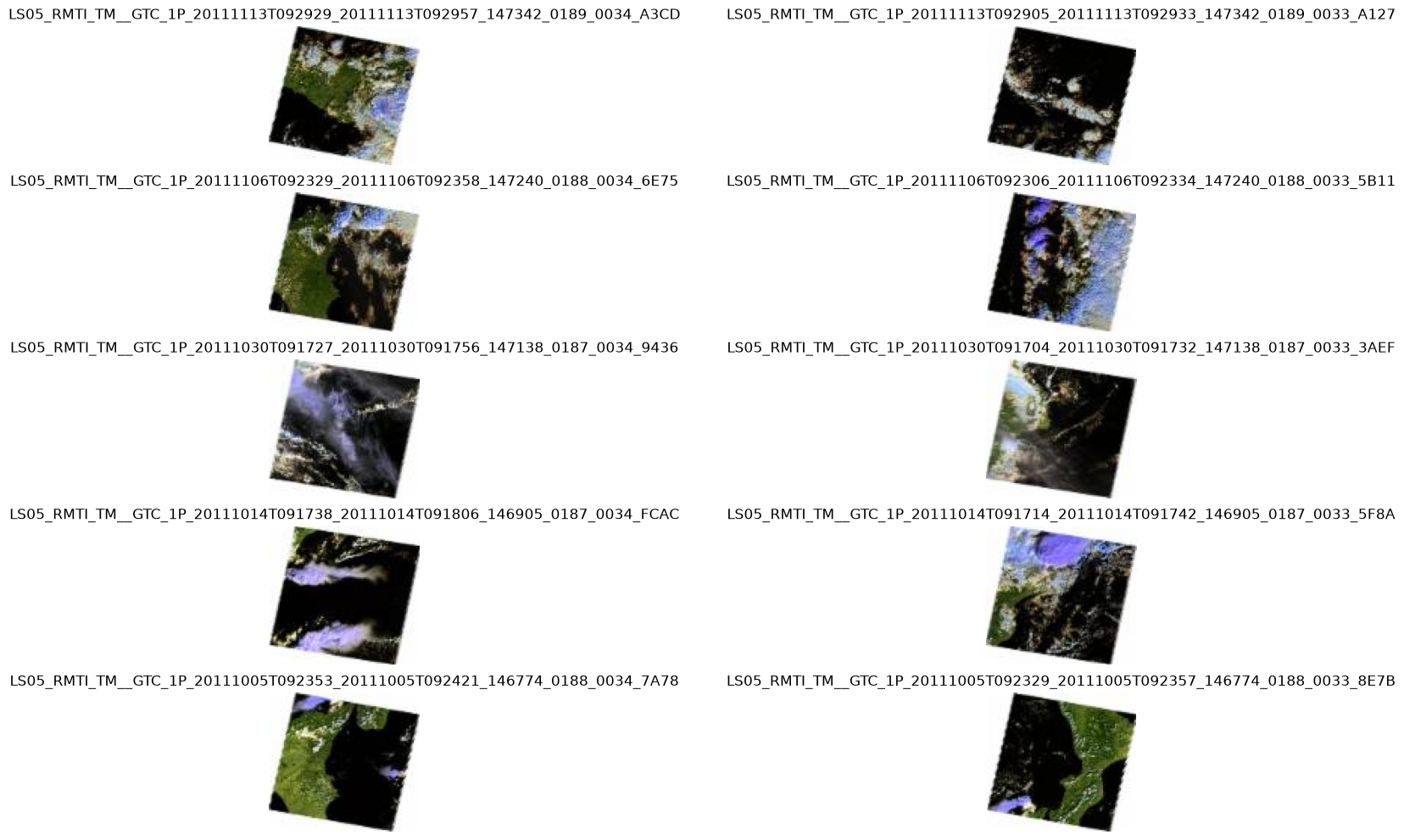
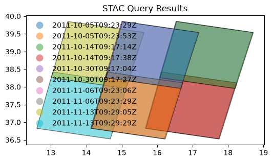
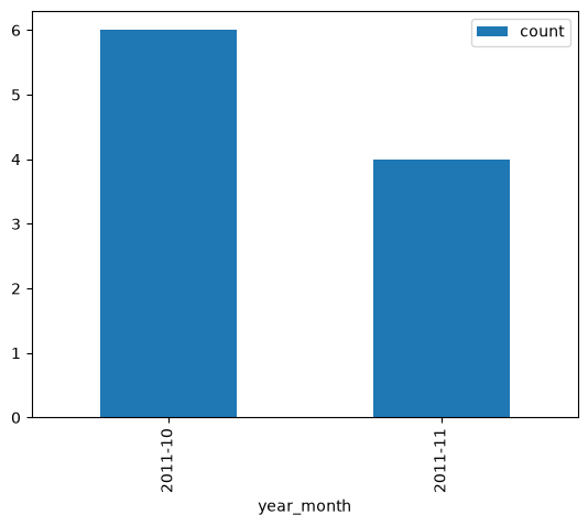
Example: 2.4
Search granules by bounding box {bbox} [RD11]. Geometry parameter is provided as Python tuple.
# x, y = (14.95, 37.74)   # Center point of query (Mount Etna)
x, y = (4.38, 51.25)   # Center point of query (Antwerp harbour)

r = 0.1
box = (x - r, y - r, x + r, y + r)

from pystac_client import Client
api = Client.open(URL_LANDING_PAGE)

results = api.search(
    method = 'GET',
    max_items=10,
    collections=[COLLECTION_ID1],
    bbox = box
)
Same request using curl.
curl -X GET -G https://fedeo.ceos.org/search \
	--data-urlencode "bbox=4.28,51.15,4.4799999999999995,51.35" \
	--data-urlencode "collections=LANDSAT.TM.GTC"
1483 items found.
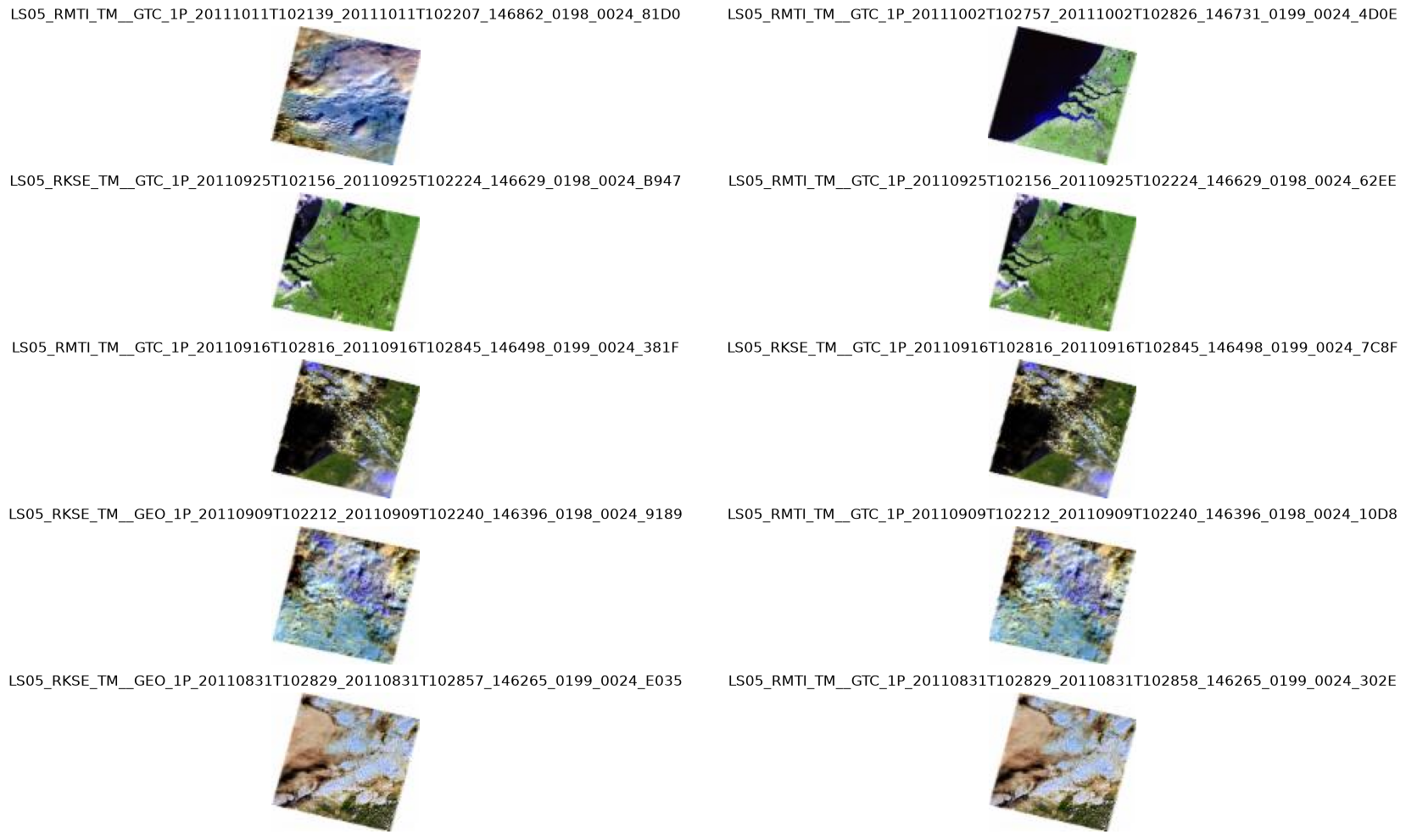
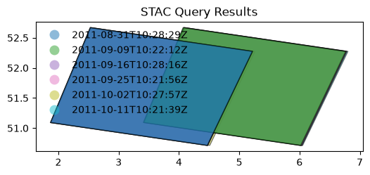
Search by temporal extent#
Example: 2.6
Search granules by date range (datetime) [RD01].
from pystac_client import Client
api = Client.open(URL_LANDING_PAGE)

results = api.search(
    method = 'GET',
    max_items = 50,
    collections=[COLLECTION_ID1],
    datetime=['2011-01-01T00:00:00Z', '2011-12-01T00:00:00Z']
)
curl -X GET -G https://fedeo.ceos.org/search \
	--data-urlencode "datetime=2011-01-01T00:00:00Z/2011-12-01T00:00:00Z" \
	--data-urlencode "collections=LANDSAT.TM.GTC"
display_date_distribution(results)
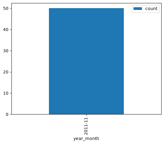
Example: 2.7
Search granules by open-ended date range (datetime) [RD01].
from pystac_client import Client
api = Client.open(URL_LANDING_PAGE)

results = api.search(
    method = 'GET',
    max_items = 50,
    collections=[COLLECTION_ID1],
    datetime=['2011-01-01T00:00:00Z', None]
)
curl -X GET -G https://fedeo.ceos.org/search \
	--data-urlencode "datetime=2011-01-01T00:00:00Z/.." \
	--data-urlencode "collections=LANDSAT.TM.GTC"
print(f"{results.matched()} items found.")
22628 items found.
display_value_distribution(results, 'sar:product_type')
sar:product_type values are not available.
Search by identifier#
Example: 2.8
Search granule by identifier (ids) [RD01].
granule_id1
'LS05_RMTI_TM__GTC_1P_20111116T100218_20111116T100236_147386_0194_0039_CA07'
from pystac_client import Client
api = Client.open(URL_LANDING_PAGE)

results = api.search(
    method = 'GET',
    collections=[COLLECTION_ID1],
    ids=[granule_id1]
)
curl -X GET -G https://fedeo.ceos.org/search \
	--data-urlencode "ids=LS05_RMTI_TM__GTC_1P_20111116T100218_20111116T100236_147386_0194_0039_CA07" \
	--data-urlencode "collections=LANDSAT.TM.GTC"
1 items found.
| 0 | |
|---|---|
| geometry | POLYGON ((3.39763 31.2415, 3.12134 30.2132, 5.... |
| grid:code | WRS-194-39 |
| proj:code | EPSG:4326 |
| start_datetime | 2011-11-16T10:02:18Z |
| end_datetime | 2011-11-16T10:02:36Z |
| view:sun_azimuth | 154.432 |
| product:type | TM__GTC_1P |
| title | LS05_RMTI_TM__GTC_1P_20111116T100218_20111116T... |
| version | SLA |
| platform | Landsat-5 |
| view:sun_elevation | 36.8489 |
| datetime | 2011-11-16T10:02:18Z |
| instruments | [TM] |
| constellation | Landsat |
| sat:orbit_state | descending |
| eo:cloud_cover | 0 |
| eopf:instrument_mode | IM |
| updated | 2026-05-29T12:03:59Z |
| sat:absolute_orbit | 147386 |
| product:acquisition_type | nominal |
Example: 2.10
Search granules with filter {filter} [RD01]. Available filters are advertised in
Queryablesobject at /collections/{id}/queryables.
from pystac_client import Client
api = Client.open(URL_LANDING_PAGE)

results = api.search(
    method = 'GET',
    max_items=10,
    collections=[COLLECTION_ID1],
    bbox = [14.90, 37.700, 14.99, 37.780], # Mount Etna
    datetime=['2011-01-01T00:00:00Z', '2011-01-15T00:00:00Z'],
    filter="productType='TM__GTC_1P' and instrument='TM'"
)
Same request with curl.
curl -X GET -G https://fedeo.ceos.org/search \
	--data-urlencode "bbox=14.9,37.7,14.99,37.78" \
	--data-urlencode "datetime=2011-01-01T00:00:00Z/2011-01-15T00:00:00Z" \
	--data-urlencode "collections=LANDSAT.TM.GTC" \
	--data-urlencode "filter=productType='TM__GTC_1P' and instrument='TM'" \
	--data-urlencode "filter-lang=cql2-text"
2 items found.

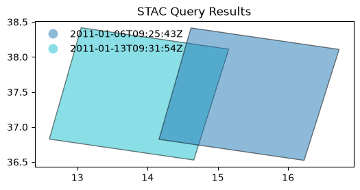
display_value_distribution(results, 'sar:product_type')
sar:product_type values are not available.
Search by cloud cover#
Example: 2.11
Search granules by cloudcover (
filterandcloudCover) [RD01]. Available filters are advertised inQueryablesobject at /collections/{id}/queryables.
from pystac_client import Client
api = Client.open(URL_LANDING_PAGE)

results = api.search(
    method = 'GET',
    max_items=50,
    collections=[COLLECTION_ID3_CLOUDS],
    filter="eo:cloud_cover < 10"
)
curl -X GET -G https://fedeo.ceos.org/search \
	--data-urlencode "collections=IKONOS.ESA.archive" \
	--data-urlencode "filter=eo:cloud_cover < 10" \
	--data-urlencode "filter-lang=cql2-text"
246 items found.
# Display cloud-cover values as histogram to show that range is taken into account
stac_json = results.item_collection_as_dict();
gdf = gpd.GeoDataFrame.from_features(stac_json)
try:
  _ = gdf[['title','eo:cloud_cover']].hist()
except:
  print("eo:cloud_cover information is not available.")
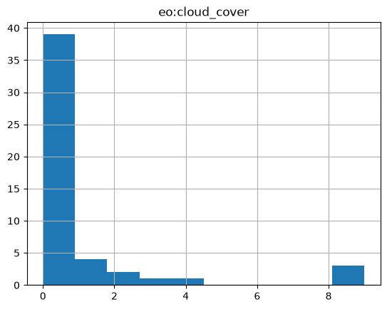
# fails if properties are not in the metadata.
try:
  # _ = gdf[['view:sun_elevation','view:incidence_angle','view:sun_azimuth']].plot.hist(alpha=0.7)
  _ = gdf[['view:sun_elevation','view:sun_azimuth']].plot.hist(alpha=0.7)
except:
  print("acquisition angle information is not available.")
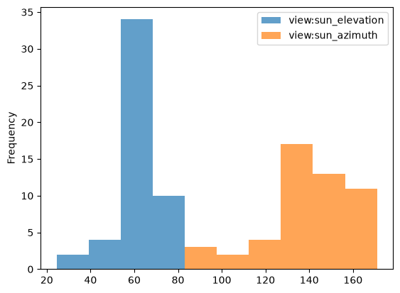
# gdf
# display_value_distribution(results, 'sat:orbit_state')
display_value_distribution(results, 'sar:product_type')
sar:product_type values are not available.
Search multiple collections#
Example: 2.12
Search granules in multiple collections {collections} [RD01].
from pystac_client import Client
api = Client.open(URL_LANDING_PAGE)

results = api.search(
    method = 'GET',
    max_items=10,
    collections=[COLLECTION_ID2_CLOUDS, COLLECTION_ID3_CLOUDS],
    bbox = [-10.5,37.5,-8.5,39.5]
)
curl -X GET -G https://fedeo.ceos.org/search \
	--data-urlencode "bbox=-10.5,37.5,-8.5,39.5" \
	--data-urlencode "collections=LANDSAT.ETM.GTC,IKONOS.ESA.archive"
print(f"{results.items()} items found.")
<generator object ItemSearch.items at 0x0000019E9AE2DA80> items found.
Example: 2.13
Search granules in multiple collections {collections} [RD01] using
POST.
from pystac_client import Client
api = Client.open(URL_LANDING_PAGE)

results = api.search(
    method = 'POST',
    max_items=50,
    collections=[COLLECTION_ID2_CLOUDS, COLLECTION_ID3_CLOUDS],
    bbox = [-10.5,37.5,-8.5,39.5]
)
curl -X POST https://fedeo.ceos.org/search \
	--header 'Content-Type: application/json' \
	--data-raw '{
		"bbox": "-10.5,37.5,-8.5,39.5",
		"collections": ["LANDSAT.ETM.GTC", "IKONOS.ESA.archive"]
	}'
print(f"{results.items()} items found.")
<generator object ItemSearch.items at 0x0000019E9AE2DA80> items found.
Granule properties#
Granules are returned via item links in the Catalog or Collection objects, or via the STAC API (Feature).
An item is a GeoJSON Feature and the encoding is derived from the original OGC 17-003r2 encoding
according to a documented mapping.
The properties available include attributes from STAC extensions as well:
Assets#
Granules provide access to a dictionary with assets. The roles attribute indicates the purpose of the asset. The href attribute provides the URL to access the asset. Granule assets include thumbnail (when available), a data download link (equivalent to the rel=enclosure), and various metadata formats.
The table below list some frequently used metadata formats and their corresponding media type (type).
Format |
type |
|---|---|
application/vnd.iso.19139+xml |
|
application/vnd.iso.19139-2+xml |
|
application/vnd.iso.19115-3+xml |
|
application/gml+xml;profile=http://www.opengis.net/spec/EOMPOM/1.1 |
|
application/geo+json;profile=http://www.opengis.net/spec/eo-geojson/1.0 |
# Show assets of first search result (GeoJSON)
data = results.item_collection_as_dict()
jstr = json.dumps(data['features'][1]['assets'], indent=3)
md("```json\n" + jstr + "\n```\n")
{
   "enclosure_zip": {
      "roles": [
         "data"
      ],
      "href": "https://landsat-diss.eo.esa.int/oads/data/LandsatETM/L07_RMTI_ETM_GTC_1P_20031226T110245_20031226T110314_024987_0204_0032_850C_v0100.SIP.ZIP",
      "published": "2003-12-26T11:03:14Z",
      "type": "application/zip",
      "title": "Download"
   },
   "thumbnail": {
      "roles": [
         "thumbnail"
      ],
      "href": "http://landsat-diss.eo.esa.int/oads/meta/LandsatETM/thumbnail/L07_RMTI_ETM_GTC_1P_20031226T110245_20031226T110314_024987_0204_0032_850C_v0100.SIP.ZIP_TIMG.jpg",
      "type": "image/jpeg",
      "title": "THUMBNAIL"
   },
   "offering_2": {
      "roles": [
         "http://www.opengis.net/spec/owc-geojson/1.0/req/wmts#GetTile"
      ],
      "href": "https://vs.eo.esa.int/wmts07/1.0.0/ETM_GTC_1P/default/2003-12-26T11:02:45Z--2003-12-26T11:03:14Z/WGS84/{TileMatrix}/{TileRow}/{TileCol}.jpgpng",
      "title": "GetTile",
      "type": "image/jpgpng"
   },
   "quicklook_png": {
      "roles": [
         "overview"
      ],
      "href": "http://landsat-diss.eo.esa.int/oads/meta/LandsatETM/browse/L07_RMTI_ETM_GTC_1P_20031226T110245_20031226T110314_024987_0204_0032_850C_v0100.SIP.ZIP_BID.PNG",
      "type": "image/png",
      "title": "QUICKLOOK"
   },
   "offering_1": {
      "roles": [
         "http://www.opengis.net/spec/owc-geojson/1.0/req/wmts#GetCapabilities"
      ],
      "href": "https://vs.eo.esa.int/wmts07/1.0.0/WMTSCapabilities.xml",
      "title": "GetCapabilities",
      "type": "application/xml"
   },
   "metadata_ogc_10_157r4": {
      "roles": [
         "metadata"
      ],
      "href": "https://catalog.maap.eo.esa.int/catalogue/collections/LANDSAT.ETM.GTC/items/LS07_RMTI_ETM_GTC_1P_20031226T110245_20031226T110314_024987_0204_0032_850C?httpAccept=application/gml%2Bxml&recordSchema=om",
      "title": "OGC 10-157r4 metadata",
      "type": "application/gml+xml;profile=\"http://www.opengis.net/spec/EOMPOM/1.1\""
   },
   "offering_4": {
      "roles": [
         "http://www.opengis.net/spec/owc-geojson/1.0/req/wms#GetMap"
      ],
      "href": "https://vs.eo.esa.int/wms07/ows?service=WMS&version=1.1.1&request=GetMap&layers=ETM_GTC_1P___heatmap&format=image/png&TRANSPARENT=true&TIME=2003-12-26T11:02:45Z/2003-12-26T11:03:14Z&width={Width}&height={Height}&SRS=EPSG:4326&styles={Styles}&bbox={BoundingBox}&dim_range={DimRange}",
      "title": "GetMap",
      "type": "image/png"
   },
   "metadata_ogc_17_003r2": {
      "roles": [
         "metadata"
      ],
      "href": "https://catalog.maap.eo.esa.int/catalogue/collections/LANDSAT.ETM.GTC/items/LS07_RMTI_ETM_GTC_1P_20031226T110245_20031226T110314_024987_0204_0032_850C?mode=owc",
      "title": "OGC 17-003r2 metadata",
      "type": "application/geo+json;profile=\"http://www.opengis.net/spec/eo-geojson/1.0\""
   },
   "metadata_iso_19139": {
      "roles": [
         "metadata"
      ],
      "href": "https://catalog.maap.eo.esa.int/catalogue/collections/LANDSAT.ETM.GTC/items/LS07_RMTI_ETM_GTC_1P_20031226T110245_20031226T110314_024987_0204_0032_850C?httpAccept=application/vnd.iso.19139%2Bxml",
      "title": "ISO 19139 metadata",
      "type": "application/vnd.iso.19139+xml"
   },
   "offering_3": {
      "roles": [
         "http://www.opengis.net/spec/owc-geojson/1.0/req/wms#GetCapabilities"
      ],
      "href": "https://vs.eo.esa.int/wms07/ows?service=WMS&version=1.1.1&request=GetCapabilities",
      "title": "GetCapabilities",
      "type": "application/xml"
   }
}
df = pd.DataFrame(columns=['roles', 'title', 'type'])

# Display assets belonging to first item in results
for item in results.items():
    assets = item.assets
    for key in assets:
        ndf = pd.DataFrame({
            'roles': assets[key].roles,
            'type': assets[key].media_type,
            'title': assets[key].title,
            # 'href': assets[key].href
        }, index = [0])
        df = pd.concat([df, ndf], ignore_index=True)

    break
df
| roles | title | type | |
|---|---|---|---|
| 0 | data | Download | application/zip |
| 1 | thumbnail | THUMBNAIL | image/jpeg |
| 2 | http://www.opengis.net/spec/owc-geojson/1.0/re... | GetTile | image/jpgpng |
| 3 | overview | QUICKLOOK | image/png |
| 4 | http://www.opengis.net/spec/owc-geojson/1.0/re... | GetCapabilities | application/xml |
| 5 | metadata | OGC 10-157r4 metadata | application/gml+xml;profile="http://www.opengi... |
| 6 | http://www.opengis.net/spec/owc-geojson/1.0/re... | GetMap | image/png |
| 7 | metadata | OGC 17-003r2 metadata | application/geo+json;profile="http://www.openg... |
| 8 | metadata | ISO 19139 metadata | application/vnd.iso.19139+xml |
| 9 | http://www.opengis.net/spec/owc-geojson/1.0/re... | GetCapabilities | application/xml |
Advanced topics#
Conformance classes#
The conformance classes supported by the STAC interface are advertised in the conformsTo property of the landing page.
[
   "http://www.opengis.net/spec/ogcapi-features-1/1.0/conf/core",
   "http://www.opengis.net/spec/ogcapi-features-1/1.0/conf/oas30",
   "http://www.opengis.net/spec/ogcapi-features-1/1.0/conf/geojson",
   "http://www.opengis.net/spec/ogcapi_common-2/1.0/conf/collections",
   "http://www.opengis.net/spec/ogcapi-common-2/1.0/conf/simple-query",
   "http://www.opengis.net/spec/ogcapi-records-1/1.0/req/cql-filter",
   "http://www.opengis.net/spec/ogcapi-features-3/1.0/conf/features-filter",
   "http://www.opengis.net/spec/ogcapi-features-3/1.0/conf/filter",
   "https://api.stacspec.org/v1.0.0/core",
   "https://api.stacspec.org/v1.0.0/ogcapi-features",
   "https://api.stacspec.org/v1.0.0/collections",
   "https://api.stacspec.org/v1.0.0-rc.1/collection-search",
   "https://api.stacspec.org/v1.0.0-rc.1/collection-search#filter",
   "https://api.stacspec.org/v1.0.0-rc.1/collection-search#free-text",
   "https://api.stacspec.org/v1.0.0-rc.1/collection-search#sort",
   "https://api.stacspec.org/v1.0.0/item-search",
   "https://api.stacspec.org/v1.0.0-rc.3/item-search#filter",
   "http://www.opengis.net/spec/cql2/1.0/conf/cql2-text",
   "http://www.opengis.net/spec/cql2/1.0/conf/basic-cql2",
   "http://www.opengis.net/spec/cql2/1.0/conf/cql2-json",
   "http://www.opengis.net/spec/cql2/1.0/conf/advanced-comparison-operators",
   "https://api.stacspec.org/v1.0.0/item-search#sort",
   "https://api.stacspec.org/v1.0.0/ogcapi-features#sort",
   "https://api.stacspec.org/v1.0.0/ogcapi-features#sort",
   "https://api.stacspec.org/v1.0.0/item-search#fields",
   "https://api.stacspec.org/v1.0.0/ogcapi-features#fields",
   "https://api.stacspec.org/v1.0.0-rc.1/collection-search#fields",
   "https://api.stacspec.org/v1.0.0/ogcapi-features/extensions/transaction"
]
Additional search parameters#
Additional search parameters beyond the STAC search parameters can be used to filter collection search results. The available parameters for collection search are advertised at https://fedeo.ceos.org/collections/queryables and represented as a JSON Schema.
URL_QUERYABLES = URL_LANDING_PAGE + 'collections/queryables'
curl -X GET -G https://fedeo.ceos.org/collections/queryables
response = requests.get(URL_QUERYABLES)
data = json.loads(response.text)
df = pd.DataFrame(data['properties'].items(),columns=['key','value'])
df['type'] = df.apply(lambda row : row['value']['type'], axis = 1)
df['format'] = df.apply(lambda row : row['value']['format'] if 'format' in row['value'] else '-' , axis = 1)
df.drop('value',axis=1).sort_values(by=['key'])
| key | type | format | |
|---|---|---|---|
| 15 | accessConstraint | string | - |
| 6 | ceosard:specification | string | - |
| 12 | ceosard:specification_version | string | - |
| 19 | classifiedAs | string | uri |
| 5 | collection | string | - |
| 10 | datetime | string | - |
| 3 | description | string | - |
| 4 | externalId | string | - |
| 2 | format | string | - |
| 16 | id | string | - |
| 11 | instruments | string | - |
| 14 | offering | string | - |
| 8 | otherConstraint | string | - |
| 9 | platform | string | - |
| 0 | processing:level | string | - |
| 18 | providers | string | - |
| 1 | sci:doi | string | - |
| 7 | title | string | - |
| 17 | updated | string | date-time |
| 13 | useLimitation | string | - |
{
"$schema": "https://json-schema.org/draft/2019-09/schema",
"description": "Queryable names for the STAC API Collection Search filter.",
"type": "object",
"title": "Queryables for the STAC API",
"properties": {
"processing:level": {
"description": "The processing level applied to the entry",
"title": "Processing level",
"type": "string"
},
"sci:doi": {
"description": "Digital Object Identifier identifying the product (see http://www.doi.org)",
"title": "Doi",
"type": "string",
"enum": [
"10.1101/2025.08.31.673375",
"10.1111/2041-210X.14416",
"10.15489/4hcq6dgkj648",
"10.15489/ifczsszkcp63",
"10.19038/SAC/10/3A-CCD-AOD",
"10.19038/SAC/10/3A-CCD-COMPOSITE-NDV",
"10.19038/SAC/10/3A-CCD-GPS",
"10.19038/SAC/10/3A-CCD-L1",
"10.19038/SAC/10/3A-CCD-NDV",
"10.19038/SAC/10/3A-VHR-DAILYOLR",
"10.19038/SAC/10/3A-VHR-DAILYQPE",
"10.19038/SAC/10/3A-VHR-DAILYSST",
"10.19038/SAC/10/3A-VHR-DAILYUTH",
"10.19038/SAC/10/3A-VHR-L1",
"10.19038/SAC/10/3A-VHR-L1-INDIAN SECTOR",
"10.19038/SAC/10/3A-VHR-L1-INDIANSECTOR",
"10.19038/SAC/10/3A-VHR-OLR",
"10.19038/SAC/10/3A-VHR-QPE",
"10.19038/SAC/10/3A-VHR-SST",
"10.19038/SAC/10/3A-VHR-UTH",
"10.19038/SAC/10/3DIMG_L1B_STD",
"10.19038/SAC/10/3DIMG_L1C_ASIA_MER",
"10.19038/SAC/10/3DIMG_L1C_SGP",
"10.19038/SAC/10/3DIMG_L2B_CMK",
"10.19038/SAC/10/3DIMG_L2B_CTP",
"10.19038/SAC/10/3DIMG_L2B_FOG",
"10.19038/SAC/10/3DIMG_L2B_HEM",
"10.19038/SAC/10/3DIMG_L2B_IMC",
"10.19038/SAC/10/3DIMG_L2B_LST",
"10.19038/SAC/10/3DIMG_L2B_OLR",
"10.19038/SAC/10/3DIMG_L2B_SST",
"10.19038/SAC/10/3DIMG_L2B_UTH",
"10.19038/SAC/10/3DIMG_L2C_CMP",
"10.19038/SAC/10/3DIMG_L2C_FOG",
"10.19038/SAC/10/3DIMG_L2C_INS",
"10.19038/SAC/10/3DIMG_L2C_SNW",
"10.19038/SAC/10/3DIMG_L2G_AOD",
"10.19038/SAC/10/3DIMG_L2G_GPI",
"10.19038/SAC/10/3DIMG_L2G_IMR",
"10.19038/SAC/10/3DIMG_L2G_SST",
"10.19038/SAC/10/3DIMG_L2G_WDP",
"10.19038/SAC/10/3DIMG_L2P_FIR",
"10.19038/SAC/10/3DIMG_L2P_IRW",
"10.19038/SAC/10/3DIMG_L2P_IRW_MERGED",
"10.19038/SAC/10/3DIMG_L2P_MRW",
"10.19038/SAC/10/3DIMG_L2P_SMK",
"10.19038/SAC/10/3DIMG_L2P_VSW",
"10.19038/SAC/10/3DIMG_L2P_WVW",
"10.19038/SAC/10/3DIMG_L2P_WV_MERGED",
"10.19038/SAC/10/3DIMG_L3B_HEM_DLY",
"10.19038/SAC/10/3DIMG_L3B_HEM_WKL",
"10.19038/SAC/10/3DIMG_L3B_OLR_DLY",
"10.19038/SAC/10/3DIMG_L3B_OLR_WKL",
"10.19038/SAC/10/3DIMG_L3B_SST_DLY",
"10.19038/SAC/10/3DIMG_L3B_SST_WKL",
"10.19038/SAC/10/3DIMG_L3B_UTH_DLY",
"10.19038/SAC/10/3DIMG_L3B_UTH_WKL",
"10.19038/SAC/10/3DIMG_L3C_INS_DLY",
"10.19038/SAC/10/3DIMG_L3C_PET_DLY",
"10.19038/SAC/10/3DIMG_L3G_GPI_DLY",
"10.19038/SAC/10/3DIMG_L3G_GPI_WKL",
"10.19038/SAC/10/3DIMG_L3G_IMR_DLY",
"10.19038/SAC/10/3DIMG_L3G_IMR_WKL",
"10.19038/SAC/10/3DSND_L1B_SA1",
"10.19038/SAC/10/3DSND_L1B_SA2",
"10.19038/SAC/10/3DSND_L1B_SB1",
"10.19038/SAC/10/3DSND_L1B_STD",
"10.19038/SAC/10/3DSND_L2B_PFL",
"10.19038/SAC/10/3DSND_L2B_SA1",
"10.19038/SAC/10/3DSND_L2B_SA2",
"10.19038/SAC/10/3DSND_L2B_SB1",
"10.19038/SAC/10/3RIMG_L1B_STD",
"10.19038/SAC/10/3RIMG_L1C_ASIA_MER",
"10.19038/SAC/10/3RIMG_L1C_SGP",
"10.19038/SAC/10/3RIMG_L2B_CMK",
"10.19038/SAC/10/3RIMG_L2B_CTP",
"10.19038/SAC/10/3RIMG_L2B_HEM",
"10.19038/SAC/10/3RIMG_L2B_IMC",
"10.19038/SAC/10/3RIMG_L2B_LST",
"10.19038/SAC/10/3RIMG_L2B_OLR",
"10.19038/SAC/10/3RIMG_L2B_SST",
"10.19038/SAC/10/3RIMG_L2B_UTH",
"10.19038/SAC/10/3RIMG_L2C_CMP",
"10.19038/SAC/10/3RIMG_L2C_FOG",
"10.19038/SAC/10/3RIMG_L2C_INS",
"10.19038/SAC/10/3RIMG_L2C_SNW",
"10.19038/SAC/10/3RIMG_L2G_AOD",
"10.19038/SAC/10/3RIMG_L2G_GPI",
"10.19038/SAC/10/3RIMG_L2G_IMR",
"10.19038/SAC/10/3RIMG_L2G_WDP",
"10.19038/SAC/10/3RIMG_L2P_FIR",
"10.19038/SAC/10/3RIMG_L2P_IRW",
"10.19038/SAC/10/3RIMG_L2P_IRW_MERGED",
"10.19038/SAC/10/3RIMG_L2P_MRW",
"10.19038/SAC/10/3RIMG_L2P_SMK",
"10.19038/SAC/10/3RIMG_L2P_VSW",
"10.19038/SAC/10/3RIMG_L2P_WVW",
"10.19038/SAC/10/3RIMG_L2P_WV_MERGED",
"10.19038/SAC/10/3RIMG_L3B_HEM_DLY",
"10.19038/SAC/10/3RIMG_L3B_HEM_WKL",
"10.19038/SAC/10/3RIMG_L3B_OLR_DLY",
"10.19038/SAC/10/3RIMG_L3B_OLR_WKL",
"10.19038/SAC/10/3RIMG_L3B_SST_DLY",
"10.19038/SAC/10/3RIMG_L3B_SST_WKL",
"10.19038/SAC/10/3RIMG_L3B_UTH_DLY",
"10.19038/SAC/10/3RIMG_L3B_UTH_WKL",
"10.19038/SAC/10/3RIMG_L3C_INS_DLY",
"10.19038/SAC/10/3RIMG_L3C_PET_DLY",
"10.19038/SAC/10/3RIMG_L3G_GPI_DLY",
"10.19038/SAC/10/3RIMG_L3G_GPI_WKL",
"10.19038/SAC/10/3RIMG_L3G_IMR_DLY",
"10.19038/SAC/10/3RIMG_L3G_IMR_WKL",
"10.19038/SAC/10/3RSND_L1B_SA1",
"10.19038/SAC/10/3RSND_L1B_SA2",
"10.19038/SAC/10/3RSND_L1B_SB1",
"10.19038/SAC/10/3RSND_L2B_SA1",
"10.19038/SAC/10/3RSND_L2B_SA2",
"10.19038/SAC/10/3RSND_L2B_SB1",
"10.19038/SAC/10/3SIMG_L1B_STD",
"10.19038/SAC/10/3SIMG_L1C_ASIA_MER",
"10.19038/SAC/10/3SIMG_L1C_SGP",
"10.19038/SAC/10/3SIMG_L2B_CMK",
"10.19038/SAC/10/3SIMG_L2B_CTP",
"10.19038/SAC/10/3SIMG_L2B_HEM",
"10.19038/SAC/10/3SIMG_L2B_IMC",
"10.19038/SAC/10/3SIMG_L2B_LST",
"10.19038/SAC/10/3SIMG_L2B_OLR",
"10.19038/SAC/10/3SIMG_L2B_SST",
"10.19038/SAC/10/3SIMG_L2B_UTH",
"10.19038/SAC/10/3SIMG_L2C_CMP",
"10.19038/SAC/10/3SIMG_L2C_FOG",
"10.19038/SAC/10/3SIMG_L2C_INS",
"10.19038/SAC/10/3SIMG_L2C_SNW",
"10.19038/SAC/10/3SIMG_L2G_AOD",
"10.19038/SAC/10/3SIMG_L2G_GPI",
"10.19038/SAC/10/3SIMG_L2G_IMR",
"10.19038/SAC/10/3SIMG_L2G_WDP",
"10.19038/SAC/10/3SIMG_L2P_AMV",
"10.19038/SAC/10/3SIMG_L2P_FIR",
"10.19038/SAC/10/3SIMG_L2P_IRW",
"10.19038/SAC/10/3SIMG_L2P_MRW",
"10.19038/SAC/10/3SIMG_L2P_SMK",
"10.19038/SAC/10/3SIMG_L2P_VSW",
"10.19038/SAC/10/3SIMG_L2P_WVW",
"10.19038/SAC/10/3SIMG_L3B_HEM_DLY",
"10.19038/SAC/10/3SIMG_L3B_IMC_DLY",
"10.19038/SAC/10/3SIMG_L3B_LST_DLY",
"10.19038/SAC/10/3SIMG_L3B_OLR_DLY",
"10.19038/SAC/10/3SIMG_L3B_SST_DLY",
"10.19038/SAC/10/3SIMG_L3B_SWR_DLY",
"10.19038/SAC/10/3SIMG_L3B_UTH_DLY",
"10.19038/SAC/10/3SIMG_L3C_INS_DLY",
"10.19038/SAC/10/3SIMG_L3C_PET_DLY",
"10.19038/SAC/10/3SIMG_L3G_GPI_DLY",
"10.19038/SAC/10/3SIMG_L3G_IMR_DLY",
"10.19038/SAC/10/3SSND_L1B_SA1",
"10.19038/SAC/10/3SSND_L1B_SB1",
"10.19038/SAC/10/3SSND_L2B_SA1",
"10.19038/SAC/10/3SSND_L2B_SB1",
"10.19038/SAC/10/E06OCM_L2C_LAC_AD",
"10.19038/SAC/10/E06OCM_L2C_LAC_GA",
"10.19038/SAC/10/E06OCM_L2C_LAC_OC",
"10.19038/SAC/10/E06OCM_L2C_LAC_PR",
"10.19038/SAC/10/E06OCM_L2C_LAC_PS",
"10.19038/SAC/10/E06OCM_L3_LAC_AD",
"10.19038/SAC/10/E06OCM_L3_LAC_FL",
"10.19038/SAC/10/E06OCM_L3_LAC_PC",
"10.19038/SAC/10/E06OCM_L4_AC",
"10.19038/SAC/10/E06SCT_L1B_SIG",
"10.19038/SAC/10/E06SCT_L2A_SIG12",
"10.19038/SAC/10/E06SCT_L2A_SIG25",
"10.19038/SAC/10/E06SCT_L2B_WV12",
"10.19038/SAC/10/E06SCT_L2B_WV25",
"10.19038/SAC/10/E06SCT_L3_SIG12_HH",
"10.19038/SAC/10/E06SCT_L3_SIG12_VV",
"10.19038/SAC/10/E06SCT_L3_SIG25_HH",
"10.19038/SAC/10/E06SCT_L3_SIG25_VV",
"10.19038/SAC/10/E06SCT_L3_WW12",
"10.19038/SAC/10/E06SCT_L3_WW25",
"10.19038/SAC/10/E06SCT_L4_AWV",
"10.19038/SAC/10/E06SCT_L4_AWV6HOURLY",
"10.19038/SAC/10/E06SCT_L4_BT_GLB",
"10.19038/SAC/10/E06SCT_L4_BT_IND",
"10.19038/SAC/10/E06SCT_L4_BT_NP",
"10.19038/SAC/10/E06SCT_L4_BT_SP",
"10.19038/SAC/10/E06SCT_L4_GAM_IND",
"10.19038/SAC/10/E06SCT_L4_GAM_NP",
"10.19038/SAC/10/E06SCT_L4_GAM_SP",
"10.19038/SAC/10/E06SCT_L4_SIG_GLB",
"10.19038/SAC/10/E06SCT_L4_SIG_IND",
"10.19038/SAC/10/E06SCT_L4_SIG_NP",
"10.19038/SAC/10/E06SCT_L4_SIG_SP",
"10.19038/SAC/10/E06SCT_L4_UI",
"10.19038/SAC/10/K1-VHR-AMV",
"10.19038/SAC/10/K1-VHR-AMV-VIS",
"10.19038/SAC/10/K1-VHR-BRT",
"10.19038/SAC/10/K1-VHR-BTW",
"10.19038/SAC/10/K1-VHR-CMK",
"10.19038/SAC/10/K1-VHR-CMV",
"10.19038/SAC/10/K1-VHR-DAILYIMR",
"10.19038/SAC/10/K1-VHR-DAILYINS",
"10.19038/SAC/10/K1-VHR-DAILYOLR",
"10.19038/SAC/10/K1-VHR-DAILYQPE",
"10.19038/SAC/10/K1-VHR-DAILYSST",
"10.19038/SAC/10/K1-VHR-DAILYUTH",
"10.19038/SAC/10/K1-VHR-HEM",
"10.19038/SAC/10/K1-VHR-IMR",
"10.19038/SAC/10/K1-VHR-INS",
"10.19038/SAC/10/K1-VHR-L1",
"10.19038/SAC/10/K1-VHR-L1-INDIANSECTOR",
"10.19038/SAC/10/K1-VHR-LST",
"10.19038/SAC/10/K1-VHR-OLR",
"10.19038/SAC/10/K1-VHR-QPE",
"10.19038/SAC/10/K1-VHR-SGP",
"10.19038/SAC/10/K1-VHR-SGP-CMV",
"10.19038/SAC/10/K1-VHR-SGP-WVWV",
"10.19038/SAC/10/K1-VHR-SST",
"10.19038/SAC/10/K1-VHR-UTH",
"10.19038/SAC/10/K1-VHR-WVWV",
"10.19038/SAC/10/MT1MADSL1A",
"10.19038/SAC/10/MT1MADSL1A2",
"10.19038/SAC/10/MT1MADSL1B",
"10.19038/SAC/10/MT1MADSRRL2A",
"10.19038/SAC/10/MT1SAPSGPL2A",
"10.19038/SAC/10/MT1SAPSL1A",
"10.19038/SAC/10/MT1SAPSL1A2",
"10.19038/SAC/10/MT1SAPSL1B",
"10.19038/SAC/10/MT1SAPSRRL2A",
"10.19038/SAC/10/MT1SCASGPL2A",
"10.19038/SAC/10/MT1SCASL1A",
"10.19038/SAC/10/MT1SCASL1A2",
"10.19038/SAC/10/MT1SCASL1B",
"10.19038/SAC/10/O2-SCT-AWV50",
"10.19038/SAC/10/O2-SCT-DAILYAWV50",
"10.19038/SAC/10/O2-SCT-HWV",
"10.19038/SAC/10/S1SCT-SIGL1B",
"10.19038/SAC/10/S1SCT-SIGL2A25",
"10.19038/SAC/10/S1SCT-SIGL2A50",
"10.19038/SAC/10/S1SCT-SIGL2B25",
"10.19038/SAC/10/S1SCT-SIGL2B50",
"10.19038/SAC/10/S1SCT-SIGL325-HH",
"10.19038/SAC/10/S1SCT-SIGL325-VV",
"10.19038/SAC/10/S1SCT-SIGL350-HH",
"10.19038/SAC/10/S1SCT-SIGL350-VV",
"10.19038/SAC/10/S1SCT-WWL325",
"10.19038/SAC/10/S1SCT-WWL350",
"10.19038/SAC/10/S1SCT_L3_BT25",
"10.19038/SAC/10/S1SCT_L3_IC",
"10.19038/SAC/10/S1SCT_L4_AWV25",
"10.19038/SAC/10/S1SCT_L4_AWV625",
"10.19038/SAC/10/S1SCT_L4_BT625_GLB",
"10.19038/SAC/10/S1SCT_L4_BT_GLB",
"10.19038/SAC/10/S1SCT_L4_BT_IND",
"10.19038/SAC/10/S1SCT_L4_BT_NP",
"10.19038/SAC/10/S1SCT_L4_BT_SP",
"10.19038/SAC/10/S1SCT_L4_GAM_GLB",
"10.19038/SAC/10/S1SCT_L4_GAM_IND",
"10.19038/SAC/10/S1SCT_L4_GAM_NP",
"10.19038/SAC/10/S1SCT_L4_GAM_SP",
"10.19038/SAC/10/S1SCT_L4_HWV",
"10.19038/SAC/10/S1SCT_L4_SIG_GLB",
"10.19038/SAC/10/S1SCT_L4_SIG_IND",
"10.19038/SAC/10/S1SCT_L4_SIG_NP",
"10.19038/SAC/10/S1SCT_L4_SIG_SP",
"10.19038/SAC/10/S1SCT_L4_UI",
"10.19038/SAC/10/SRLGPN",
"10.19038/SAC/10/SRLGPR",
"10.19038/SAC/10/SRLGPS",
"10.19038/SAC/10/SRLIPN",
"10.19038/SAC/10/SRLIPR",
"10.19038/SAC/10/SRLIPS",
"10.19038/SAC/10/SRLOPN",
"10.19038/SAC/10/SRLOPR",
"10.19038/SAC/10/atm_prf_igr_1d",
"10.19038/SAC/10/atm_prf_igr_l2",
"10.19038/SAC/10/atm_prf_igs_l2",
"10.19038/SAC/10/atm_prf_igu_1d",
"10.19038/SAC/10/atm_prf_igu_l2",
"10.2909/08f6ac55-b896-481f-bb1c-bd9e5e18c411",
"10.2909/0929daf7-a0a3-4428-9bc1-cec6691e85d8",
"10.2909/09578c73-4f5d-4d2c-90ff-4e17fb7dbf69",
"10.2909/0a29152a-cf72-416f-9d8e-f1b9d9d5014d",
"10.2909/0aedea4c-f2e3-4823-a60d-a4f3873aa13c",
"10.2909/0bceb940-f7a8-4467-a1f9-6f3d6a22791f",
"10.2909/0c03dc8e-b8b2-4c5c-88a5-8e9f9c153bc7",
"10.2909/1012ec6a-a073-4cb5-95f4-95dad6f4f423",
"10.2909/1f5db4df-b91a-4c4f-98de-aec229c89068",
"10.2909/219fdc9f-616b-444b-a495-198f527b4722",
"10.2909/281e62fc-fe9e-40ef-9a78-1e104dc2a352",
"10.2909/29051bfa-afd8-4ffc-a99d-4c097152749e",
"10.2909/290e81fb-4c84-42ad-ae12-f663312b0eda",
"10.2909/34ad510f-bba7-4c55-b1a6-8aac544bc216",
"10.2909/3893c1e6-eea1-46bc-9321-d11f0e39a044",
"10.2909/39e1ff33-01d9-45c2-9edc-00924383f34f",
"10.2909/4187eaf1-69f8-40ba-afff-c13b2433dd53",
"10.2909/45a5c6e5-f142-4e66-8017-fa9161c2768b",
"10.2909/47ff73a4-eb52-4e8d-80e7-b6c3910d8891",
"10.2909/49778fb4-bf1a-4e89-bd1d-09f1370e2bb9",
"10.2909/4a9529e9-4f5e-401f-bd72-dde7068848f6",
"10.2909/4cd93293-e944-4046-987c-66e4f59a2071",
"10.2909/58ca9f01-a526-418d-8862-b4be43ef4738",
"10.2909/59cc02d6-ddfe-4820-83cb-345205eacec5",
"10.2909/5a38461b-3ef7-4f97-a933-4c9f51a0eda5",
"10.2909/5ad6499b-c37e-45b6-8753-324963a2f551",
"10.2909/5bdf0a9e-7635-4d26-b949-2beed6dec23e",
"10.2909/5c6763f3-834c-4b9a-ba3a-bc3c14f85875",
"10.2909/5f0f5752-b908-4bfa-8270-4764cc4be991",
"10.2909/602507b2-96c7-47bb-b79d-7ba25e97d0a9",
"10.2909/64a4d49d-281d-42c0-a45c-3abb3f337ad3",
"10.2909/668f4071-5d18-48dc-9034-9680a2aea717",
"10.2909/67797662-7edc-4a29-b93b-a58af384b137",
"10.2909/6fda150f-5c38-4c7a-bddf-b327d07137bd",
"10.2909/709c4b92-a925-4dec-bab2-d110fe97b3c3",
"10.2909/711e5cf8-b0dd-4e34-9814-b7b60aba109f",
"10.2909/7417c491-9706-4eb4-989c-e339b27b1bc5",
"10.2909/77a7f444-2715-41df-bf09-38df610589a5",
"10.2909/7c47ba10-0419-4d68-90f7-49f7e28a0a3f",
"10.2909/7c6a6fab-6c7c-4790-a129-bfa48ec1f052",
"10.2909/7d726671-9647-4116-8dc3-cf7470a1a782",
"10.2909/7f2eb891-cadb-4aa0-8b43-2c18e2a442e9",
"10.2909/801137b8-9575-43ef-a073-140b663cc61c",
"10.2909/8048eb1c-8579-45c6-b188-b0a26ef26248",
"10.2909/832c7297-a20f-4b92-8e32-1e2e1548e642",
"10.2909/86c14646-c0b6-4b82-a82f-cbb23b331743",
"10.2909/8d5eac19-877e-459a-a501-e1182516d64d",
"10.2909/8fa58061-28ab-49bb-9b77-c26b50733e34",
"10.2909/9029c361-18b7-4189-bff9-744a2821858d",
"10.2909/905223f4-2c3d-4cb6-ad8c-d6d065707465",
"10.2909/90ca3e33-7926-4f71-857b-7336818cbd23",
"10.2909/9143c7a3-5c81-4b0d-b5d1-8cfea8a73d84",
"10.2909/9452ed34-081d-445f-a092-de13cf7d2830",
"10.2909/98c5e00e-3580-4bb3-9509-50a572b1e935",
"10.2909/9c0519f9-d2c2-4469-a9e1-2222d37c33d6",
"10.2909/a696fab4-c3dc-4dcc-b1d8-6fcd9a2ce1eb",
"10.2909/aa809355-f50a-4925-9fb1-bef32ff1c9aa",
"10.2909/ae760a70-708e-459a-8eec-6852462a5faf",
"10.2909/b0b65b9d-f826-4c7e-b8bf-1c9b8a407e5b",
"10.2909/b4149b9b-f020-42ea-9159-9c437ce4c15b",
"10.2909/b4e3720f-19a7-4b04-9de1-786eb52807ac",
"10.2909/b54be6e3-5962-4e9a-a443-9ff7ea943dfe",
"10.2909/b8e48c8d-f44e-40eb-9583-4a3254c2bbb3",
"10.2909/bfd77180-7d7c-4c1c-b193-1489f735d5f1",
"10.2909/c6377c6e-76cc-4d03-8330-628a03693042",
"10.2909/c828c1b2-6ea8-40f3-897d-c92080ba1daf",
"10.2909/c8cf5bec-83e9-4e27-8c13-80f74a89bd0c",
"10.2909/cd23c4bb-b3cb-4331-bb89-93321b46f8ed",
"10.2909/d12aa3df-1376-491f-9663-12a3e0822986",
"10.2909/d2e6d5d6-96cc-4aad-86ec-9be590fc7d1b",
"10.2909/d3e5340d-5325-4196-8c98-cb4e397746ea",
"10.2909/d5fdc595-2e03-4cbe-a39e-5f006f9cef07",
"10.2909/deae3db1-a214-4375-8d1a-63c42498050e",
"10.2909/e15ffbfd-644c-48e8-8c2c-5a14e0f523c1",
"10.2909/e2dd658f-8835-4b17-bcd5-eeb921a79a61",
"10.2909/e45d33d0-7a28-4446-adb4-fb70805bd650",
"10.2909/e7b99351-7a89-42c7-8bba-1d9fc0463946",
"10.2909/e934b15f-7d48-4c6d-a9c6-6484488aa58f",
"10.2909/ec45177f-56a7-41a2-bb22-ef6fe8b83ab8",
"10.2909/ed144dd3-a54b-41bc-a449-af8f0e01c7e9",
"10.2909/edc0eb49-fbd7-4ed2-bca5-8ec0e67dc9fe",
"10.2909/f2dab19c-57d5-4b26-9c1b-9dababff1f2a",
"10.2909/fa9d1d46-70a4-4f85-bed7-6e1af8e1ff36",
"10.2909/fb3b9550-d542-4eb9-a661-27d586780f76",
"10.2909/ff1e948d-36ca-4c70-9e34-393ea3d9c785",
"10.5066/P975CC9B",
"10.5067/NIL2GCOV-B1",
"10.5067/NIL2GUNW-B1",
"10.5067/SNWG/ARIA_S1_GUNW_001",
"10.5270/AL1-5e400fd",
"10.5270/AL1-a06d3ac",
"10.5270/AL1-b459f4e",
"10.5270/AL1-d9cfa6d",
"10.5270/AL1-d9d4874",
"10.5270/AVH-f1i8784",
"10.5270/CR2-05fbc11",
"10.5270/CR2-2xs4q4l",
"10.5270/CR2-52fafc4",
"10.5270/CR2-53hztdl",
"10.5270/CR2-656eeb1",
"10.5270/CR2-cbow23i",
"10.5270/DM1-w9tup3r",
"10.5270/EN1-179289a",
"10.5270/EN1-42e99a2",
"10.5270/EN1-4c37krv",
"10.5270/EN1-5eab12a",
"10.5270/EN1-61d6y63",
"10.5270/EN1-77pi5sd",
"10.5270/EN1-88oasur",
"10.5270/EN1-a1rc3jf",
"10.5270/EN1-c8hgqx4",
"10.5270/EN1-cu4a5e3",
"10.5270/EN1-d9ryw7t",
"10.5270/EN1-eqvj8vs",
"10.5270/EN1-opsw96m",
"10.5270/EN1-q74d24h",
"10.5270/EN1-ttqbj6p",
"10.5270/EN1-u55aesn",
"10.5270/EN1-ueksx4q",
"10.5270/EN1-vqoj1gs",
"10.5270/EN1-w5xkqmx",
"10.5270/EN1-x542no0",
"10.5270/ER2-ua38y2m",
"10.5270/ER2-uw3eflc",
"10.5270/ERS-0p2cu8d",
"10.5270/ERS-7c3qhyo",
"10.5270/ERS-suu0xfp",
"10.5270/ESA-6615b19",
"10.5270/ESA-852456e",
"10.5270/ESA-86e26dc",
"10.5270/ESA-a36265c",
"10.5270/ESA-c26d993",
"10.5270/ESA-c5d3d65",
"10.5270/IK2-5dwhs28",
"10.5270/JE1-408s1ur",
"10.5270/JE1-64xxf7c",
"10.5270/JE1-cerzmcu",
"10.5270/KO2-2ijzzay",
"10.5270/OD1-010f2d4",
"10.5270/PRV-xw3omb1",
"10.5270/QB2-ftu9xmh",
"10.5270/S2_-742ikth",
"10.5270/S2_-znk9xsj",
"10.5270/SE1-99j66hv",
"10.5270/esa-02d6cbf",
"10.5270/esa-2d07033",
"10.5270/esa-2eb13ab",
"10.5270/esa-4427c33",
"10.5270/esa-6mxo3sr",
"10.5270/esa-6riial9",
"10.5270/esa-79a176b",
"10.5270/esa-7c37033",
"10.5270/esa-7nc8pjp",
"10.5270/esa-8sfucze",
"10.5270/esa-8xb8scs",
"10.5270/esa-a681fe7",
"10.5270/esa-d69ulft",
"10.5270/esa-e3e68ff",
"10.5270/esa-ht6sxz7",
"10.5270/esa-iboli84",
"10.5270/esa-j340roh",
"10.5270/esa-jfhe2um",
"10.5270/esa-l8g67jw",
"10.5270/esa-otce9j2",
"10.5270/esa-qoe849q",
"10.5285/bf535053562141c6bb7ad831f5998d77",
"10.57746/EO.01gs73ankp5nsj9w7a41sxnrk0",
"10.57746/EO.01gs73anmzbbdkzngpky9hywas",
"10.57746/EO.01gs73annwe31ftc9c80n3vq6b",
"10.57746/EO.01gs73anppggkj1jpr4j32mdhy",
"10.57746/EO.01gs73anqeytqxdmjrzaz9z43k",
"10.57746/EO.01gs73anr632weebbr02yhkf06",
"10.57746/EO.01gs73ans548qghaknzdjyxd2h",
"10.57746/EO.01gs73ant4d0y20r133tz5bz7p",
"10.57746/EO.01gs73anv4x0v0qy9t7za4xpfg",
"10.57746/EO.01gs73anvz1jrqfgtdmye2mqma",
"10.57746/EO.01gs73anwrpft4gz4z14zwmzyf",
"10.57746/EO.01gs73anxjte9nkbqbpbh1ndrd",
"10.57746/EO.01gs73anycgsvxcazyyh4cwb1x",
"10.57746/EO.01gs73anz7h435s777v6k88nw3",
"10.57746/EO.01gs73ap01pmdjhe72nct603gb",
"10.57746/EO.01gs73ap0xa35tt1640q2kaqj2",
"10.57746/EO.01gs73ap1p92ayft0xw6x7qt5f",
"10.57746/EO.01gs73ap2gkb452jyc3e64ye44",
"10.57746/EO.01gs73ap3bdr7r1w5tsk7y5r4e",
"10.57746/EO.01gs73ap4ksndas0vya7503qc8",
"10.57746/EO.01gs73ap5hwekq1tbqc58m3k41",
"10.57746/EO.01gs73ap6ee0mjmj7e6z44c6d0",
"10.57746/EO.01gs73ap79724wx1tbavhwnhvx",
"10.57746/EO.01gs73ap83ycf4fj6hs9f77qxa",
"10.57746/EO.01gs73ap8yavpjmr379ds9vkgq",
"10.57746/EO.01gs73ap9rc42mcferznjpz39e",
"10.57746/EO.01gs73apakrpmcnzft2xtsg3fn",
"10.57746/EO.01gs73apbdnwg2md4x2zayvhkb",
"10.57746/EO.01gs73apc624d4t3pgg7wryfcd",
"10.57746/EO.01gs73apd0sp5cm4pjm4xsp7r3",
"10.57746/EO.01gs73apdsj6m31ctxgmhs542y",
"10.57746/EO.01gs73apejgg5eexkvma0agc58",
"10.57746/EO.01gs73apfcq6sg1x2tmmn99bkc",
"10.57746/EO.01gs73apg6c1a6tzttbkmd6m8p",
"10.57746/EO.01gs73apgz2k5syxhfh8qce4af",
"10.57746/EO.01gs73aphsp4xyn70mqv5z19et",
"10.57746/EO.01gs73apjj45hhezqj2sdy1234",
"10.57746/EO.01gs73apkddkktq4y0qrfkfs2y",
"10.57746/EO.01gs73apm60j7gv9zj11jmztwj",
"10.57746/EO.01gs73apn0bkx892j43h06pgrr",
"10.57746/EO.01gs73apns8xy5c3edyf77zh7r",
"10.57746/EO.01gs73appragggtn91rqewmf0h",
"10.57746/EO.01gs73apqmt919atvpsqjgf790",
"10.57746/EO.01gs73aprfah4nc595ggn78y6q",
"10.57746/EO.01gs73aps926kayt1wh7cd85nf",
"10.57746/EO.01gs73apt2092zdms7hj1hwb6f",
"10.57746/EO.01gs73aptxt6zkepyy5jc5tkdr",
"10.57746/EO.01gs73apvrhz6th5krz9pdy8cd",
"10.57746/EO.01gs73apwkkmqe2tby2eh954ft",
"10.57746/EO.01gs73apxdyrsywjc0cg9701r8",
"10.57746/EO.01gs73apy6d4zk47cgzxs4q8zq",
"10.57746/EO.01gs73apyzm1sbrbbpszswazh7",
"10.57746/EO.01gs73apzs1psvg1z86ey012xw",
"10.57746/EO.01gs73aq0hm3yph2d77rajyap8",
"10.57746/EO.01gs73aq1b6xhpc7c5f6nczcmp",
"10.57746/EO.01gs73aq24yepychbq0bqead0n"
]
},
"format": {
"description": "Product encoding formats",
"title": "Format",
"type": "string"
},
"description": {
"description": "Free text search term",
"title": "Query",
"type": "string"
},
"externalId": {
"description": "Search by external identifier",
"title": "External identifiers",
"type": "string"
},
"collection": {
"description": "The parent of the entry in a hierarchy of resources",
"title": "Parent identifier",
"type": "string",
"enum": [
"EOP:DLR:EOC",
"EOP:DLR:GEOSERVICE",
"EOP:ESA:EARTH-ONLINE",
"EOP:ESA:ECV",
"EOP:ESA:MAAP",
"EOP:EU:CDSE",
"EOP:EU:CMEMS",
"EOP:EUMETSAT",
"EOP:INPE:DATA",
"EOP:ISRO:MOSDAC",
"EOP:JAXA:G-PORTAL",
"EOP:NRCAN:EODMS",
"EOP:NRSC:BHOONIDHI",
"EOP:STFC:CEDA-CCI",
"EOP:USGS:LANDSATLOOK",
"EOP:VITO:TERRASCOPE",
"EOP:NASA:CMR"
]
},
"ceosard:specification": {
"description": "ARD specification {ceosard:specification}",
"title": "Specification",
"type": "string",
"enum": [
"NRB",
"POL",
"SR",
"ST"
]
},
"title": {
"description": "A name given to the resource",
"title": "Title",
"type": "string"
},
"otherConstraint": {
"description": "Other restrictions and legal prerequisites for accessing and using the resource or metadata",
"title": "Other constraint",
"type": "string"
},
"platform": {
"description": "The platform short name",
"title": "Platform",
"type": "string",
"enum": [
"ADEOS-I",
"ADEOS-II",
"AEM-2",
"ALOS",
"ALOS-1",
"ALOS-2",
"AQUA",
"Aeolus",
"Air-based Platform",
"Amazonia-1",
"Aura",
"BIROS",
"Beijing-1",
"BelKA",
"Biomass",
"CALIPSO",
"CBERS",
"CBERS-2",
"CBERS-2B",
"CBERS-4",
"CBERS-4A",
"CFOSAT",
"CHAMP",
"COSMO-SkyMed Second Generation",
"COSMO-SkyMed",
"CloudSat",
"CryoSat-2",
"DMSP 5D-1/F2",
"DMSP 5D-1/F3",
"DMSP 5D-1/F4",
"DMSP 5D-2/F10",
"DMSP 5D-2/F11",
"DMSP 5D-2/F12",
"DMSP 5D-2/F13",
"DMSP 5D-2/F14",
"DMSP 5D-2/F8",
"DMSP 5D-3/F15",
"DMSP 5D-3/F16",
"DMSP 5D-3/F17",
"DMSP 5D-3/F18",
"DMSP 5D-3/F19",
"EO-1",
"ERS-1",
"ERS-2",
"EarthCARE",
"Elektro-L-N1",
"EnMAP",
"Envisat",
"FLEX",
"FORMOSAT-2",
"FSSCAT",
"FY-3A",
"FY-3B",
"FY-3C",
"FireBIRD",
"GCOM-C1",
"GCOM-W1",
"GEOSAT-1",
"GEOSAT-2",
"GHGSat-C1",
"GHGSat-C2",
"GMS-1",
"GMS-2",
"GMS-3",
"GMS-4",
"GMS-5",
"GOCE",
"GOES",
"GOES-1",
"GOES-10",
"GOES-11",
"GOES-12",
"GOES-13",
"GOES-14",
"GOES-15",
"GOES-16",
"GOES-19",
"GOES-2",
"GOES-3",
"GOES-4",
"GOES-5",
"GOES-6",
"GOES-7",
"GOES-8",
"GOES-9",
"GOSAT-1",
"GOSAT-2",
"GOSAT-GW",
"GPM",
"GRACE",
"GeoEye-1",
"ICEYE",
"IKONOS",
"IKONOS-2",
"INSAT",
"INSAT-3D",
"INSAT-3DR",
"INSAT-3DS",
"IRS-1C",
"IRS-1D",
"IRS-P5",
"IRS-P6",
"IRS-R2",
"ISS",
"JASON-3",
"JERS-1",
"JPSS-1",
"Jason-1",
"Jason-2",
"KANOPUS_V1",
"KOMPSAT-1",
"KOMPSAT-2",
"Kalpana-1",
"Landsat",
"Landsat-1",
"Landsat-2",
"Landsat-3",
"Landsat-4",
"Landsat-5",
"Landsat-7",
"Landsat-8",
"Landsat-9",
"METEOR-3M",
"MFG",
"MONITOR-E",
"MOS-1A",
"MOS-1B",
"MSG",
"MTSAT-1R",
"MTSAT-2",
"Megha-Tropiques",
"Meteosat-10",
"Meteosat-11",
"Meteosat-2",
"Meteosat-3",
"Meteosat-4",
"Meteosat-5",
"Meteosat-6",
"Meteosat-7",
"Meteosat-8",
"Meteosat-9",
"Metop-A",
"Metop-B",
"Metop-C",
"NISAR",
"NOAA POES",
"NOAA-10",
"NOAA-11",
"NOAA-12",
"NOAA-14",
"NOAA-15",
"NOAA-16",
"NOAA-17",
"NOAA-18",
"NOAA-19",
"NOAA-2",
"NOAA-20",
"NOAA-3",
"NOAA-4",
"NOAA-5",
"NOAA-6",
"NOAA-7",
"NOAA-8",
"NOAA-9",
"Nahla",
"NigeriaSat-1",
"Nimbus-4",
"Nimbus-7",
"ODIN",
"OceanSat-2",
"OceanSat-3",
"OrbView-2",
"PAZ",
"PROBA-V",
"Parasol-1",
"PlanetScope",
"Pleiades Neo",
"Pleiades",
"Pleiades-1A",
"Pleiades-1B",
"QUICKBIRD",
"QuickBird-2",
"QuikSCAT",
"RADARSAT-1",
"RADARSAT-2",
"RESURS-DK1",
"RESURS-P1",
"RESURS-P2",
"Radarsat",
"RapidEye",
"SAC-D",
"SAOCOM-1A",
"SAOCOM-1B",
"SARAL",
"SCISAT-1",
"SMAP",
"SMOS",
"SMS-1",
"SMS-2",
"SORCE",
"SPACE SHUTTLES",
"SPOT 1",
"SPOT 2",
"SPOT 4",
"SPOT 5",
"SPOT",
"SPOT-1",
"SPOT-2",
"SPOT-3",
"SPOT-4",
"SPOT-5",
"SPOT-6",
"SPOT-7",
"Seasat",
"Sentinel-1",
"Sentinel-1A",
"Sentinel-1B",
"Sentinel-1C",
"Sentinel-1D",
"Sentinel-2",
"Sentinel-2B",
"Sentinel-2C",
"Sentinel-3",
"Sentinel-3A",
"Sentinel-3B",
"Sentinel-5",
"Sentinel-5P",
"Sentinel-6A",
"SkySat",
"Spire",
"Swarm",
"TERRA",
"TET-1",
"TIROS-N",
"TOPEX/POSEIDON",
"TRMM",
"TanDEM-X",
"TanSat",
"TerraSAR-X",
"UARS",
"UK-DMC-1",
"Vision-1",
"WORLDVIEW-1",
"WindSat",
"WorldView-2",
"WorldView-3",
"WorldView-4"
]
},
"datetime": {
"description": "Temporal interval to search",
"title": "Datetime",
"type": "string"
},
"instruments": {
"description": "The instrument (e.g. MERIS, AATSR, ASAR, HRVIR. SAR)",
"title": "Instrument",
"type": "string",
"enum": [
"GEOTON-L1",
"GSA",
"MSS",
"PSS",
"SHMSA_SR",
"SHMSA_VR",
"AATSR",
"ABI",
"ACC",
"ACE-FTS",
"ACGS",
"AIRSAFE",
"ALADIN",
"ALTIKA",
"AMI/SAR",
"AMI/Scatterometer",
"AMSR",
"AMSR-E",
"AMSR2",
"AMSR3",
"AMSU-B",
"ASAR",
"ASCAT",
"ASM",
"ASTER",
"ATLID",
"ATSR-1",
"ATSR-2",
"AVHRR",
"AVHRR-2",
"AVHRR-3",
"AVNIR",
"AVNIR-2",
"AwiFS",
"BBR",
"BGI",
"BLACKJACK",
"BUV",
"C-SAR",
"CALIOP",
"CAPI",
"CIRC",
"CPR",
"CSG-SAR",
"CSIMBA",
"DESIS",
"DORIS",
"DPR",
"EFI",
"EGG",
"ETM",
"FLORIS",
"GERB",
"GIS",
"GLI",
"GMI",
"GOES I-M IMAGER",
"GOES N-P IMAGER",
"GOES-13 IMAGER",
"GOME",
"GOME-2",
"GOMOS",
"GPSR",
"GRACE ACC",
"GRACE INTERFEROMETER",
"GRACE LRR",
"GRACE SCA",
"GRAS",
"HALOE",
"HIRS/2",
"HIRS/3",
"HIRS/4",
"HRG",
"HRS",
"HRV",
"HRVIR",
"HSI",
"HiRAIS",
"HiRI",
"HyperScout-2",
"IASI",
"IIR",
"JAMI",
"KBR",
"LIMS",
"LISS-3",
"LISS-4",
"LRR",
"MAESTRO",
"MERIS",
"MESSR",
"MGM",
"MHS",
"MIPAS",
"MIRAS",
"MODIS",
"MSC",
"MSI",
"MTSAT 2 IMAGER",
"MVIRI",
"MWHS-1",
"MWR",
"NAOMI",
"NRA",
"OCTS",
"OLCI",
"OLI Instrument",
"OLI",
"OLI-2",
"OLS",
"OMI",
"OPS",
"OSA",
"OSCAT",
"OSIRIS",
"P-SAR",
"PALSAR",
"PALSAR-2",
"PAN",
"PANMUX",
"PAZ-SAR",
"PNEO",
"POAM-II",
"POAM-III",
"POLDER",
"POSEIDON-2",
"POSEIDON-3",
"PR",
"PRARE",
"PRISM",
"PlanetScope Camera",
"RA",
"RA-2",
"RBV",
"SAGE-I",
"SAOCOM-SAR",
"SAPHIR",
"SAR",
"SBUV",
"SBUV/2",
"SCARAB",
"SCAT",
"SCIAMACHY",
"SENSE",
"SEVIRI",
"SGLI",
"SIM",
"SIRAL",
"SLIM6",
"SLSTR",
"SMMR",
"SMR",
"SOLSTICE",
"SRAL",
"SSALT",
"SSM/I",
"SSM/T-2",
"SSMIS",
"SSTI",
"STR",
"STRATOS",
"SWIM",
"SeaWiFS",
"SeaWinds",
"SkySat Camera",
"SpaceView-110",
"TANSO-CAI",
"TANSO-CAI-2",
"TANSO-FTS",
"TANSO-FTS-2",
"TDX-1",
"TIM",
"TIROS-N",
"TIRS",
"TIRS-2",
"TM",
"TMI",
"TOMS",
"TROPOMI",
"TSX-1",
"VAS",
"VFM",
"VG1",
"VG2",
"VGT",
"VHRR",
"VIIRS",
"VISSR",
"VISSR-GMS",
"VTIR",
"WAF-P",
"WFC",
"WFI",
"WINDSAT",
"WPM",
"WV110",
"WV60",
"X-SAR"
]
},
"ceosard:specification_version": {
"description": "ARD specification version {ceosard:specification_version}",
"title": "Specification_version",
"type": "string",
"enum": [
"1.1",
"5.0",
"5.0.1"
]
},
"useLimitation": {
"description": "A string identifying informing if the resource has usage limitations",
"title": "Use limitation",
"type": "string",
"enum": [
"FedEO",
"Nutzungsbedingungen: Das DLR ist nicht haftbar f\u00fcr Sch\u00e4den, die sich aus der Nutzung ergeben. / Terms of use: DLR not liable for damage resulting from use.",
"Nutzungseinschr\u00e4nkungen: DLR not liable for damage resulting from use",
"Nutzungseinschr\u00e4nkungen: Das DLR ist nicht haftbar f\u00fcr Sch\u00e4den, die sich aus der Nutzung ergeben. / Use Limitations: DLR not liable for damage resulting from use.",
"See Copernicus Marine Environment Monitoring Service Data commitments and licence at: http://marine.copernicus.eu/web/27-service-commitments-and-licence.php",
"The user is entitled to use G-Portal data free of charge without any restrictions (including commercial use) except for the condition about acknowledgement of data credit as stipulated in G-portal terms of use 7.(2).Click [here](https://gportal.jaxa.jp/gpr/index/eula?lang=en) for detailed G-Portal data usage constrains.",
"The users are entitled to use, reprocess and redistribute G-Portal data including commercial use for free except for the condition about acknowledgement of data credit as stipulated in G-Portal terms of use 7.(2). Click [here](https://gportal.jaxa.jp/gpr/index/eula?lang=en) for detailed G-Portal data usage constrains."
]
},
"offering": {
"description": "Related service offering",
"title": "Offering",
"type": "string",
"enum": [
"download-1.0-ftp--download",
"link-1.0-http--link",
"link-1.0-http--partners",
"search",
"wcs",
"wms"
]
},
"accessConstraint": {
"description": "A string identifying informing acces type of the resource",
"title": "Access constraint",
"type": "string"
},
"id": {
"description": "Item identifier",
"title": "Item ID",
"type": "string"
},
"updated": {
"format": "date-time",
"description": "The date when the metadata item was last modified (i.e. updated) in the catalogue",
"title": "Modification date",
"type": "string"
},
"providers": {
"description": "The name of the organization responsible for the resource",
"title": "Organisation name",
"type": "string",
"enum": [
"ASF",
"Airbus Defence and Space Geo",
"Airbus Defence and Space",
"BIRA-IASB",
"BKG",
"BR/INPE",
"Belgian Federal Science Policy Office (BELSPO)",
"CA/NRCAN/ESS",
"CEDA",
"CMEMS",
"CNES/CESBIO/Magellium",
"CloudFerro",
"Copernicus Land Monitoring Service (CLMS)",
"Copernicus Land Monitoring Service",
"DE/DLR",
"DOC/NOAA",
"DOC/NOAA/NESDIS/NCEI",
"DOI/USGS",
"DOI/USGS/EROS",
"EC",
"ECMWF",
"EEA",
"ENVEO GmbH",
"ESA EO Catalogue",
"ESA/ESRIN",
"EU/C3S",
"EUMETSAT",
"EUMETSAT/CMSAF",
"EUMETSAT/OSISAF",
"European Commission's Joint Research Centre",
"European Environment Agency (EEA)",
"European Environment Agency",
"FMI",
"FMI/ENVEO",
"FR/CNES",
"FR/Meteo-France",
"GeoVille GmbH",
"German Remote Sensing Data Center (DFD), Department \"Geo-Risks and Civil Security\"",
"IN/ISRO/MOSDAC",
"IN/ISRO/NDC",
"JP/JAXA/SAOC",
"JP/JMA",
"Japan Aerospace Exploration Agency (JAXA)",
"Laboratoire d'Oc\u00e9anologie et de G\u00e9osciences",
"Magellium",
"Magellium/CESBIO",
"Magellium/CNES",
"NASA JPL",
"NASA",
"NASA/JPL (SRTM)",
"NL/KNMI",
"NO/MET",
"NRSC",
"OpenGeoHub Foundation",
"OpenGeoHub",
"OpenTopography",
"ROSCOSMOS",
"SatOC",
"Terrestrial Ecosystem Research Network",
"UC-LONDON/CPOM",
"UK/CCLRC/RAL",
"USGS",
"VITO",
"ZENODO"
]
},
"classifiedAs": {
"format": "uri",
"description": "Keyword URI appearing in metadata record",
"title": "Classified as",
"type": "string"
}
},
"$id": "https://fedeo.ceos.org/collections/queryables"
}
Additional search parameters beyond the STAC search parameters can be used to filter granule search results. The available parameters for granule search are advertised for each individual collection and represented as a JSON Schema.
For example, the collection LANDSAT.TM.GTC, advertises its search parameters at https://fedeo.ceos.org/collections/LANDSAT.TM.GTC/queryables in JSON Schema format. Therefore, the following parameters can be used within a filter expression.
Get filter parameters for granule search
curl -X GET -G https://fedeo.ceos.org/collections/LANDSAT.TM.GTC/queryables
| key | type | format | |
|---|---|---|---|
| 10 | datetime | string | - |
| 14 | eo:cloud_cover | number | - |
| 16 | eopf:instrument_mode | string | - |
| 2 | externalId | string | - |
| 21 | frame | string | - |
| 15 | id | string | - |
| 1 | illuminationZenithAngle | number | - |
| 11 | instruments | string | - |
| 6 | platform | string | - |
| 7 | platformSerialIdentifier | string | - |
| 20 | product:acquisition_type | string | - |
| 3 | product:type | string | - |
| 13 | productionStatus | string | - |
| 4 | published | string | - |
| 9 | q | string | - |
| 18 | sat:absolute_orbit | integer | - |
| 12 | sat:orbit_state | string | - |
| 17 | track | string | - |
| 19 | updated | string | date-time |
| 5 | version | string | - |
| 0 | view:sun_azimuth | number | - |
| 8 | view:sun_elevation | number | - |
{
   "$schema": "https://json-schema.org/draft/2019-09/schema",
   "description": "Queryable names for the STAC API Item Search filter.",
   "type": "object",
   "title": "Queryables for LANDSAT.TM.GTC collection",
   "properties": {
      "view:sun_azimuth": {
         "description": "Mean illumination/solar azimuth angle given in degrees. (i.e. uom='deg')",
         "maximum": 360,
         "title": "Illumination azimuth angle",
         "type": "number",
         "minimum": 0
      },
      "illuminationZenithAngle": {
         "description": "Mean illumination/solar zenith angle given in degrees",
         "title": "Illumination zenith angle",
         "type": "number"
      },
      "externalId": {
         "description": "Search by external identifier",
         "title": "External identifiers",
         "type": "string"
      },
      "product:type": {
         "description": "A string identifying the entry type",
         "title": "Product type",
         "type": "string",
         "enum": [
            "TM__GEO_1P",
            "TM__GTC_1P"
         ]
      },
      "published": {
         "description": "The time when the result became available (e.g. if postprocessing or laboratory analysis is required, it might be different to the phenomenonTime). dateTime in ISO 8601 format (CCYY-MM- DDThh:mm[:ss[.cc]]Z)",
         "title": "Availability time",
         "type": "string"
      },
      "version": {
         "description": "The version of the product",
         "title": "Product version",
         "type": "string",
         "enum": [
            "sla"
         ]
      },
      "platform": {
         "description": "The platform short name",
         "title": "Platform",
         "type": "string",
         "enum": [
            "Landsat"
         ]
      },
      "platformSerialIdentifier": {
         "description": "The platform serial identifier",
         "title": "Platform serial identifier",
         "type": "string",
         "enum": [
            "5"
         ]
      },
      "view:sun_elevation": {
         "description": "Mean illumination/solar elevation angle given in degrees. (i.e. uom='deg')",
         "maximum": 180,
         "title": "Illumination elevation angle",
         "type": "number",
         "minimum": 0
      },
      "q": {
         "description": "Free text search term",
         "title": "API Records Query",
         "type": "string"
      },
      "datetime": {
         "description": "Temporal interval to search",
         "title": "Datetime",
         "type": "string"
      },
      "instruments": {
         "description": "The instrument (e.g. MERIS, AATSR, ASAR, HRVIR. SAR)",
         "title": "Instrument",
         "type": "string",
         "enum": [
            "TM"
         ]
      },
      "sat:orbit_state": {
         "description": "The acquisition orbit direction",
         "title": "Orbit direction",
         "type": "string",
         "enum": [
            "ASCENDING",
            "DESCENDING"
         ]
      },
      "productionStatus": {
         "description": "The status of the entry",
         "title": "Production status",
         "type": "string",
         "enum": [
            "ARCHIVED"
         ]
      },
      "eo:cloud_cover": {
         "description": "The cloud cover % (0-100)",
         "maximum": 100,
         "title": "Cloud cover",
         "type": "number",
         "minimum": 0
      },
      "id": {
         "description": "Item identifier",
         "title": "Item ID",
         "type": "string"
      },
      "eopf:instrument_mode": {
         "description": "The sensor mode",
         "title": "Sensor mode",
         "type": "string",
         "enum": [
            "IM"
         ]
      },
      "track": {
         "description": "The orbit track",
         "title": "Track",
         "type": "string"
      },
      "sat:absolute_orbit": {
         "description": "The acquisition orbit number",
         "title": "Orbit number",
         "type": "integer"
      },
      "updated": {
         "format": "date-time",
         "description": "The date when the metadata item was last modified (i.e. updated) in the catalogue",
         "title": "Modification date",
         "type": "string"
      },
      "product:acquisition_type": {
         "description": "Used to distinguish at a high level the appropriateness of the acquisition for \"general\" use, whether the product is a nominal acquisition, special calibration product or other",
         "title": "Acquisition type",
         "type": "string",
         "enum": [
            "NOMINAL"
         ]
      },
      "frame": {
         "description": "The orbit frame",
         "title": "Frame",
         "type": "string"
      }
   },
   "$id": "https://fedeo.ceos.org/collections/LANDSAT.TM.GTC/queryables"
}
CQL filter expressions#
The STAC interface supports the filter parameter and filter expressions in cql-text filter format at the following endpoints:
/collections
/collections/{collection-id}/items
/search
At the /search endpoint, it is required that a single collection can be determined from the collections or ids parameter. The queryables allowed in the filter expression are then identical to the ones at the corresponding /collections/{collection-id}/items/queryables endpoint. filter cannot be used at the /search endpoint when collections contains 0 or more than 1 collection identifiers.
Filter expressions are to be expressed with the Text encoding of the Basic Common Query Language (Basic CQL2-Text) [RD22]. See the OGC API Features “Conformance class Filter” section for CQL2 examples.
Example: 8.1
CQL Filter for collection search with logical operators (and, or).
filter = "platform = 'EarthCARE' and ( instrument = 'MSI' or instrument = 'CPR' ) and organisationName = 'ESA/ESRIN'"

results = api.collection_search(
    filter = filter
)
curl -X GET -G https://fedeo.ceos.org/collections \
	--data-urlencode "filter=platform = 'EarthCARE' and ( instrument = 'MSI' or instrument = 'CPR' ) and organisationName = 'ESA/ESRIN'" \
	--data-urlencode "filter-lang=cql2-text"
data = results.collection_list_as_dict()
df = pd.json_normalize(data, record_path=['collections'])
df[['id', 'title']]
| id | title | |
|---|---|---|
| 0 | EarthCAREL2Validated_MAAP | EarthCARE ESA L2 Products |
| 1 | EarthCAREL2InstChecked_MAAP | EarthCARE ESA L2 Products for Cal/Val Users |
| 2 | EarthCAREL1Validated_MAAP | EarthCARE L1 Products |
| 3 | EarthCAREL1InstChecked_MAAP | EarthCARE L1 Products for Cal/Val Users |
| 4 | EarthCAREL2Products_MAAP | EarthCARE ESA L2 Products for the Commissionin... |
Example: 8.2
CQL filter for granule search with comparison operators. Search granules with cloudCover between 10 and 15%.
from pystac_client import Client
api = Client.open(URL_LANDING_PAGE)

results = api.search(
    method = 'GET',
    max_items = 30,
    collections = [COLLECTION_ID3_CLOUDS],
    filter = "eo:cloud_cover >= 10 and eo:cloud_cover < 15"
)
curl -X GET -G https://fedeo.ceos.org/search \
	--data-urlencode "collections=IKONOS.ESA.archive" \
	--data-urlencode "filter=eo:cloud_cover >= 10 and eo:cloud_cover < 15" \
	--data-urlencode "filter-lang=cql2-text"
print(f"{results.matched()} items found.")
26 items found.
# Display cloud-cover values as histogram to show that range is taken into account
stac_json = results.item_collection_as_dict()
gdf = gpd.GeoDataFrame.from_features(stac_json)
try:
  _ = gdf[['title','eo:cloud_cover']].hist()
except:
  print("eo:cloud_cover information is not available.")
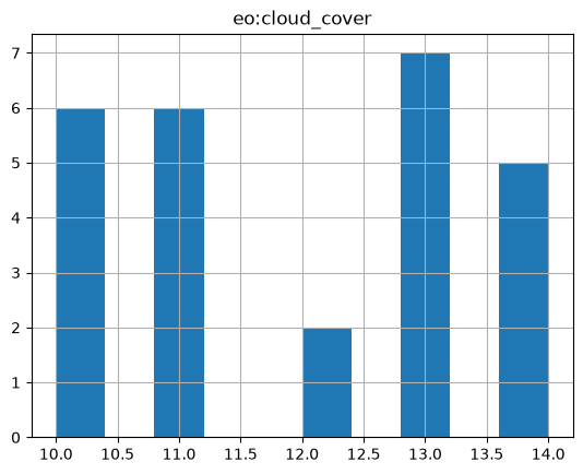
Example: 8.3
CQL filter with
LIKEoperator.
from pystac_client import Client
api = Client.open(URL_LANDING_PAGE)

results = api.collection_search(
    filter = "title LIKE '%Bio%'",
    max_collections=10
)
curl_str = curl_command(results.url_with_parameters())
md("```shell\n" + curl_str + "\n```\n")
curl -X GET -G https://fedeo.ceos.org/collections \
	--data-urlencode "filter=title LIKE '%Bio%'" \
	--data-urlencode "filter-lang=cql2-text"
print(f"{results.matched()} collections found.")
data = results.collection_list_as_dict()
df = pd.json_normalize(data, record_path=['collections'])
df[['id', 'title']]
114 collections found.
| id | title | |
|---|---|---|
| 0 | OCEANCOLOUR_MED_BGC_HR_L4_NRT_009_211 | Mediterranean Sea, Bio-Geo-Chemical, L4, month... |
| 1 | OCEANCOLOUR_MED_BGC_L3_NRT_009_141 | Mediterranean Sea, Bio-Geo-Chemical, L3, daily... |
| 2 | OCEANCOLOUR_BLK_BGC_L4_NRT_009_152 | Black Sea, Bio-Geo-Chemical, L4, monthly means... |
| 3 | OCEANCOLOUR_NWS_BGC_HR_L4_NRT_009_209 | North West Shelf Region, Bio-Geo-Chemical, L4,... |
| 4 | OCEANCOLOUR_BLK_BGC_HR_L4_NRT_009_212 | Black Sea, Bio-Geo-Chemical, L4, monthly means... |
| 5 | OCEANCOLOUR_BAL_BGC_HR_L4_NRT_009_208 | Baltic Sea, Bio-Geo-Chemical, L4, monthly mean... |
| 6 | GLOBAL_ANALYSISFORECAST_BGC_001_028 | Global Ocean Biogeochemistry Analysis and Fore... |
| 7 | OCEANCOLOUR_MED_BGC_HR_L3_NRT_009_205 | Mediterranean Sea, Bio-Geo-Chemical, L3, daily... |
| 8 | OCEANCOLOUR_ATL_BGC_L4_MY_009_118 | Atlantic Ocean Colour (Copernicus-GlobColour),... |
| 9 | NWSHELF_ANALYSISFORECAST_BGC_004_002 | Atlantic - European North West Shelf - Ocean B... |
Example: 8.4
CQL filter with
INoperator.
from pystac_client import Client
api = Client.open(URL_LANDING_PAGE)

results = api.collection_search(
    filter = "platform IN ('Biomass','EarthCARE')",
    max_collections=10
)
curl_str = curl_command(results.url_with_parameters())
md("```shell\n" + curl_str + "\n```\n")
curl -X GET -G https://fedeo.ceos.org/collections \
	--data-urlencode "filter=platform IN ('Biomass','EarthCARE')" \
	--data-urlencode "filter-lang=cql2-text"
print(f"{results.matched()} collections found.")
data = results.collection_list_as_dict()
df = pd.json_normalize(data, record_path=['collections'])
df[['id', 'summaries.platform']]
47 collections found.
| id | summaries.platform | |
|---|---|---|
| 0 | BiomassLevel0IOC | [Biomass] |
| 1 | BiomassAuxIOC | [Biomass] |
| 2 | BiomassLevel2bIOC | [Biomass] |
| 3 | BiomassLevel2b | [Biomass] |
| 4 | EarthCAREAuxiliary_MAAP | [EarthCARE] |
| 5 | EarthCAREOrbitData_MAAP | [EarthCARE] |
| 6 | BiomassLevel1a | [Biomass] |
| 7 | BiomassLevel1c | [Biomass] |
| 8 | BiomassAux | [Biomass] |
| 9 | JAXAL2Validated_MAAP | [EarthCARE] |
Example: 8.5
CQL filter with
BETWEENoperator.
from pystac_client import Client
api = Client.open(URL_LANDING_PAGE)

results = api.search(
    method = 'POST',
    max_items=50,
    collections=[COLLECTION_ID1],
    filter="sat:absolute_orbit BETWEEN 1200 AND 2000"
)
curl_str = curl_command(results.url_with_parameters())
md("```shell\n" + curl_str + "\n```\n")
curl -X GET -G https://fedeo.ceos.org/search \
	--data-urlencode "collections=LANDSAT.TM.GTC" \
	--data-urlencode "filter=sat:absolute_orbit BETWEEN 1200 AND 2000" \
	--data-urlencode "filter-lang=cql2-text"
print(f"{results.matched()} items found.")
1781 items found.
# Display cloud-cover values as histogram to show that range is taken into account
stac_json = results.item_collection_as_dict()
gdf = gpd.GeoDataFrame.from_features(stac_json)
try:
  _ = gdf[['title','sat:absolute_orbit']].hist()
except:
  print("sat:absolute_orbit information is not available.")
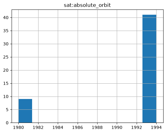
Example: 8.6
Unsupported filter returns an HTTP error. E.g. collection search with advanced temporal function.
URL = URL_LANDING_PAGE + "collections"+ "?filter=T_INTERSECTS(modificationDate , INTERVAL('2022-01-01T00:00:00Z', '2024-11-01T00:00:00Z'))"
curl_str = curl_command(URL)
md("```shell\n" + curl_str + "\n```\n")
response = requests.get(URL)
print("HTTP Code: ",response.status_code)
print("HTTP Body: ",response.content)
HTTP Code:  500
HTTP Body:  b'<!doctype html><html lang="en"><head><title>HTTP Status 500 \xe2\x80\x93 Internal Server Error</title><style type="text/css">body {font-family:Tahoma,Arial,sans-serif;} h1, h2, h3, b {color:white;background-color:#525D76;} h1 {font-size:22px;} h2 {font-size:16px;} h3 {font-size:14px;} p {font-size:12px;} a {color:black;} .line {height:1px;background-color:#525D76;border:none;}</style></head><body><h1>HTTP Status 500 \xe2\x80\x93 Internal Server Error</h1></body></html>'
CQL2 JSON filter expressions#
The STAC interface supports the filter parameter and filter expressions in cql2-json filter format at the following endpoints:
/collections
/collections/{collection-id}/items
/search
At the /search endpoint, it is required that at least one collection can be determined from the collections or ids parameter. The queryables allowed in the filter expression are then identical to the ones at the corresponding /collections/{collection-id}/items/queryables endpoint.
Filter expressions are to be expressed with the JSON encoding of the Basic Common Query Language (Basic CQL2-Text) [RD22].
Example: 9.1
CQL JSON Filter for collection search with logical operators (and, or) with cql2-json filter-lang.
_filter = {
    "op": "and",
    "args": [
        {
            "op": "=","args": [
                { "property": "platform" },
                "EarthCARE"
            ]
        },
        {
            "op": "or","args": [
                {"op": "=","args": [
                    { "property": "instrument" },
                    "MSI"
                ]
            },
            {"op": "=","args": [
                { "property": "instrument" },
                "CPR"
                ]
            }
            ]
        },
        {
            "op": "=","args": [
                { "property": "organisationName" },
                "ESA/ESRIN"
            ]
        }
    ]
}
results = api.collection_search(
    # api does not support a 'dict' as parameter ?
    max_collections=10,
    filter = json.dumps(_filter),
    filter_lang = "cql2-json"
)
curl_str = curl_command(results.url_with_parameters())
md("```shell\n" + curl_str + "\n```\n")
curl -X GET -G https://fedeo.ceos.org/collections \
	--data-urlencode "filter={"op": "and", "args": [{"op": "=", "args": [{"property": "platform"}, "EarthCARE"]}, {"op": "or", "args": [{"op": "=", "args": [{"property": "instrument"}, "MSI"]}, {"op": "=", "args": [{"property": "instrument"}, "CPR"]}]}, {"op": "=", "args": [{"property": "organisationName"}, "ESA/ESRIN"]}]}" \
	--data-urlencode "filter-lang=cql2-json"
data = results.collection_list_as_dict()
df = pd.json_normalize(data, record_path=['collections'])
df[['id', 'summaries.platform','summaries.instruments']]
| id | summaries.platform | summaries.instruments | |
|---|---|---|---|
| 0 | EarthCAREL2Validated_MAAP | [EarthCARE] | [ATLID] |
| 1 | EarthCAREL2InstChecked_MAAP | [EarthCARE] | [ATLID] |
| 2 | EarthCAREL1Validated_MAAP | [EarthCARE] | [ATLID] |
| 3 | EarthCAREL1InstChecked_MAAP | [EarthCARE] | [ATLID] |
| 4 | EarthCAREL2Products_MAAP | [EarthCARE] | [ATLID] |
Example: 9.2
CQL filter with
BETWEENoperator.
filter_dict = {
    "op":"between",
    "args":[
        {"property":"sat:absolute_orbit"},
        5000,
        5010
    ]
}
results = api.search(
    method = 'POST',
    max_items = 30,
    collections = [COLLECTION_ID1],
    filter = filter_dict,
    filter_lang = "cql2-json"
)
curl_str = curl_command(results.url_with_parameters())
md("```shell\n" + curl_str + "\n```\n")
curl -X GET -G https://fedeo.ceos.org/search \
	--data-urlencode "collections=LANDSAT.TM.GTC" \
	--data-urlencode "filter=op" \
	--data-urlencode "filter=args" \
	--data-urlencode "filter-lang=cql2-json"
print(f"{results.matched()} items found.")
66 items found.
# Display sat:absolute_orbit values as histogram to show that range is taken into account
stac_json = results.item_collection_as_dict()
gdf = gpd.GeoDataFrame.from_features(stac_json)
try:
  _ = gdf[['title','sat:absolute_orbit']].hist()
except:
  print("sat:absolute_orbit information is not available.")
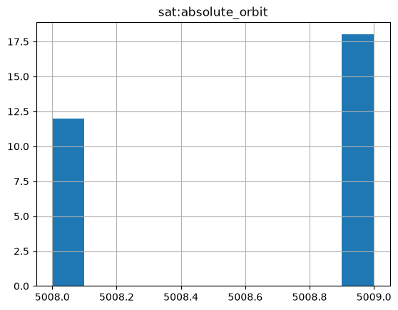
Example: 9.3
CQL filter for granule search with comparison operators using cql2-json filterLang. Search granules with orbit number (sat:absolute_orbit) between 5000 and 5010.
from pystac_client import Client
api = Client.open(URL_LANDING_PAGE)

results = api.search(
    method = 'GET',
    max_items = 30,
    collections = [COLLECTION_ID1],
    filter = '{"op": "and","args": [{"op": ">=","args":[{"property":"sat:absolute_orbit"},5000]},{"op":"<","args":[{"property":"sat:absolute_orbit"},5010]}]}',
    filter_lang="cql2-json"
)
curl_str = curl_command(results.url_with_parameters())
md("```shell\n" + curl_str + "\n```\n")
curl -X GET -G https://fedeo.ceos.org/search \
	--data-urlencode "collections=LANDSAT.TM.GTC" \
	--data-urlencode "filter={"op": "and","args": [{"op": ">=","args":[{"property":"sat:absolute_orbit"},5000]},{"op":"<","args":[{"property":"sat:absolute_orbit"},5010]}]}" \
	--data-urlencode "filter-lang=cql2-json"
print(f"{results.matched()} items found.")
66 items found.
# Display sat:absolute_orbit values as histogram to show that range is taken into account
stac_json = results.item_collection_as_dict()
gdf = gpd.GeoDataFrame.from_features(stac_json)
try:
    _ = gdf[['title','sat:absolute_orbit']].hist()
except:
    print("sat:absolute_orbit information is not available.")
Example: 9.4
CQL JSON filter for granule search with comparison operators using cql2-json filterLang on the POST endpoint. Search granules with orbit number (sat:absolute_orbit) between 5000 and 5010.
filter_dict = {
    "op": "and",
    "args": [
        {
            "op": ">=",
            "args": [
                {"property": "sat:absolute_orbit"},
                5000
            ]
        },
        {
            "op": "<",
            "args": [
                {"property": "sat:absolute_orbit"},
                5010
            ]
        }
    ]
}
results = api.search(
    method='POST',
    max_items=30,
    collections=[COLLECTION_ID1],
    filter= filter_dict,
    filter_lang="cql2-json"
)
# Display cloud-cover values as histogram to show that range is taken into account
stac_json = results.item_collection_as_dict()
gdf = gpd.GeoDataFrame.from_features(stac_json)
try:
    _ = gdf[['title','sat:absolute_orbit']].hist()
except:
    print("sat:absolute_orbit information is not available.")
Sorting results#
The STAC interface supports the sortby parameter at the following endpoints:
/collections
/collections/{collection-id}/items
/search
At the /search endpoint, it is required that a single collection can be determined from the collections parameter. The sortables allowed in the filter expression are then identical to the ones at the corresponding /collections/{collection-id}/items endpoint. sortby cannot be used at the /search endpoint when collections contains 0 or more than 1 collection identifiers.
Sorting of search results is available for collection and granule searches, but the available criteria differ per resource type. The STAC API Sort Extension [RD26] defines the syntax to be used. The sorting parameter has to be expressed as the corresponding STAC property name. A minus sign (-) before the property name indicates a descending order. If the property used for sorting is an array with more than one element, the result may be unexpected. A 400 Bad Request status code is returned when the sort criteria used are not supported.
Collections (at /collections) |
|---|
[properties.]id |
[properties.]instruments |
[properties.]platform |
[properties.]processing:level |
[properties.]providers |
[properties.]sci:doi |
[properties.]title |
[properties.]updated |
The available sort criteria for items (granules) depend also on the sensortype, e.g. optical, radar, etc. and whether the remote catalogue hosting the granule metadata supports sorting as well.
Items (granules at /items or /search) |
|---|
[properties.]created |
[properties.]datetime |
[properties.]end_datetime |
[properties.]eo:cloud_cover |
[properties.]eo:snow_cover |
[properties.]eofeos:global_coverage_id |
[properties.]eofeos:is_coregistration_primary |
[properties.]eofeos:major_cycle_id |
[properties.]eofeos:mission_phase |
[properties.]eofeos:orbit_drift_flag |
[properties.]eofeos:repeat_cycle_id |
[properties.]eofeos:stack_id |
[properties.]eopf:datatake_id |
[properties.]eopf:instrument_mode |
[properties.]id |
[properties.]instruments |
[properties.]platform |
[properties.]processing:datetime |
[properties.]processing:facility |
[properties.]processing:level |
[properties.]processing:software |
[properties.]product:acquisition_type |
[properties.]product:type |
[properties.]sar:observation_direction |
[properties.]sar:polarizations |
[properties.]sat:absolute_orbit |
[properties.]sat:orbit_state |
[properties.]sci:doi |
[properties.]start_datetime |
[properties.]updated |
[properties.]version |
[properties.]view:sun_azimuth |
[properties.]view:sun_elevation |
The sort criteria can optionally be prefixed by “properties.” for compatibility with the STACBrowser software.
The /collections and /items endpoints support only the GET method.
At the /search endpoint, both the GET and POST method are supported.
Example: 10.1
Sort collection search results by platform (ascending) and instrument (descending).
results = api.collection_search(
    filter="parentIdentifier='EOP:ESA:EARTH-ONLINE' and organisationName='ESA/ESRIN'",
    limit=10,
    max_collections=10,
    sortby="platform,-instruments"
)

print(f"{results.matched()} collections found.")
163 collections found.
curl_str = curl_command(results.url_with_parameters())
md("```shell\n" + curl_str + "\n```\n")
curl -X GET -G https://fedeo.ceos.org/collections \
	--data-urlencode "limit=10" \
	--data-urlencode "filter=parentIdentifier='EOP:ESA:EARTH-ONLINE' and organisationName='ESA/ESRIN'" \
	--data-urlencode "filter-lang=cql2-text" \
	--data-urlencode "sortby=+platform,-instruments"
data = results.collection_list_as_dict()
df = pd.json_normalize(data, record_path=['collections'])
df[['id','title','summaries.platform','summaries.instruments']]
| id | title | summaries.platform | summaries.instruments | |
|---|---|---|---|---|
| 0 | WorldViewLegionfullarchiveandtasking0 | WorldView Legion full archive and tasking | [WorldView Legion] | [WorldView Legion Camera] |
| 1 | alos.prism.l1c.european.coverage.cloud.free | ALOS PRISM L1C European Coverage Cloud Free | [ALOS-1] | [PRISM] |
| 2 | alos-prism-l1c | ALOS PRISM L1C | [ALOS-1] | [PRISM] |
| 3 | ALOS_PRISM_L1B | Alos PRISM L1B | [ALOS-1] | [PRISM] |
| 4 | ALOS.PALSAR.FBS.FBD.PLR.products | ALOS PALSAR products | [ALOS-1] | [PALSAR] |
| 5 | ALOSIPY | ALOS PALSAR International Polar Year Antarctica | [ALOS-1] | [PALSAR] |
| 6 | ALOS | ALOS African Coverage ESA archive | [ALOS-1] | [AVNIR-2] |
| 7 | ALOS.AVNIR-2.L1C | ALOS AVNIR-2 L1C | [ALOS-1] | [AVNIR-2] |
| 8 | TropForest | TropForest- ALOS, GEOSAT-1 & KOMPSAT-2 optical... | [ALOS-1, GEOSAT-1, KOMPSAT-2] | [AVNIR-2, SLIM6, MSC] |
| 9 | ADAM.Surface.Reflectance.Database | ADAM Surface Reflectance Database v4.0 | [TERRA, AQUA, QuikSCAT, OrbView-2] | [MODIS, MODIS, SeaWinds, SeaWiFS] |
Example: 10.2
Sort collection search results by instrument (descending).
results = api.collection_search(
    filter="platform='EarthCARE'",
    limit=10,
    max_collections=10,
    sortby="-instruments"
)

print(f"{results.matched()} collections found.")
19 collections found.
curl_str = curl_command(results.url_with_parameters())
md("```shell\n" + curl_str + "\n```\n")
curl -X GET -G https://fedeo.ceos.org/collections \
	--data-urlencode "limit=10" \
	--data-urlencode "filter=platform='EarthCARE'" \
	--data-urlencode "filter-lang=cql2-text" \
	--data-urlencode "sortby=-instruments"
data = results.collection_list_as_dict()
df = pd.json_normalize(data, record_path=['collections'])
df[['id','summaries.platform','summaries.instruments']]
| id | summaries.platform | summaries.instruments | |
|---|---|---|---|
| 0 | EarthCARE_MSI_L2A_MSI_CLP | [EarthCARE] | [MSI] |
| 1 | EarthCARE_CPR_L2A_CPR_CLP | [EarthCARE] | [CPR] |
| 2 | EarthCARE_CPR_L2A_CPR_ECO | [EarthCARE] | [CPR] |
| 3 | EarthCARE_CPR_L1B_CPR_NOM | [EarthCARE] | [CPR] |
| 4 | EarthCARE_L2B_ACM_CLP | [EarthCARE] | [MSI] |
| 5 | EarthCARE_L2B_AC__CLP | [EarthCARE] | [ATLID] |
| 6 | EarthCARE_L2B_ALL_RAD | [EarthCARE] | [BBR] |
| 7 | EarthCAREL2Validated_MAAP | [EarthCARE] | [ATLID] |
| 8 | EarthCAREL2InstChecked_MAAP | [EarthCARE] | [ATLID] |
| 9 | EarthCAREL1Validated_MAAP | [EarthCARE] | [ATLID] |
Example: 10.3
Sort collection search results by modification date (ascending).
results = api.collection_search(
    filter="parentIdentifier='EOP:ESA:EARTH-ONLINE'",
    limit=10,
    max_collections=10,
    sortby="properties.updated"
)

print(f"{results.matched()} collections found.")
163 collections found.
curl_str = curl_command(results.url_with_parameters())
md("```shell\n" + curl_str + "\n```\n")
curl -X GET -G https://fedeo.ceos.org/collections \
	--data-urlencode "limit=10" \
	--data-urlencode "filter=parentIdentifier='EOP:ESA:EARTH-ONLINE'" \
	--data-urlencode "filter-lang=cql2-text" \
	--data-urlencode "sortby=+properties.updated"
data = results.collection_list_as_dict()
df = pd.json_normalize(data, record_path=['collections'])
df[['title','updated']]
| title | updated | |
|---|---|---|
| 0 | Ocean and Coastal Topography Thematic Data Pro... | 2024-10-29T15:34:08Z |
| 1 | Atmospheric Thematic Data Product [MWR_TDPATM] | 2024-10-29T15:45:22Z |
| 2 | Inland Waters Thematic Data Product [ALT_TDP_IW] | 2024-10-29T15:45:51Z |
| 3 | Land Ice Thematic Data Product [ALT_TDP_LI] | 2024-10-29T15:46:10Z |
| 4 | Fundamental Data Records for Radiometry [MWR_F... | 2024-10-29T15:48:43Z |
| 5 | WorldView-3 full archive and tasking | 2026-02-06T14:34:30Z |
| 6 | WorldView-2 full archive and tasking | 2026-02-06T14:37:32Z |
| 7 | WorldView-4 full archive | 2026-02-06T14:45:25Z |
| 8 | SkySat Full Archive and New Tasking | 2026-02-09T11:17:58Z |
| 9 | SPOT-6 to 7 full archive and tasking | 2026-02-09T11:24:51Z |
Example: 10.4
Sort collection search results by title (ascending).
results = api.collection_search(
    filter="parentIdentifier='EOP:ESA:EARTH-ONLINE'",
    limit=10,
    max_collections=20,
    sortby="properties.title"
)

print(f"{results.matched()} collections found.")
163 collections found.
curl_str = curl_command(results.url_with_parameters())
md("```shell\n" + curl_str + "\n```\n")
curl -X GET -G https://fedeo.ceos.org/collections \
	--data-urlencode "limit=10" \
	--data-urlencode "filter=parentIdentifier='EOP:ESA:EARTH-ONLINE'" \
	--data-urlencode "filter-lang=cql2-text" \
	--data-urlencode "sortby=+properties.title"
data = results.collection_list_as_dict()
df = pd.json_normalize(data, record_path=['collections'])
df[['id','title']]
| id | title | |
|---|---|---|
| 0 | ADAM.Surface.Reflectance.Database | ADAM Surface Reflectance Database v4.0 |
| 1 | ALOS | ALOS African Coverage ESA archive |
| 2 | ALOS.AVNIR-2.L1C | ALOS AVNIR-2 L1C |
| 3 | ALOSIPY | ALOS PALSAR International Polar Year Antarctica |
| 4 | ALOS.PALSAR.FBS.FBD.PLR.products | ALOS PALSAR products |
| 5 | ALOS_PRISM_L1B | Alos PRISM L1B |
| 6 | alos-prism-l1c | ALOS PRISM L1C |
| 7 | alos.prism.l1c.european.coverage.cloud.free | ALOS PRISM L1C European Coverage Cloud Free |
| 8 | TDPforAtmosphere | Atmospheric Thematic Data Product [MWR_TDPATM] |
| 9 | NASA_OMI | Aura OMI complete NASA dataset |
| 10 | AVHRRLocalAreaCoverageImagery10 | AVHRR Level-1B/1C Local Area Coverage Imagery |
| 11 | CartoSat-1.archive.and.Euro-Maps.3D.Digital.Su... | CartoSat-1 archive and Euro-Maps 3D Digital Su... |
| 12 | COSMO-SkyMed.full.archive.and.tasking | COSMO-SkyMed full archive and tasking |
| 13 | EnvisatAATSRL1BBrightnessTemperatureRadianceAT... | Envisat AATSR L1B Brightness Temperature/Radia... |
| 14 | ASA_AP__0P_Scenes | Envisat ASAR AP Co- and Cross-polar L0 [ASA_AP... |
| 15 | ENVISAT.ASA.APM_1P | Envisat ASAR AP Medium Resolution L1 [ASA_APM_1P] |
| 16 | ENVISAT.ASA.APP_1P | Envisat ASAR AP Precision L1 [ASA_APP_1P] |
| 17 | ENVISAT.ASA.APS_1P | Envisat ASAR AP Single-Look Complex L1 [ASA_AP... |
| 18 | ENVISAT.ASA.GM1_1P | Envisat ASAR Global Monitoring L1 [ASA_GM1_1P] |
| 19 | ENVISAT.ASA.IM__0P | Envisat ASAR IM L0 [ASA_IM__0P] |
Example: 10.5
Sort item search results by orbit number (ascending) and id (ascending) at
/itemsendpoint.
results = api.search(
    collections=[COLLECTION_ID1],
    max_items=10,
    limit=10,
    sortby="sat:absolute_orbit,id"
)

print(f"{results.matched()} item found.")
776422 item found.
curl_str = curl_command(results.url_with_parameters())
md("```shell\n" + curl_str + "\n```\n")
curl -X GET -G https://fedeo.ceos.org/search \
	--data-urlencode "limit=10" \
	--data-urlencode "collections=LANDSAT.TM.GTC" \
	--data-urlencode "sortby=+sat:absolute_orbit,+id"
data = results.item_collection_as_dict()
df = pd.json_normalize(data, record_path=['features'])
df[['id', 'properties.sat:absolute_orbit']]
| id | properties.sat:absolute_orbit | |
|---|---|---|
| 0 | LS05_RFUI_TM__GTC_1P_19840406T074459_19840406T... | 522 |
| 1 | LS05_RFUI_TM__GTC_1P_19840406T074523_19840406T... | 522 |
| 2 | LS05_RFUI_TM__GTC_1P_19840406T074547_19840406T... | 522 |
| 3 | LS05_RFUI_TM__GTC_1P_19840406T091530_19840406T... | 523 |
| 4 | LS05_RFUI_TM__GTC_1P_19840406T091554_19840406T... | 523 |
| 5 | LS05_RFUI_TM__GTC_1P_19840406T091730_19840406T... | 523 |
| 6 | LS05_RFUI_TM__GTC_1P_19840406T091841_19840406T... | 523 |
| 7 | LS05_RFUI_TM__GTC_1P_19840406T091929_19840406T... | 523 |
| 8 | LS05_RFUI_TM__GTC_1P_19840406T092017_19840406T... | 523 |
| 9 | LS05_RFUI_TM__GTC_1P_19840406T092041_19840406T... | 523 |
Example: 10.6
Sort item search results (granules) by start_datetime (descending) at
/searchendpoint (GET).
results = api.search(
    method = 'GET',
    collections=[COLLECTION_ID1],
    max_items=10,
    limit=10,
    sortby="-start_datetime"
)

print(f"{results.matched()} item found.")
776422 item found.
curl_str = curl_command(results.url_with_parameters())
md("```shell\n" + curl_str + "\n```\n")
curl -X GET -G https://fedeo.ceos.org/search \
	--data-urlencode "limit=10" \
	--data-urlencode "collections=LANDSAT.TM.GTC" \
	--data-urlencode "sortby=-start_datetime"
data = results.item_collection_as_dict()
df = pd.json_normalize(data, record_path=['features'])
df[['id', 'properties.start_datetime']]
| id | properties.start_datetime | |
|---|---|---|
| 0 | LS05_RMTI_TM__GTC_1P_20111116T100218_20111116T... | 2011-11-16T10:02:18Z |
| 1 | LS05_RMTI_TM__GTC_1P_20111116T100154_20111116T... | 2011-11-16T10:01:54Z |
| 2 | LS05_RMTI_TM__GTC_1P_20111116T100130_20111116T... | 2011-11-16T10:01:30Z |
| 3 | LS05_RMTI_TM__GTC_1P_20111116T100106_20111116T... | 2011-11-16T10:01:06Z |
| 4 | LS05_RMTI_TM__GTC_1P_20111116T100042_20111116T... | 2011-11-16T10:00:42Z |
| 5 | LS05_RMTI_TM__GTC_1P_20111116T100018_20111116T... | 2011-11-16T10:00:18Z |
| 6 | LS05_RMTI_TM__GTC_1P_20111116T095954_20111116T... | 2011-11-16T09:59:54Z |
| 7 | LS05_RMTI_TM__GTC_1P_20111116T095930_20111116T... | 2011-11-16T09:59:30Z |
| 8 | LS05_RMTI_TM__GTC_1P_20111116T095907_20111116T... | 2011-11-16T09:59:07Z |
| 9 | LS05_RMTI_TM__GTC_1P_20111116T095843_20111116T... | 2011-11-16T09:58:43Z |
Example: 10.7
Sort item search results by start_datetime (descending) at
/itemsendpoint.
URL = URL_LANDING_PAGE + "collections/"+ COLLECTION_ID1 + "/items" \
    + "?sortby=-start_datetime"
curl_str = curl_command(URL)
md("```shell\n" + curl_str + "\n```\n")
curl -X GET -G https://fedeo.ceos.org/collections/LANDSAT.TM.GTC/items \
	--data-urlencode "sortby=-start_datetime"
response = requests.get(URL)
data = json.loads(response.text)
df = pd.json_normalize(data, record_path=['features'])
df[['id', 'properties.start_datetime']]
| id | properties.start_datetime | |
|---|---|---|
| 0 | LS05_RMTI_TM__GTC_1P_20111116T100218_20111116T... | 2011-11-16T10:02:18Z |
| 1 | LS05_RMTI_TM__GTC_1P_20111116T100154_20111116T... | 2011-11-16T10:01:54Z |
| 2 | LS05_RMTI_TM__GTC_1P_20111116T100130_20111116T... | 2011-11-16T10:01:30Z |
| 3 | LS05_RMTI_TM__GTC_1P_20111116T100106_20111116T... | 2011-11-16T10:01:06Z |
| 4 | LS05_RMTI_TM__GTC_1P_20111116T100042_20111116T... | 2011-11-16T10:00:42Z |
| 5 | LS05_RMTI_TM__GTC_1P_20111116T100018_20111116T... | 2011-11-16T10:00:18Z |
| 6 | LS05_RMTI_TM__GTC_1P_20111116T095954_20111116T... | 2011-11-16T09:59:54Z |
| 7 | LS05_RMTI_TM__GTC_1P_20111116T095930_20111116T... | 2011-11-16T09:59:30Z |
| 8 | LS05_RMTI_TM__GTC_1P_20111116T095907_20111116T... | 2011-11-16T09:59:07Z |
| 9 | LS05_RMTI_TM__GTC_1P_20111116T095843_20111116T... | 2011-11-16T09:58:43Z |
Example: 10.8
Sort item search results by cloud cover (ascending) and id (ascending) at
/itemsendpoint.
URL = URL_LANDING_PAGE + "collections/"+ COLLECTION_ID1 + "/items" \
    + "?datetime=1998-08-01T00:00:00/1998-08-01T07:59:59" \
    + "&sortby=eo:cloud_cover,id"
curl_str = curl_command(URL)
md("```shell\n" + curl_str + "\n```\n")
curl -X GET -G https://fedeo.ceos.org/collections/LANDSAT.TM.GTC/items \
	--data-urlencode "datetime=1998-08-01T00:00:00/1998-08-01T07:59:59" \
	--data-urlencode "sortby=eo:cloud_cover,id"
response = requests.get(URL)
data = json.loads(response.text)
df = pd.json_normalize(data, record_path=['features'])
df[['id', 'properties.eo:cloud_cover', 'properties.datetime']]
| id | properties.eo:cloud_cover | properties.datetime | |
|---|---|---|---|
| 0 | LS05_RKSE_TM__GTC_1P_19980801T061607_19980801T... | 0 | 1998-08-01T06:16:07Z |
| 1 | LS05_RKSE_TM__GTC_1P_19980801T061743_19980801T... | 0 | 1998-08-01T06:17:43Z |
| 2 | LS05_RKSE_TM__GTC_1P_19980801T062053_19980801T... | 1 | 1998-08-01T06:20:53Z |
| 3 | LS05_RKSE_TM__GTC_1P_19980801T062253_19980801T... | 1 | 1998-08-01T06:22:53Z |
| 4 | LS05_RKSE_TM__GTC_1P_19980801T062117_19980801T... | 2 | 1998-08-01T06:21:17Z |
| 5 | LS05_RKSE_TM__GTC_1P_19980801T061631_19980801T... | 3 | 1998-08-01T06:16:31Z |
| 6 | LS05_RKSE_TM__GTC_1P_19980801T062141_19980801T... | 3 | 1998-08-01T06:21:41Z |
| 7 | LS05_RKSE_TM__GTC_1P_19980801T075659_19980801T... | 3 | 1998-08-01T07:56:59Z |
| 8 | LS05_RKSE_TM__GTC_1P_19980801T062030_19980801T... | 4 | 1998-08-01T06:20:30Z |
| 9 | LS05_RKSE_TM__GTC_1P_19980801T061543_19980801T... | 5 | 1998-08-01T06:15:43Z |
Control properties returned#
The STAC interface supports the fields parameter at the following endpoints:
/collections
/collections/{collection-id}/items
/search
fields = '-geometry,-properties,-links,-assets'
URL = URL_LANDING_PAGE + "collections/TropForest/items" + "?fields=" + fields
curl_str = curl_command(URL)
md("```shell\n" + curl_str + "\n```\n")
curl -X GET -G https://fedeo.ceos.org/collections/TropForest/items \
	--data-urlencode "fields=-geometry,-properties,-links,-assets"
response = requests.get(URL)
data = json.loads(response.text)
jstr = json.dumps(data["features"][0], indent=3)
md("```json\n" + jstr + "\n```\n")
{
   "stac_version": "1.0.0",
   "bbox": [
      137.91480986,
      -2.08862852,
      138.09225579,
      -1.91288316
   ],
   "id": "KO2_OTPF_KO2_MSC_2F_20110809T003821_20110809T003821_000000_E138_S002",
   "collection": "TropForest",
   "type": "Feature",
   "stac_extensions": [
      "https://stac-extensions.github.io/eo/v2.0.0/schema.json",
      "https://stac-extensions.github.io/projection/v2.0.0/schema.json",
      "https://stac-extensions.github.io/processing/v1.2.0/schema.json",
      "https://cs-si.github.io/eopf-stac-extension/v1.2.0/schema.json",
      "https://stac-extensions.github.io/sat/v1.2.0/schema.json",
      "https://stac-extensions.github.io/view/v1.0.0/schema.json",
      "https://stac-extensions.github.io/product/v1.0.0/schema.json",
      "https://stac-extensions.github.io/web-map-links/v1.2.0/schema.json"
   ]
}
Example: 11.2
Excluding nested fields at
/itemsendpoint (GET).
fields = '-properties.title,-properties.updated'
URL = URL_LANDING_PAGE + "collections/TropForest/items" + "?fields=" + fields
curl_str = curl_command(URL)
md("```shell\n" + curl_str + "\n```\n")
curl -X GET -G https://fedeo.ceos.org/collections/TropForest/items \
	--data-urlencode "fields=-properties.title,-properties.updated"
response = requests.get(URL)
data = json.loads(response.text)
jstr = json.dumps(data["features"][0]["properties"], indent=3)
md("```json\n" + jstr + "\n```\n")
{
   "proj:code": "EPSG:4326",
   "start_datetime": "2011-08-09T00:38:21Z",
   "end_datetime": "2011-08-09T00:38:21Z",
   "processing:facility": "Astrium Services",
   "view:sun_azimuth": 52.90402745,
   "product:type": "KO2_MSC_2F",
   "platform": "KOMPSAT-2",
   "view:sun_elevation": 51.2569825,
   "datetime": "2011-08-09T00:38:21Z",
   "instruments": [
      "MSC"
   ],
   "constellation": "KOMPSAT",
   "sat:orbit_state": "descending",
   "eo:cloud_cover": 1,
   "processing:datetime": "2012-12-13T00:00:00Z",
   "eopf:instrument_mode": "MS",
   "product:acquisition_type": "nominal"
}
Example: 11.3
Excluding fields at
/searchendpoint (GET).
results = api.search(
    method = 'GET',
    max_items = 10,
    collections=['TropForest'],
    # fields = ['bbox','id','type','properties', 'geometry']
    fields = ['-geometry','-properties','-links','-assets']
)
curl_str = curl_command(results.url_with_parameters())
md("```shell\n" + curl_str + "\n```\n")
curl -X GET -G https://fedeo.ceos.org/search \
	--data-urlencode "collections=TropForest" \
	--data-urlencode "fields=-geometry,-properties,-links,-assets"
stac_json = results.item_collection_as_dict()
stac_json['features'][0]
{'stac_version': '1.0.0',
 'bbox': [137.91480986, -2.08862852, 138.09225579, -1.91288316],
 'id': 'KO2_OTPF_KO2_MSC_2F_20110809T003821_20110809T003821_000000_E138_S002',
 'collection': 'TropForest',
 'type': 'Feature',
 'stac_extensions': ['https://stac-extensions.github.io/eo/v2.0.0/schema.json',
  'https://stac-extensions.github.io/projection/v2.0.0/schema.json',
  'https://stac-extensions.github.io/processing/v1.2.0/schema.json',
  'https://cs-si.github.io/eopf-stac-extension/v1.2.0/schema.json',
  'https://stac-extensions.github.io/sat/v1.2.0/schema.json',
  'https://stac-extensions.github.io/view/v1.0.0/schema.json',
  'https://stac-extensions.github.io/product/v1.0.0/schema.json',
  'https://stac-extensions.github.io/web-map-links/v1.2.0/schema.json']}
Example: 11.4
Excluding fields at
/searchendpoint (POST).
results = api.search(
    method = 'POST',
    max_items = 10,
    collections=['TropForest'],
    # fields = ['bbox','id','type','properties', 'geometry']
    # Specification requires "include" and "exclude".  Not present in pystac_client.
    fields = ['-geometry','-properties','-links','-assets']
)
curl_str = curl_command(results.url_with_parameters(),'POST')
md("```shell\n" + curl_str + "\n```\n")
curl -X POST https://fedeo.ceos.org/search \
	--header 'Content-Type: application/json' \
	--data-raw '{
		"collections": ["TropForest"],
		"fields": "-geometry,-properties,-links,-assets"
	}'
stac_json = results.item_collection_as_dict()
stac_json['features'][0]
{'stac_version': '1.0.0',
'bbox': [137.91480986, -2.08862852, 138.09225579, -1.91288316],
'id': 'KO2_OTPF_KO2_MSC_2F_20110809T003821_20110809T003821_000000_E138_S002',
'collection': 'TropForest',
'type': 'Feature',
'stac_extensions': ['https://stac-extensions.github.io/eo/v2.0.0/schema.json',
'https://stac-extensions.github.io/projection/v2.0.0/schema.json',
'https://stac-extensions.github.io/processing/v1.2.0/schema.json',
'https://cs-si.github.io/eopf-stac-extension/v1.2.0/schema.json',
'https://stac-extensions.github.io/sat/v1.2.0/schema.json',
'https://stac-extensions.github.io/view/v1.0.0/schema.json',
'https://stac-extensions.github.io/product/v1.0.0/schema.json',
'https://stac-extensions.github.io/web-map-links/v1.2.0/schema.json']}
Example: 11.5
Including fields at
/itemsendpoint (GET).
fields = 'bbox,id,type'
URL = URL_LANDING_PAGE + "collections/TropForest/items" + "?fields=" + fields
curl_str = curl_command(URL)
md("```shell\n" + curl_str + "\n```\n")
curl -X GET -G https://fedeo.ceos.org/collections/TropForest/items \
--data-urlencode "fields=bbox,id,type"
response = requests.get(URL)
data = json.loads(response.text)
# show remaining content of first item
jstr = json.dumps(data["features"][0], indent=3)
md("```json\n" + jstr + "\n```\n")
{
"bbox": [
137.91480986,
-2.08862852,
138.09225579,
-1.91288316
],
"id": "KO2_OTPF_KO2_MSC_2F_20110809T003821_20110809T003821_000000_E138_S002",
"type": "Feature"
}
Example: 11.6
Including fields at
/searchendpoint (GET).
results = api.search(
method = 'GET',
max_items = 10,
collections=['TropForest'],
# fields = ['bbox','id','type','properties', 'geometry']
fields = ['id','bbox']
)
curl_str = curl_command(results.url_with_parameters())
md("```shell\n" + curl_str + "\n```\n")
curl -X GET -G https://fedeo.ceos.org/search \
--data-urlencode "collections=TropForest" \
--data-urlencode "fields=+id,+bbox"
stac_json = results.item_collection_as_dict()
stac_json['features'][0]
{'bbox': [137.91480986, -2.08862852, 138.09225579, -1.91288316],
'id': 'KO2_OTPF_KO2_MSC_2F_20110809T003821_20110809T003821_000000_E138_S002'}
Example: 11.7
Including fields at
/searchendpoint (POST).
results = api.search(
method = 'POST',
max_items = 10,
collections=['TropForest'],
# fields = ['bbox','id','type','properties', 'geometry']
fields = ['id', 'bbox']
)
curl_str = curl_command(results.url_with_parameters(),'POST')
md("```shell\n" + curl_str + "\n```\n")
curl -X POST https://fedeo.ceos.org/search \
--header 'Content-Type: application/json' \
--data-raw '{
"collections": ["TropForest"],
"fields": "+id,+bbox"
}'
stac_json = results.item_collection_as_dict()
stac_json['features'][0]
{'bbox': [137.91480986, -2.08862852, 138.09225579, -1.91288316],
'id': 'KO2_OTPF_KO2_MSC_2F_20110809T003821_20110809T003821_000000_E138_S002'}
Example: 11.8
Including fields at
/collectionsendpoint (GET).
results = api.collection_search(
max_collections = 10,
# fields = ['bbox','id','type','properties', 'geometry']
fields = ['id','license']
)
curl_str = curl_command(results.url_with_parameters())
md("```shell\n" + curl_str + "\n```\n")
curl -X GET -G https://fedeo.ceos.org/collections \
--data-urlencode "fields=+id,+license"
data = results.collection_list_as_dict()
data['collections'][0]
{'license': 'various', 'id': 'EO:EUM:DAT:METOP:OAS012'}